Accessibility
- Some accessibility criteria that are particularly relevant at the master planning stage:
- Terrain / Trail surface
- State Parks Guidelines state:
- "The surface of trails, passing spaces, and resting spaces shall be firm and stable."
- Access NorCal defines the following classification
- Hard: Paved, boardwalk, asphalt, brick
- Firm: Hardened soil, decomposed granite with stabilizer
- Moderately firm: Gravel or dirt mix with firm underlayment. May be problematic for manual wheelchairs but not motorized wheelchairs/scooters.
- Soft: Wood fiber, loose gravel, loose dirt. Problematic for manual wheelchairs and possibly for motorized wheelchairs/scooters.
- Very Soft: Wood fiber, loose gravel, loose dirt. Problematic for manual wheelchairs and possibly for motorized wheelchairs/scooters
- FORTAG will be paved, meeting State Parks standards and Access NorCal's highest classification
- Grade / gradient / runnning slope
- State Parks Guidelines:
- 0% to 5% indefinitely
- 5% to 8.33% for no more than 200 feet
- 8.33% to 10% for no more than 30 feet
- 10% to 12% for no more than 10 feet
- Access NorCal defines the following classification
- Level
- Gentle (1:12 (8.33%) or less, manual chair can negotiate)
- Mostly level or gentle (has at least one steep section)
- Steep (> 1:12 (8.33%), power chair and someone with good upper body strength can generally negotiate)
- Very steep (dangerous without assistance)
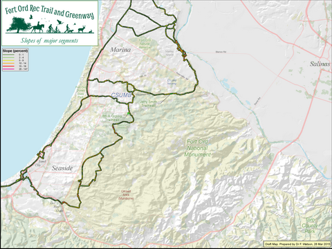
- The FORTAG team have mapped the gradient of all of ~30 miles of FORTAG in 30-foot increments, and are working on ensuring compliance for as much of the trail system as possible, hopefully all of it.
Where the gradient is out of compliance, we're looking for ways to adjust the route or re-grade the underlying terrain.
- Here's the map of trail gradients:
 Click to enlarge
- Here's an example of what that looks like when zoomed-in, including some sections that need re-alignment or earth moving to stay in compliance:
 Click to enlarge
- Links:
 Click to enlarge
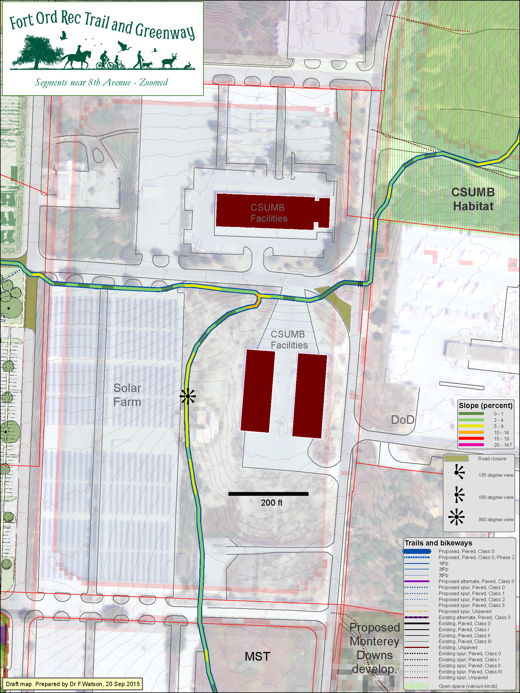 Click to enlarge