Data download
Warning: We're constantly adjusting these data as we collaborate with stakeholders and as we gather new information. If you want to put FORTAG on your map and you need the latest GIS files, please email us and we'll make sure the posted data are up to date.
Here's an ArcGIS Layer Package (LPK file) containing all FORTAG feature classes and associated layer symbologies. After opening the package in ArcGIS, you could save individual layers to shapefiles as needed.
- FORTAG_FFO_Blank_171010_forGeneralDistribution_BasedOnSubsettedShp.lpk
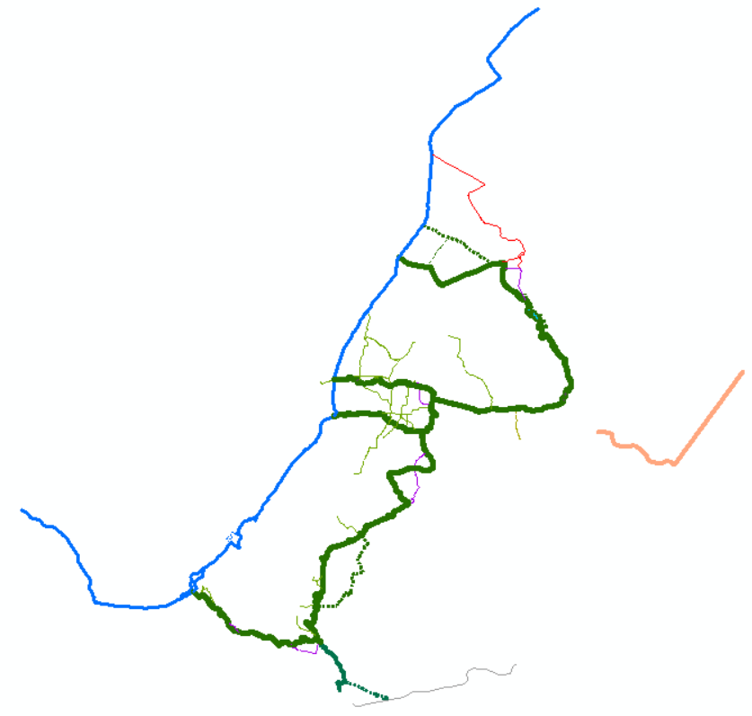
The above LPK file will open in ArcMap to look like this: