Maps
Latest official
map - incorporated into the FORTAG Master Agreement (2020)
(In some areas, this map shows more alternatives than would actually be constructed e.g. north of Marina)
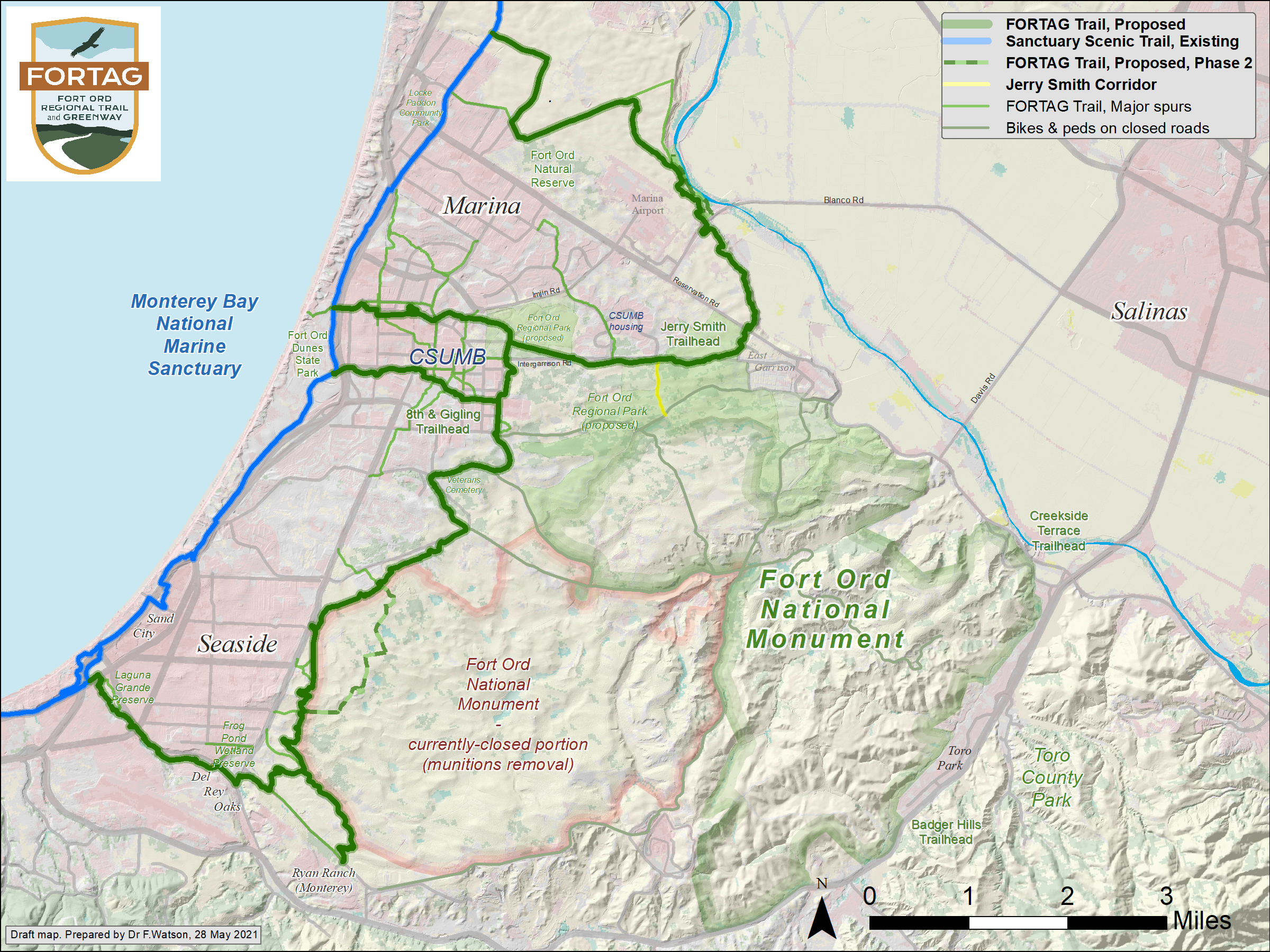
Latest unofficial map - an attempt to reflect our numerous conversations
Various maps
many of which were produced prior to the 2020 environmental review and approval phase
e.g during initial concentualization (2013 onwards) and Measure X approval (2016)
(most of these are about 5 MB or more, so please be patient, or right-click and save to your desktop)
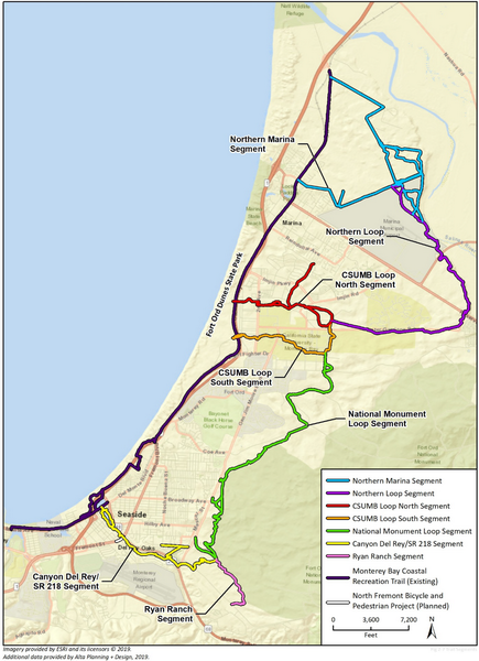
Main FORTAG maps
Former Fort Ord - Master Agreement - 2020
Click map to enlarge
Former Fort Ord - Simple layout - Unofficial - 28 May 2021
Click map to enlarge
Former Fort Ord - Simple layout - 2 Sep 2016
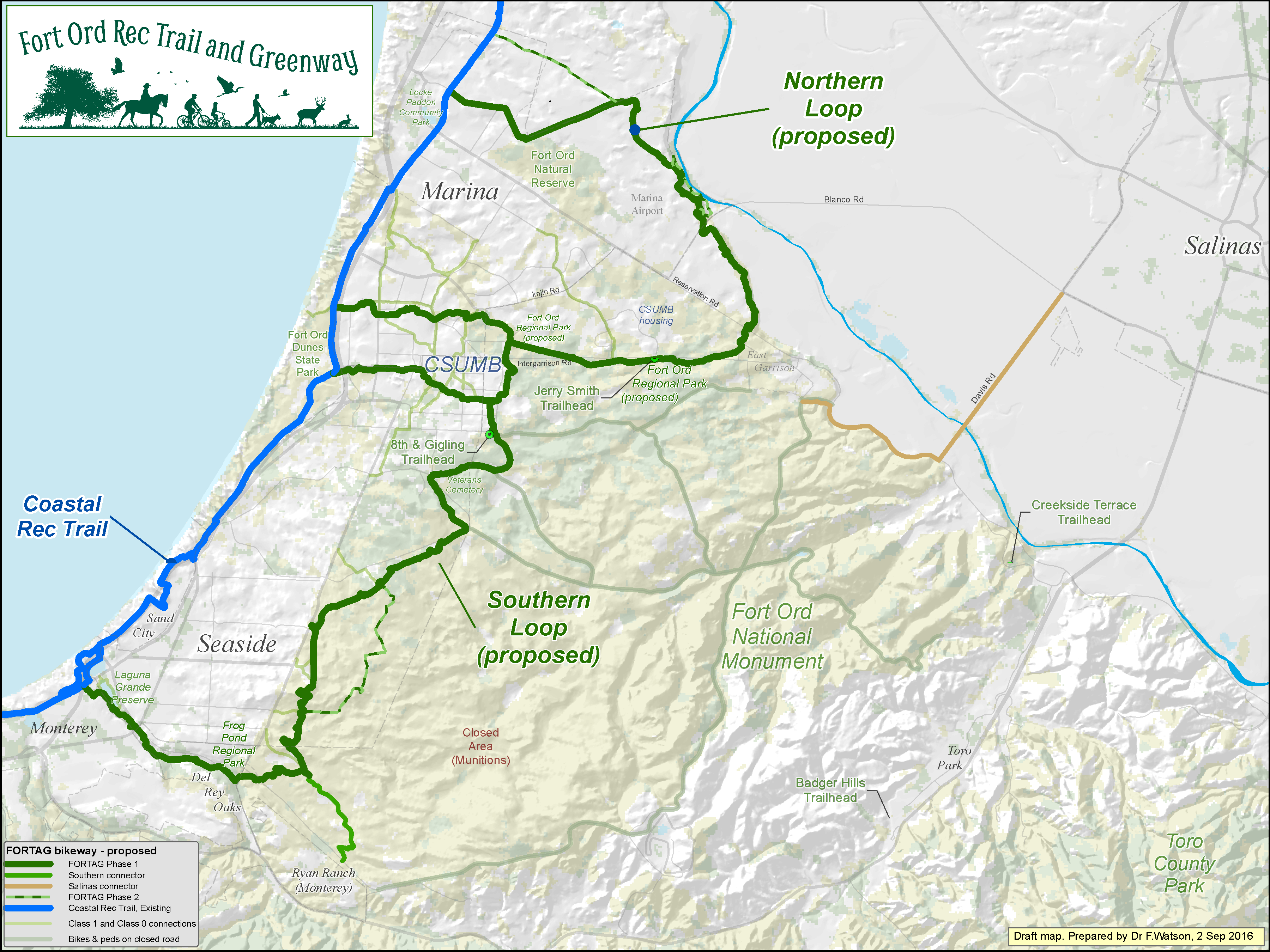
Click map to enlarge
Former Fort Ord - Simple layout - Version 2 - 15 Jan 2018
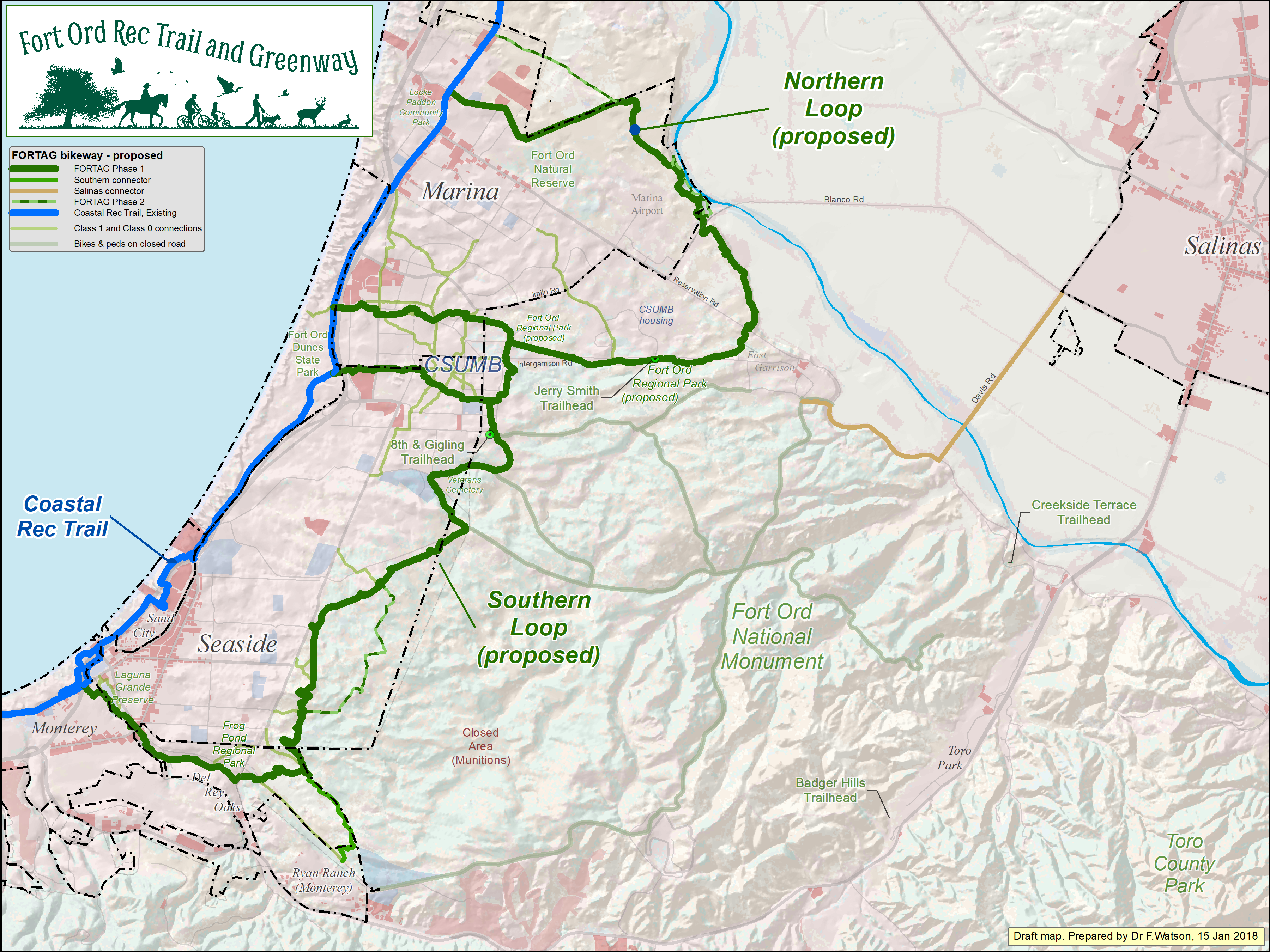
Click map to enlarge
Former Fort Ord - Detailed layout - 30 Jan 2015

Click map to enlarge
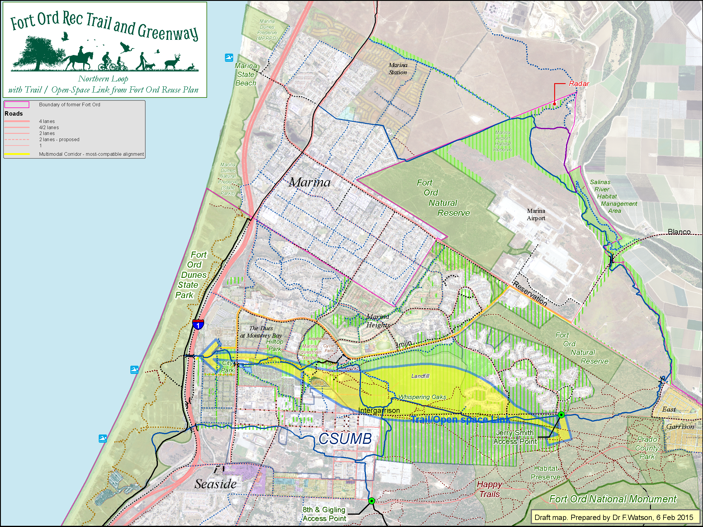
Northern Loop - simple layout - 12 Dec 2016
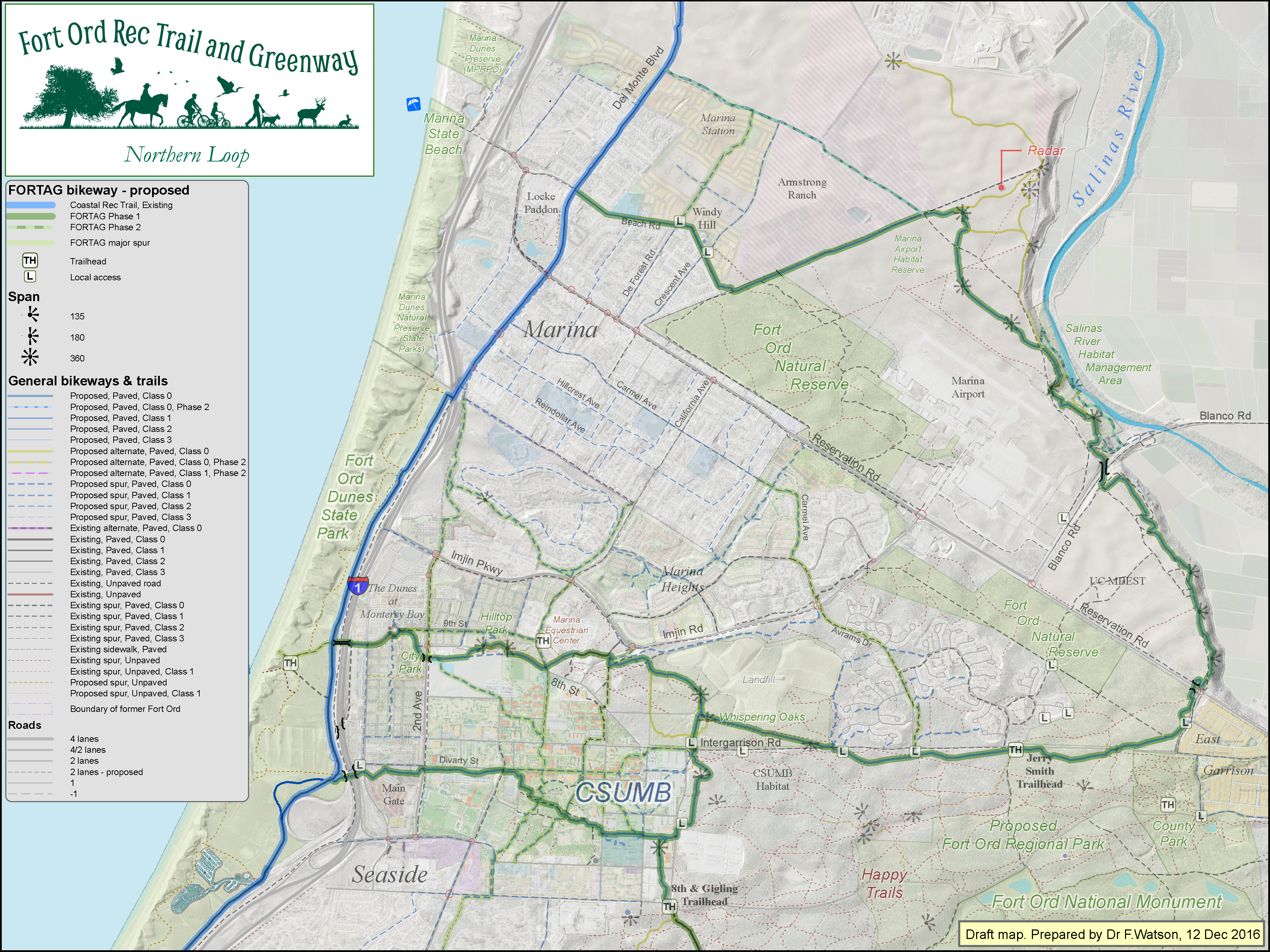
Click map to enlarge
Northern Loop - detailed layout - 30 Jan 2015
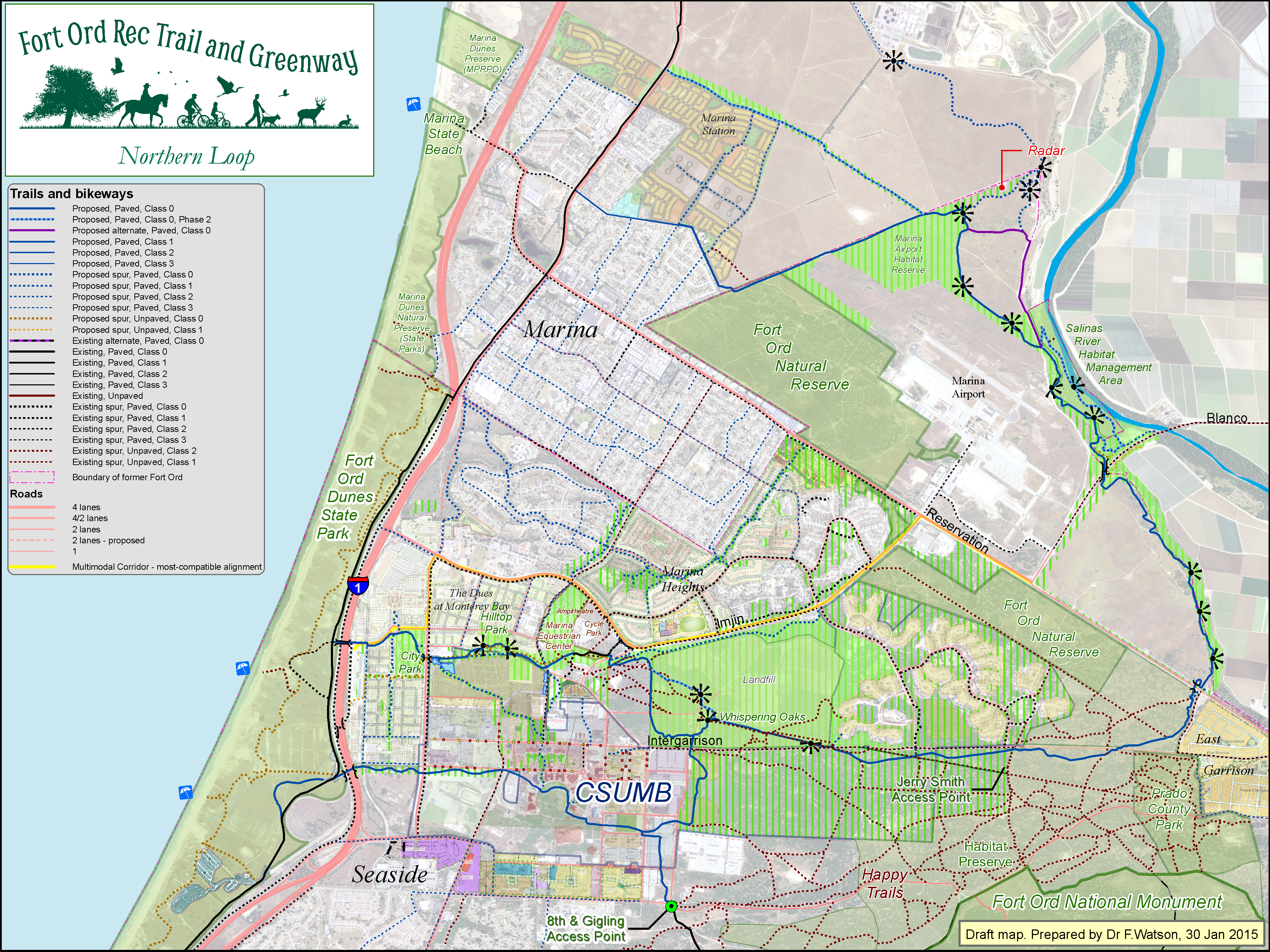
Click map to enlarge
Central Loop - simple layout - 1 April 2016
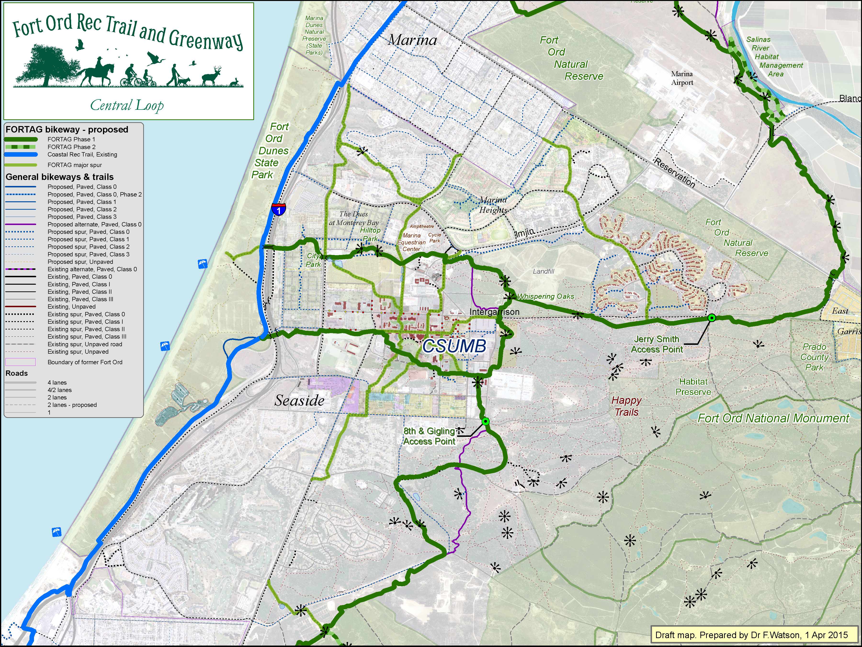
Click map to enlarge
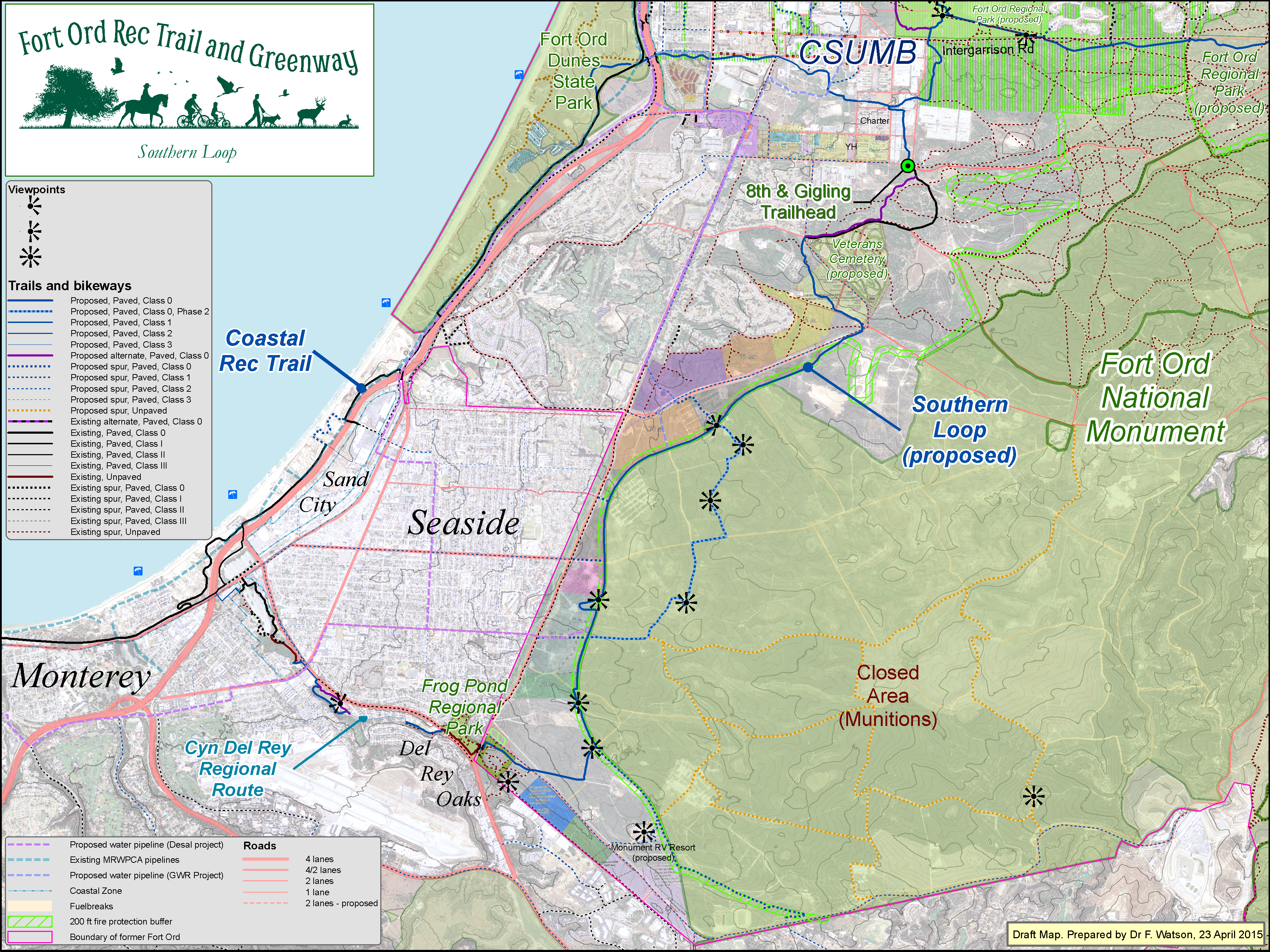
Southern Loop - simple layout - 1 Oct 2016

Click map to enlarge
Southern Loop - detailed layout - 10 Dec 2014
Click map to enlarge
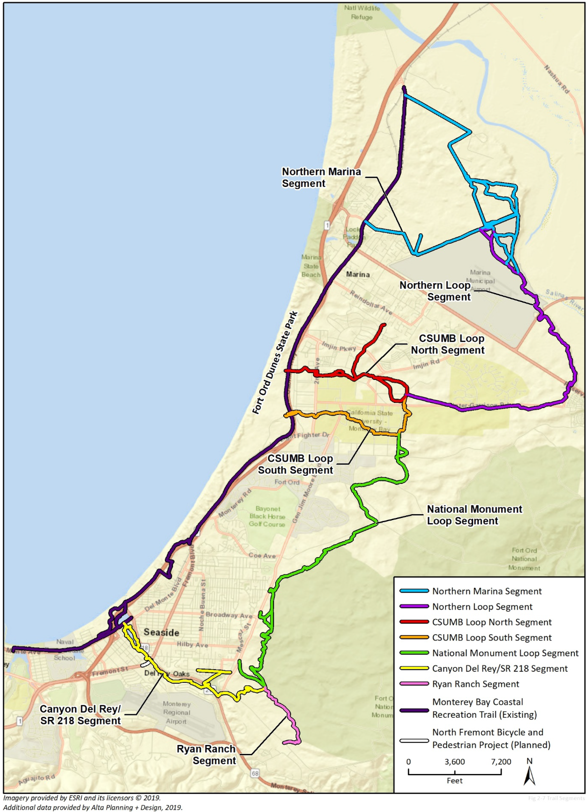
Seaside - vertical layout - 27 Oct 2016
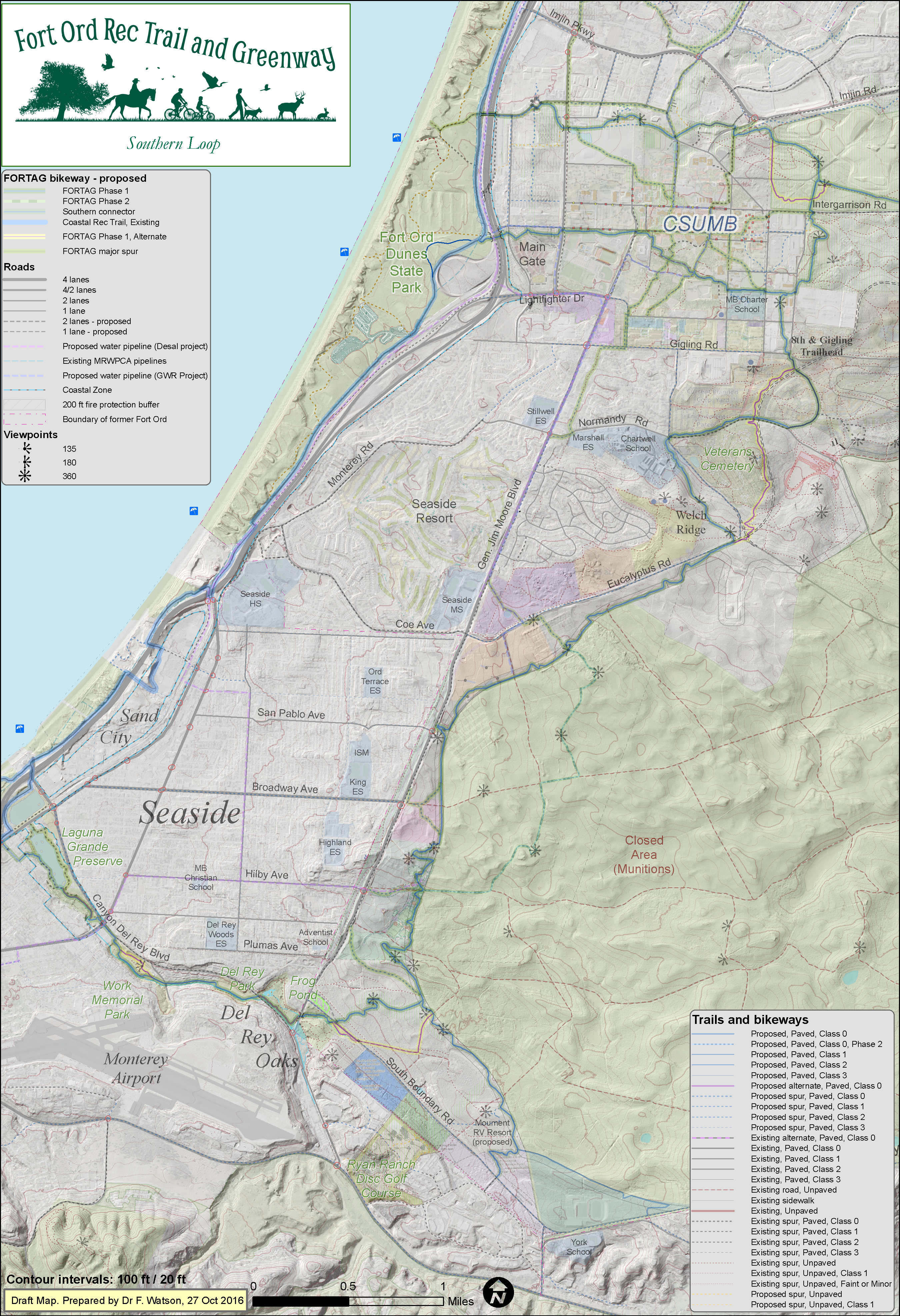
Click map to enlarge
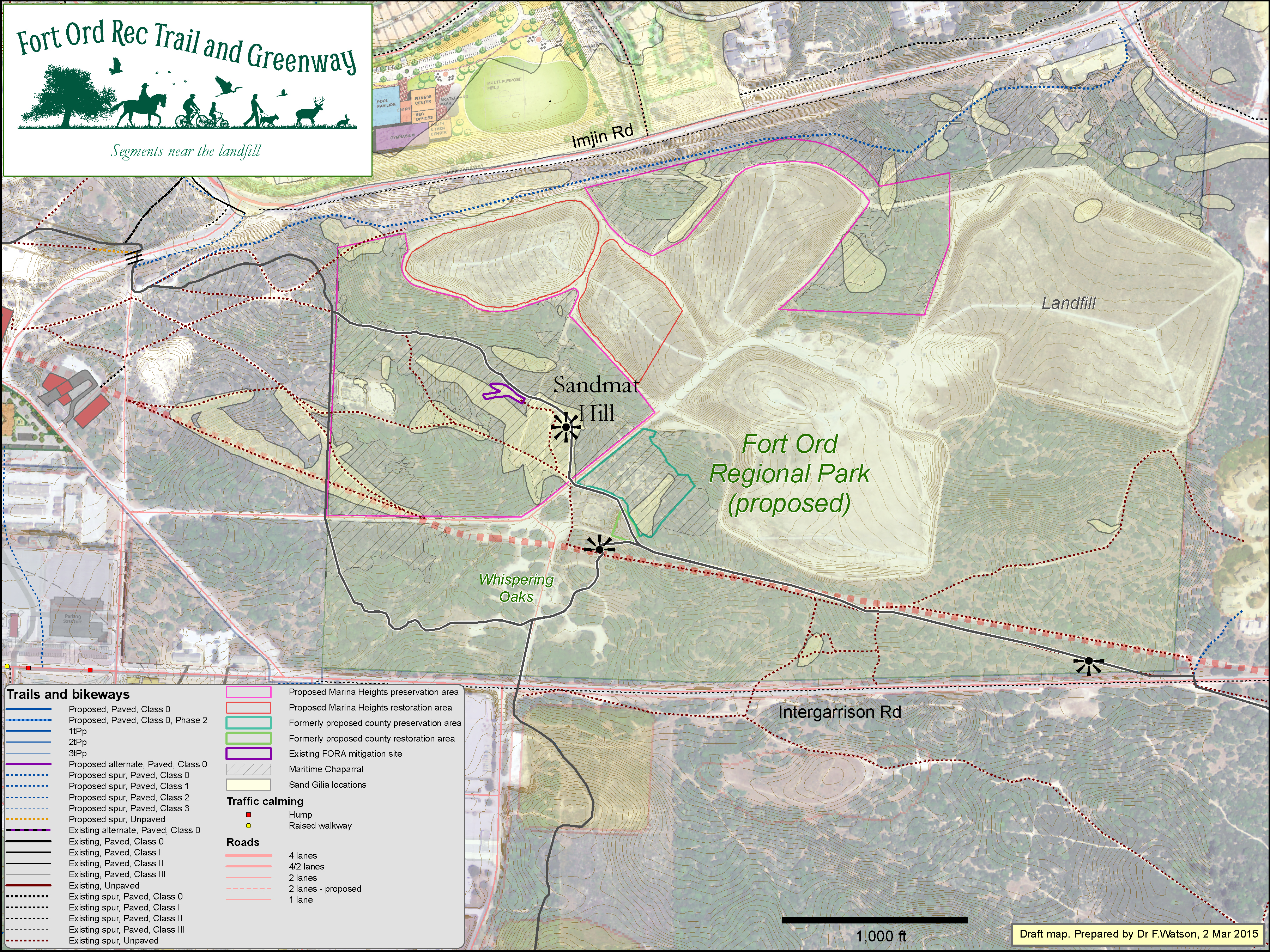
Fort Ord Regional Park (proposed) - 23 Oct 2015
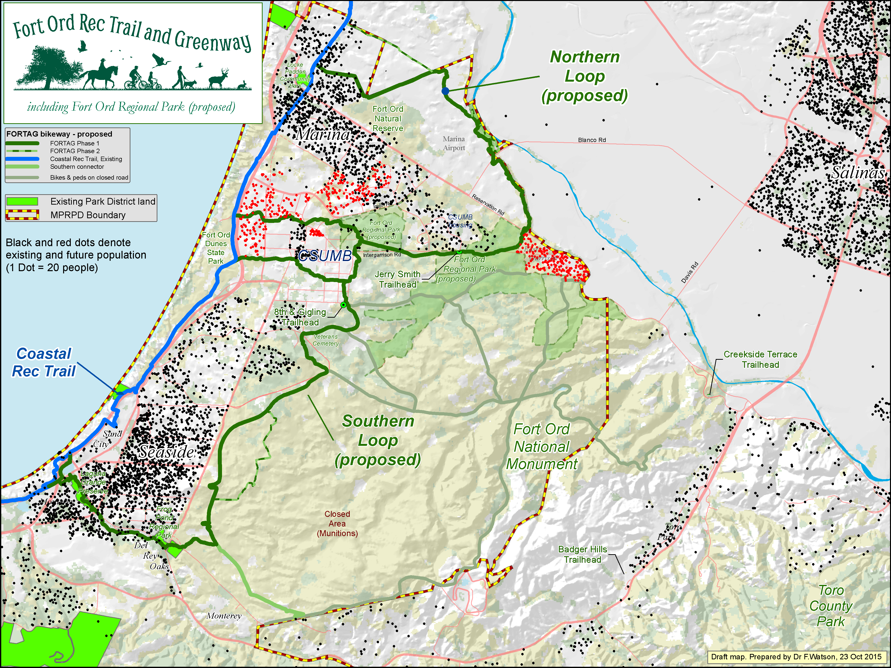
Click map to enlarge
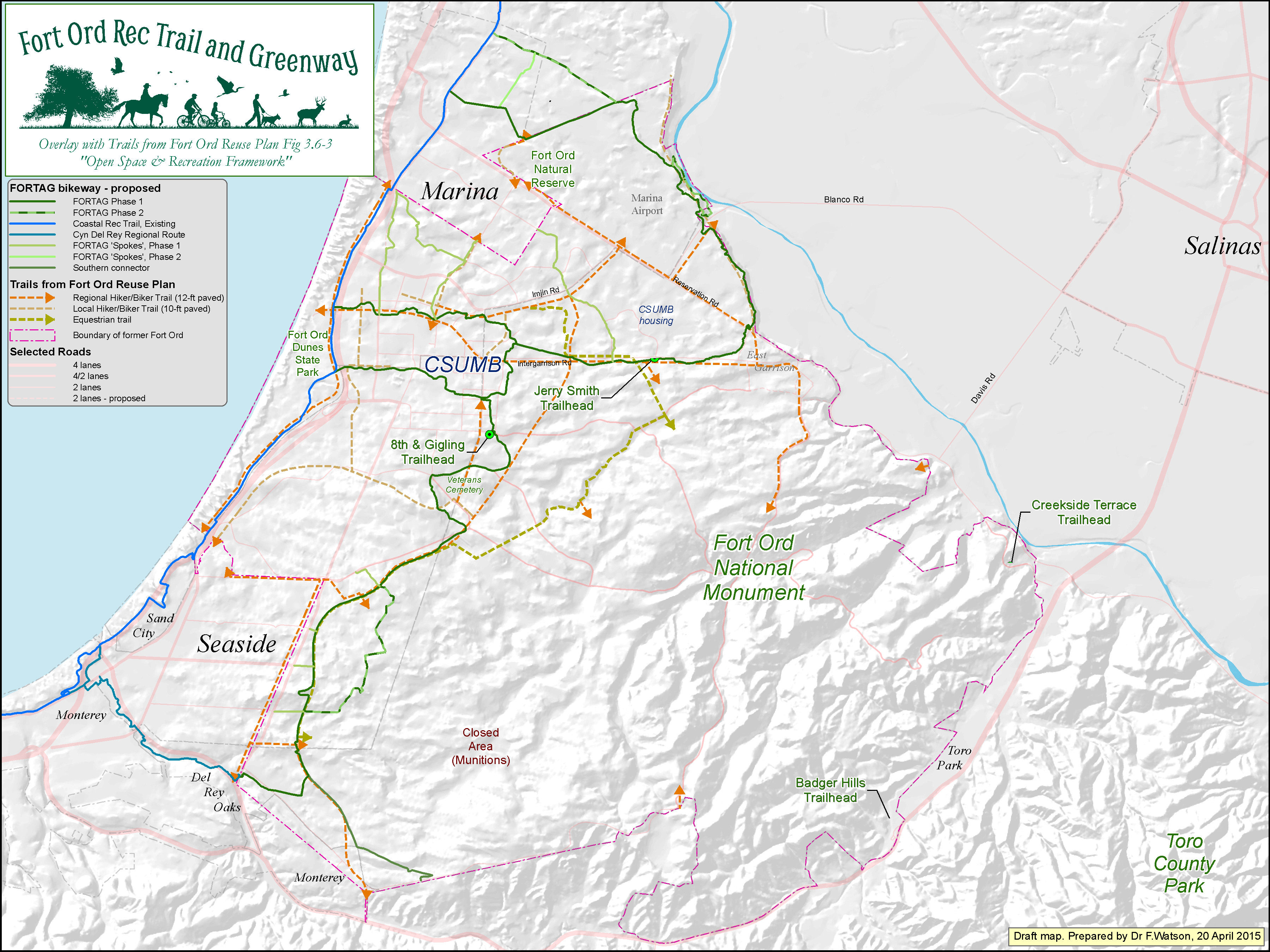
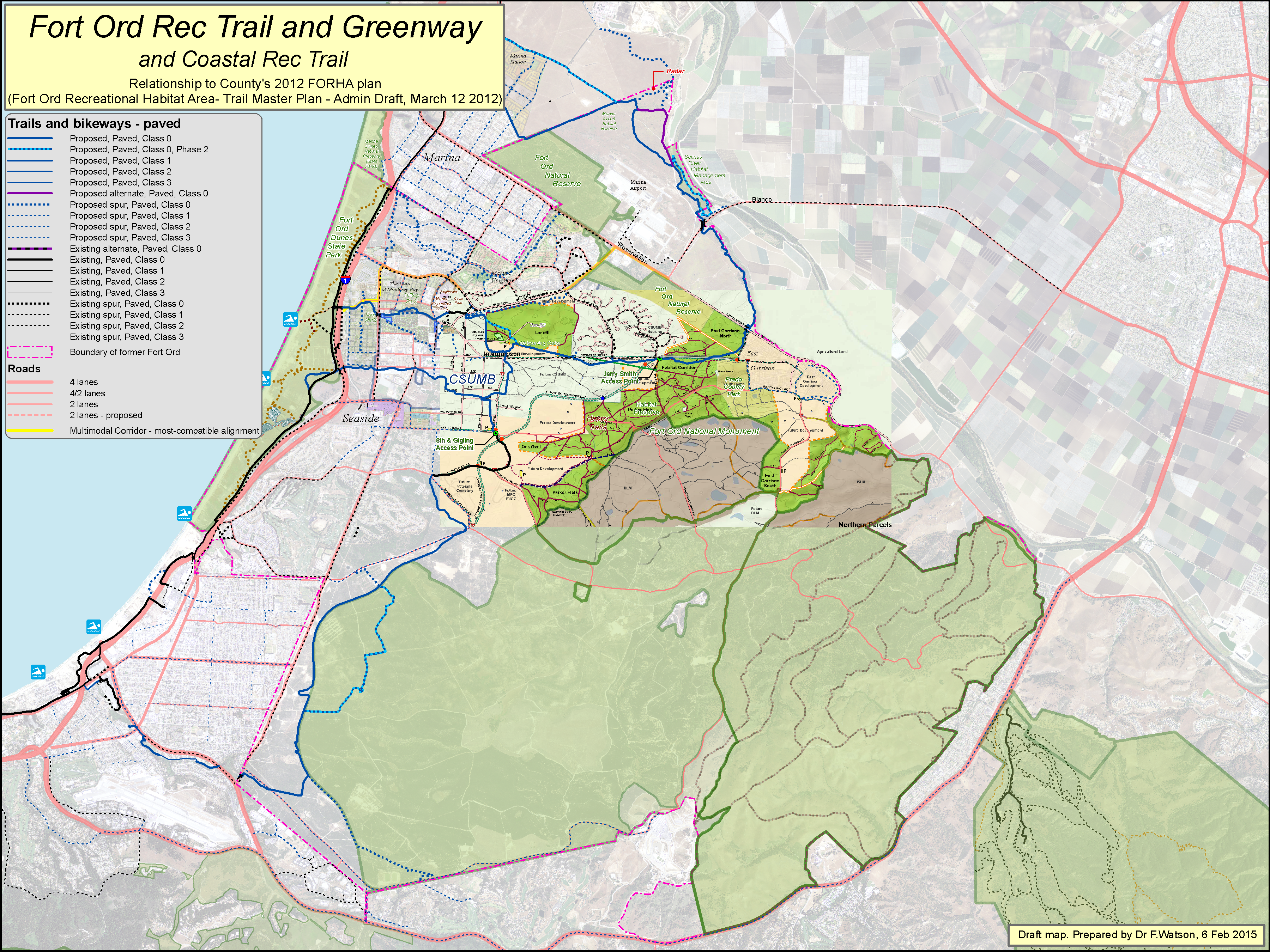
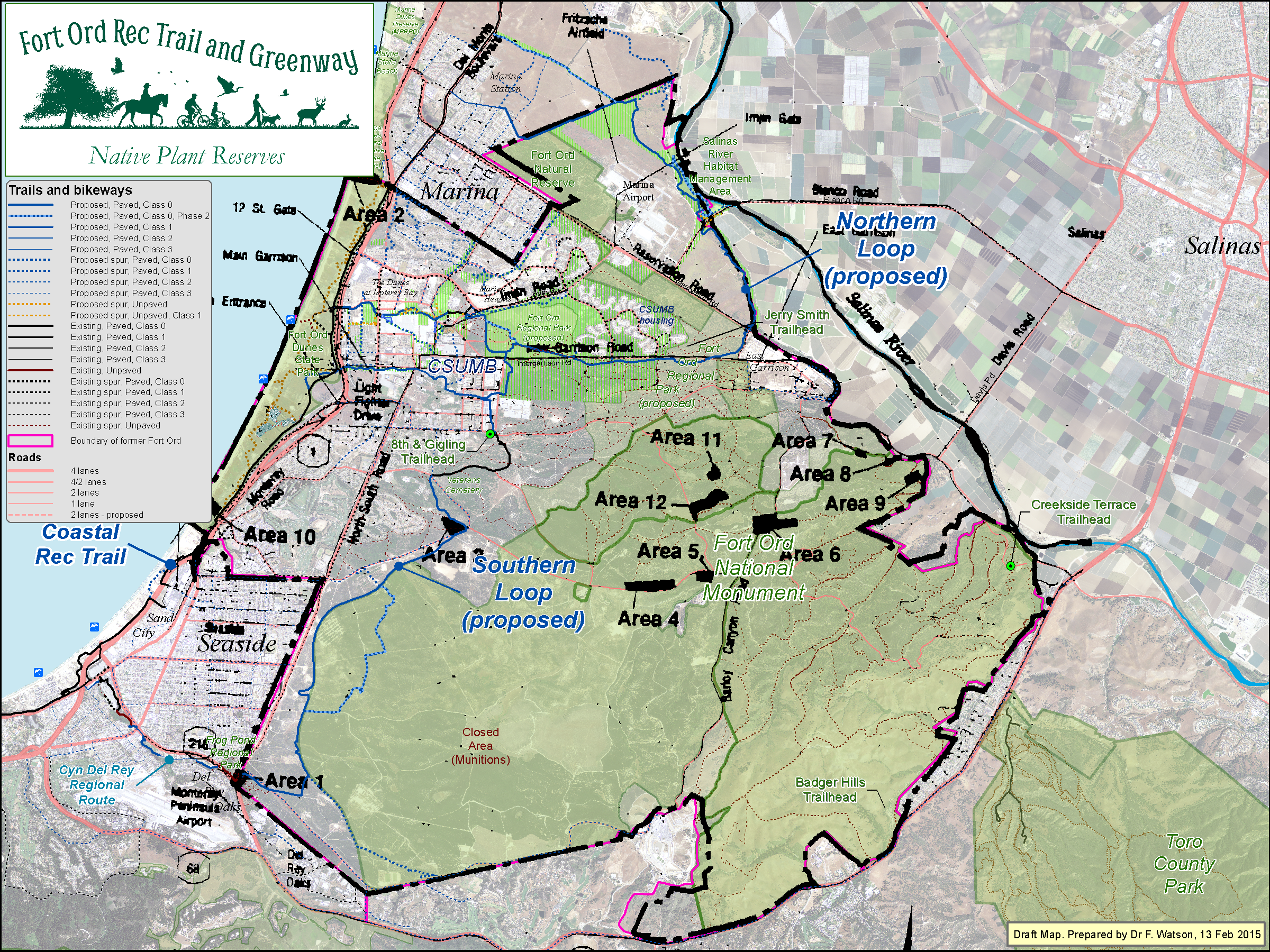
Wider regional view - 6 Feb 2015
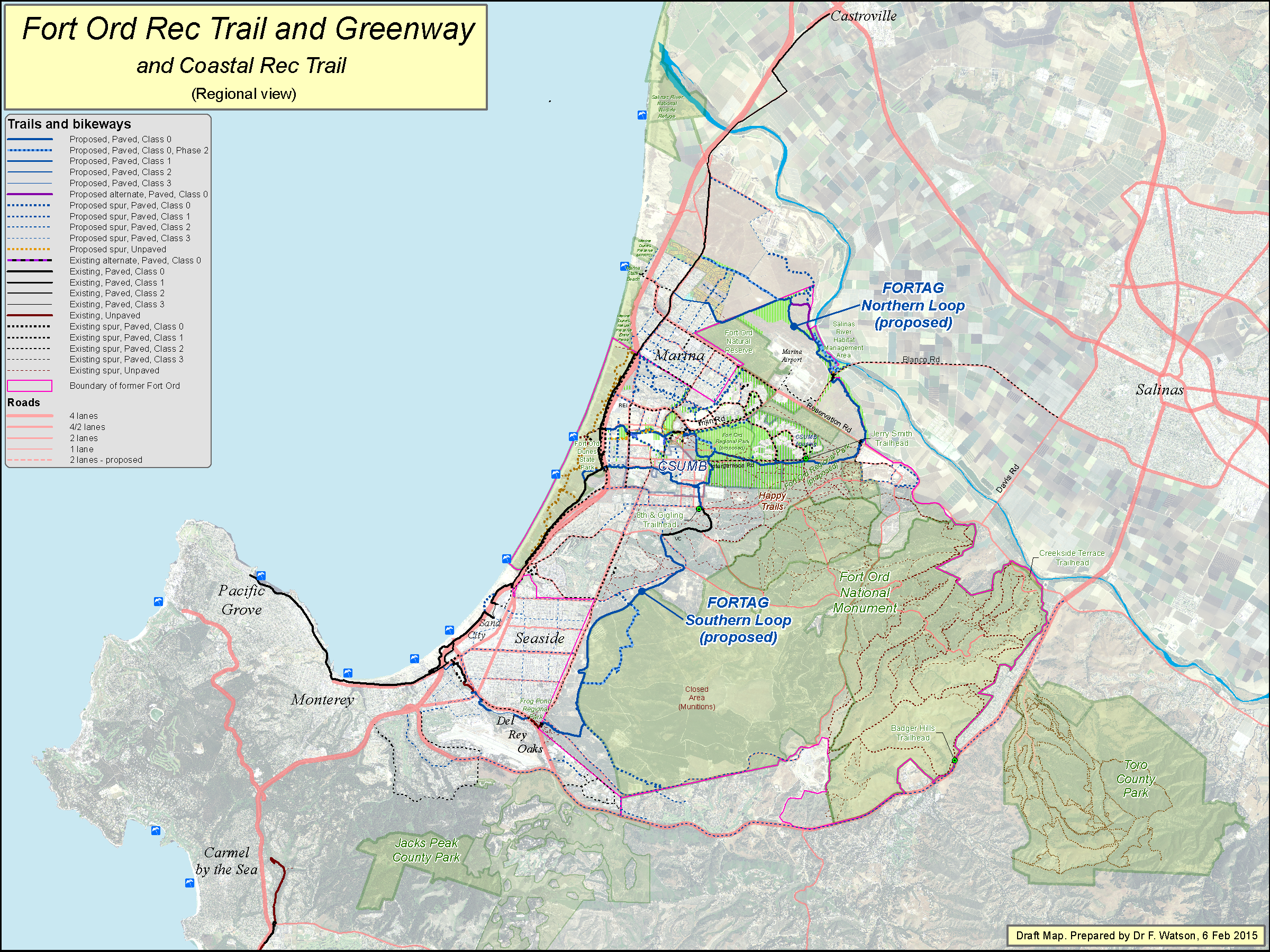
Click map to enlarge
Zoomed FORTAG maps
City of Marina - 7 Dec 2014
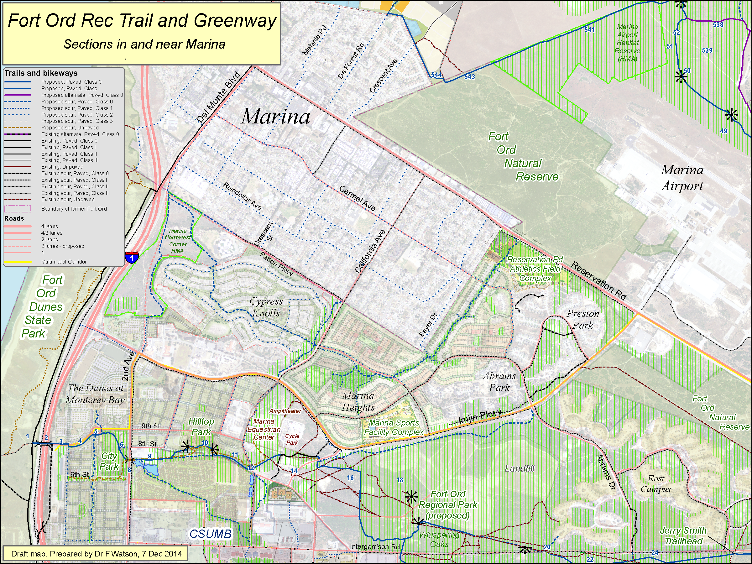
Click map to enlarge
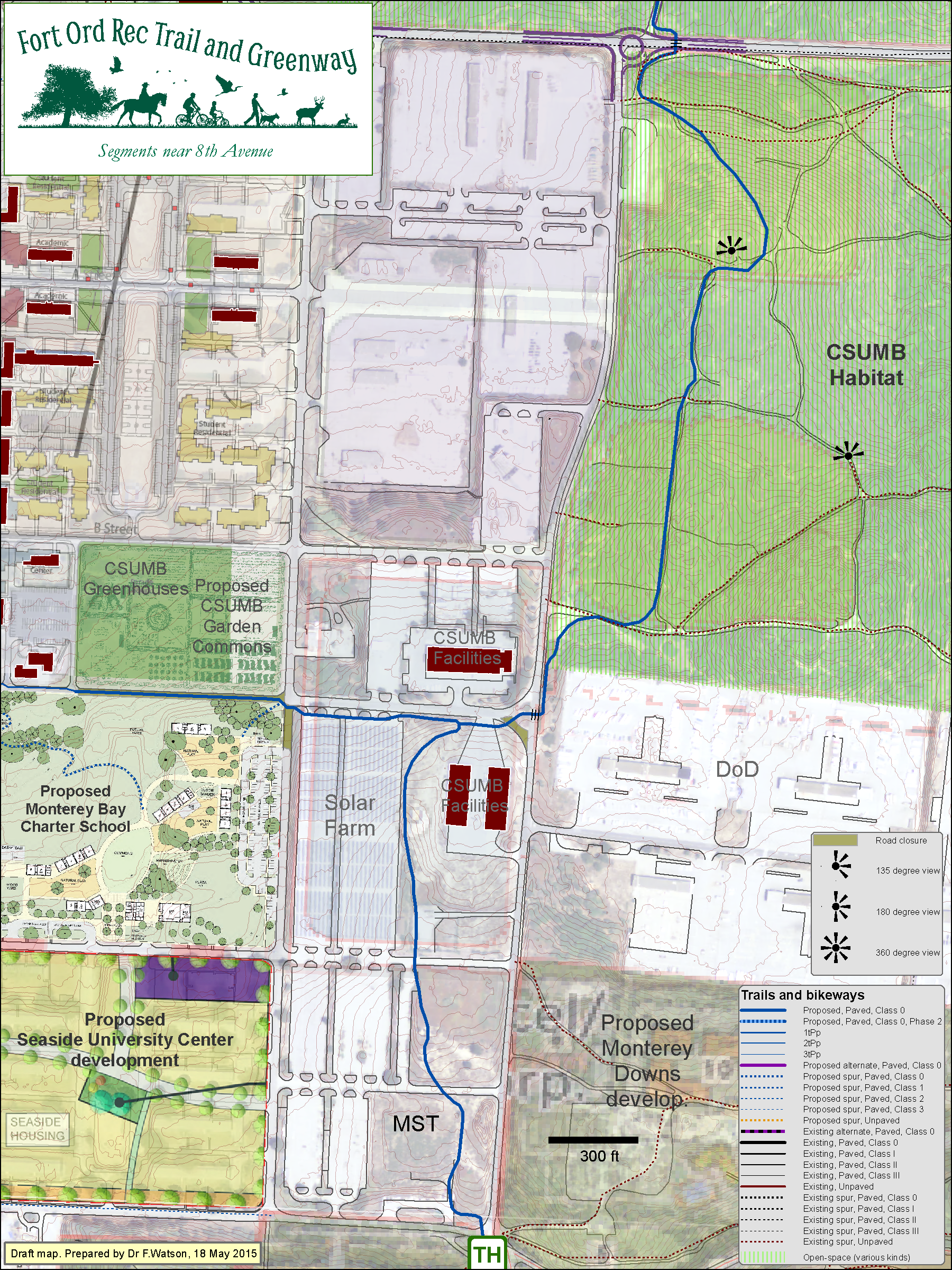
8th St to Inter-Garrison - 23 April 2015
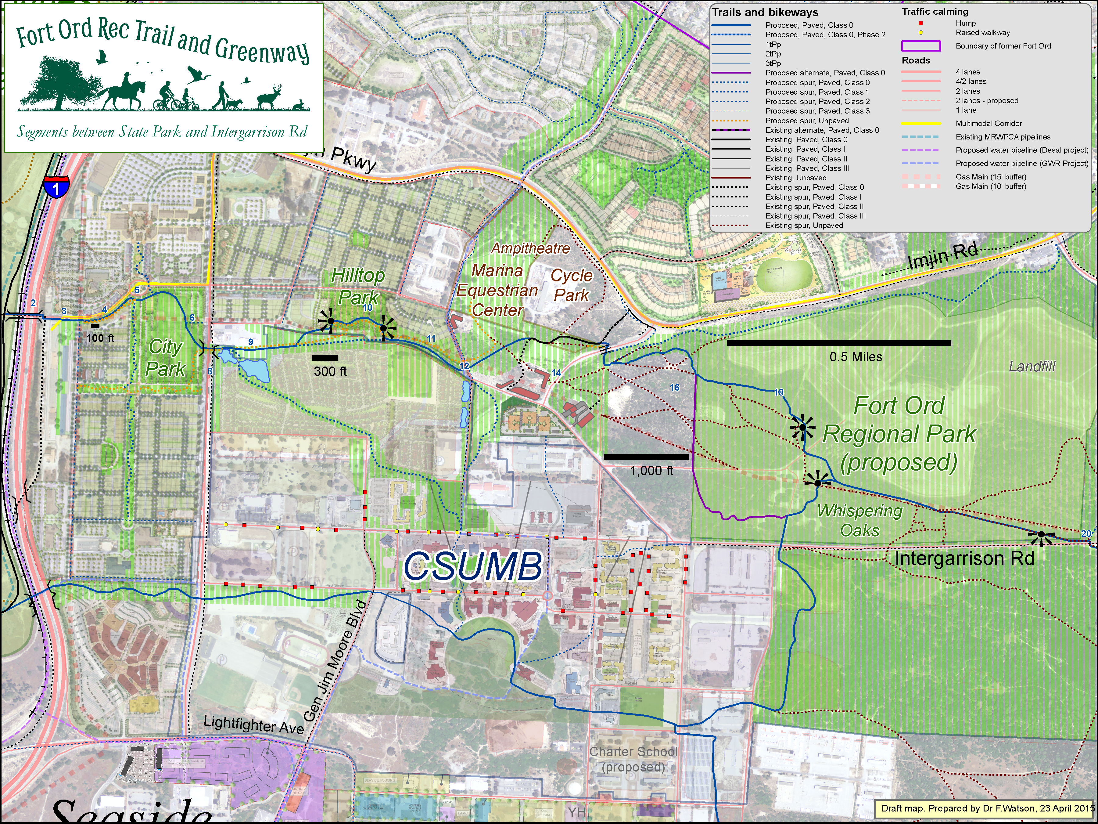
Click map to enlarge
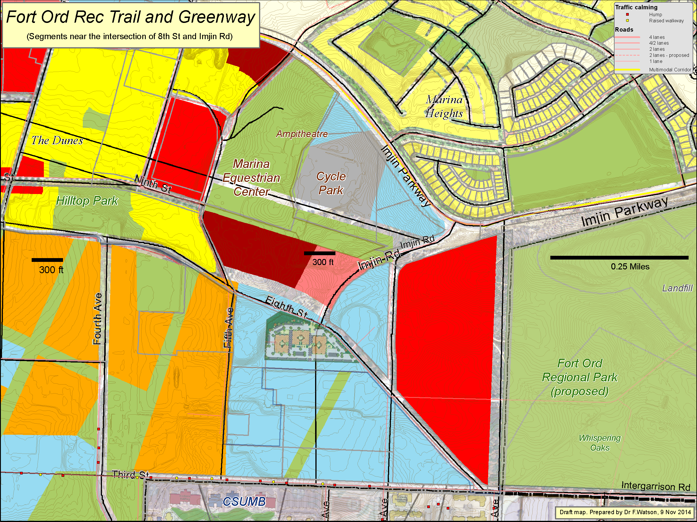
8th St & Imjin Rd - 10 Dec 2014
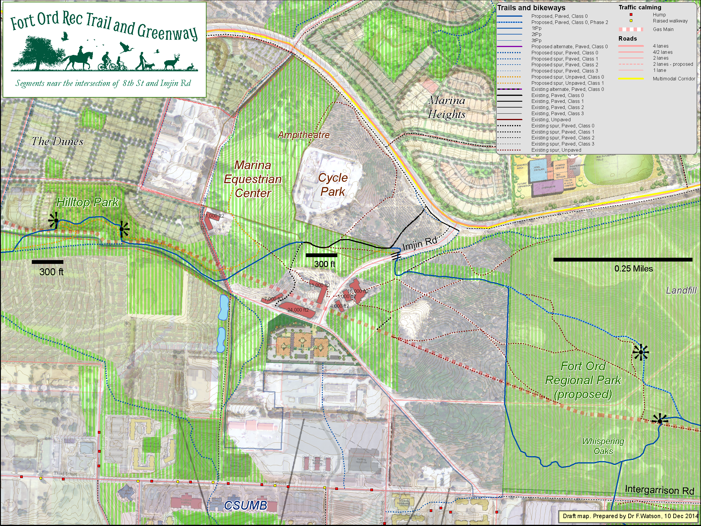
Click map to enlarge
8th St & Imjin Rd - Zoomed - 1 Mar 2015
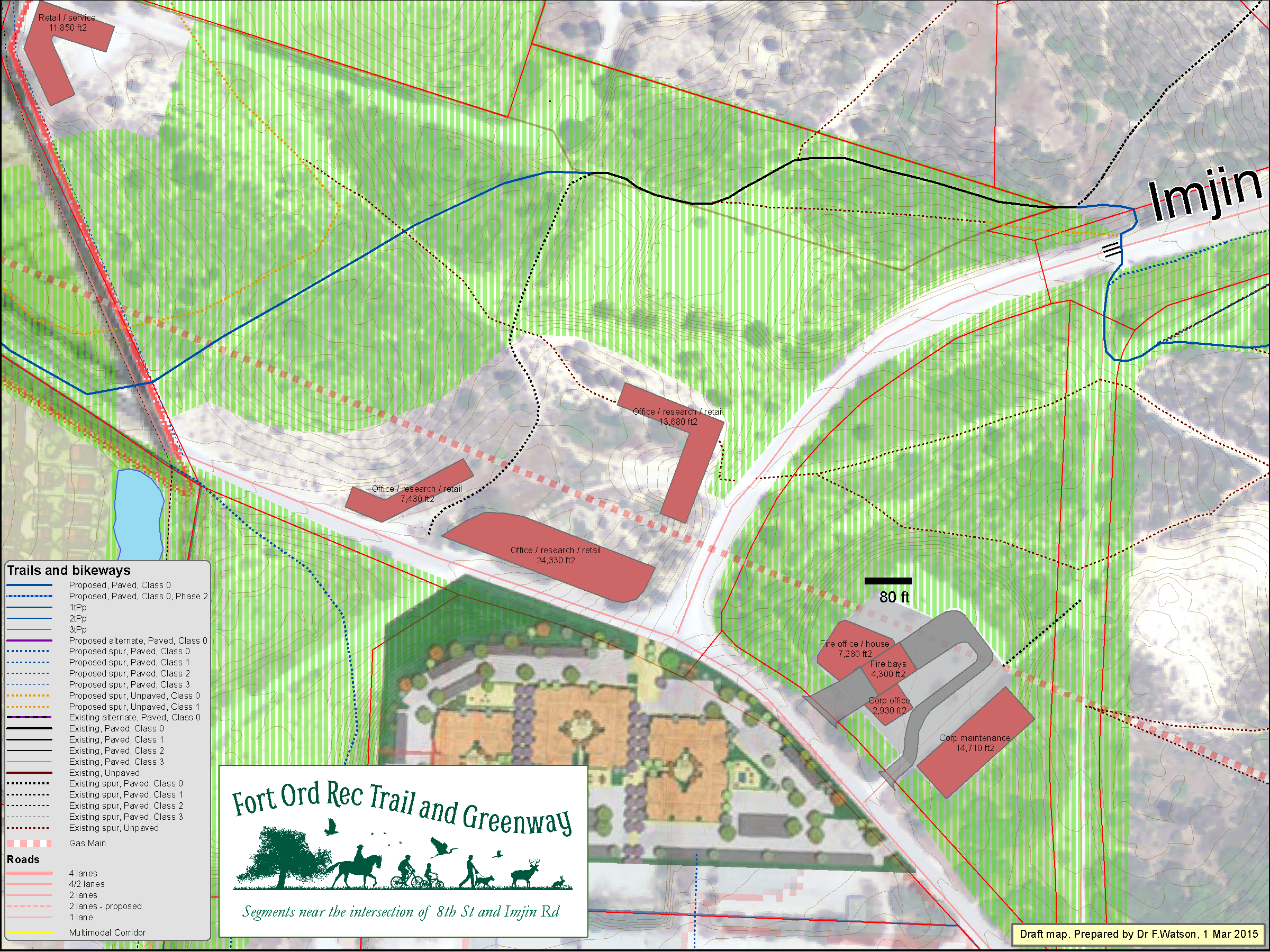
Click map to enlarge
8th St & Imjin Rd - Zoomed - 1 Mar 2015

Click map to enlarge
Landfill / Whispering Oaks - 2 Mar 2015
Click map to enlarge
8th Ave & Intergarrison - 16 May 2015
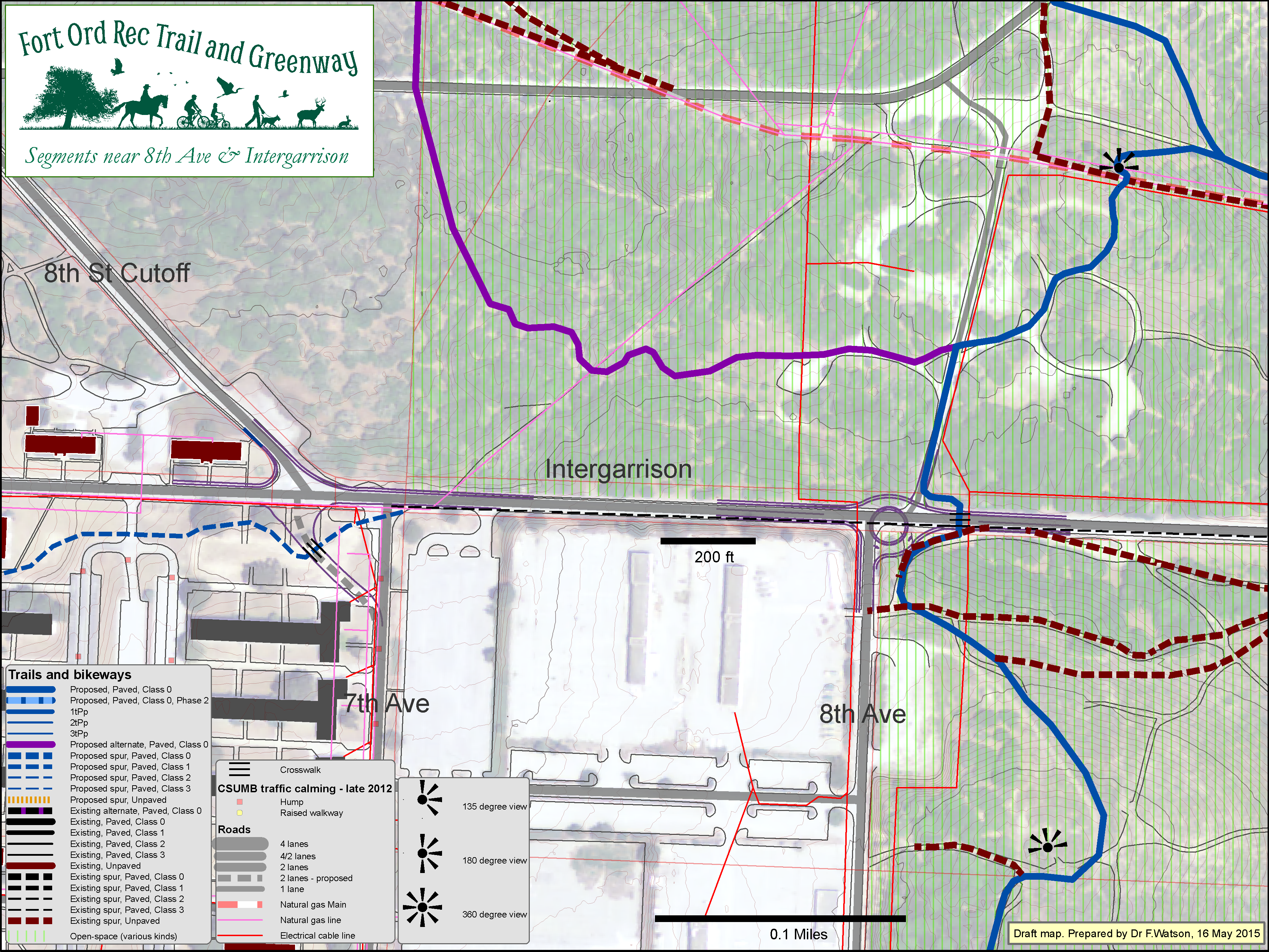
Click map to enlarge
Intergarrison - 17 May 2015

Click map to enlarge
Carmel Ave- 23 Oct 2015
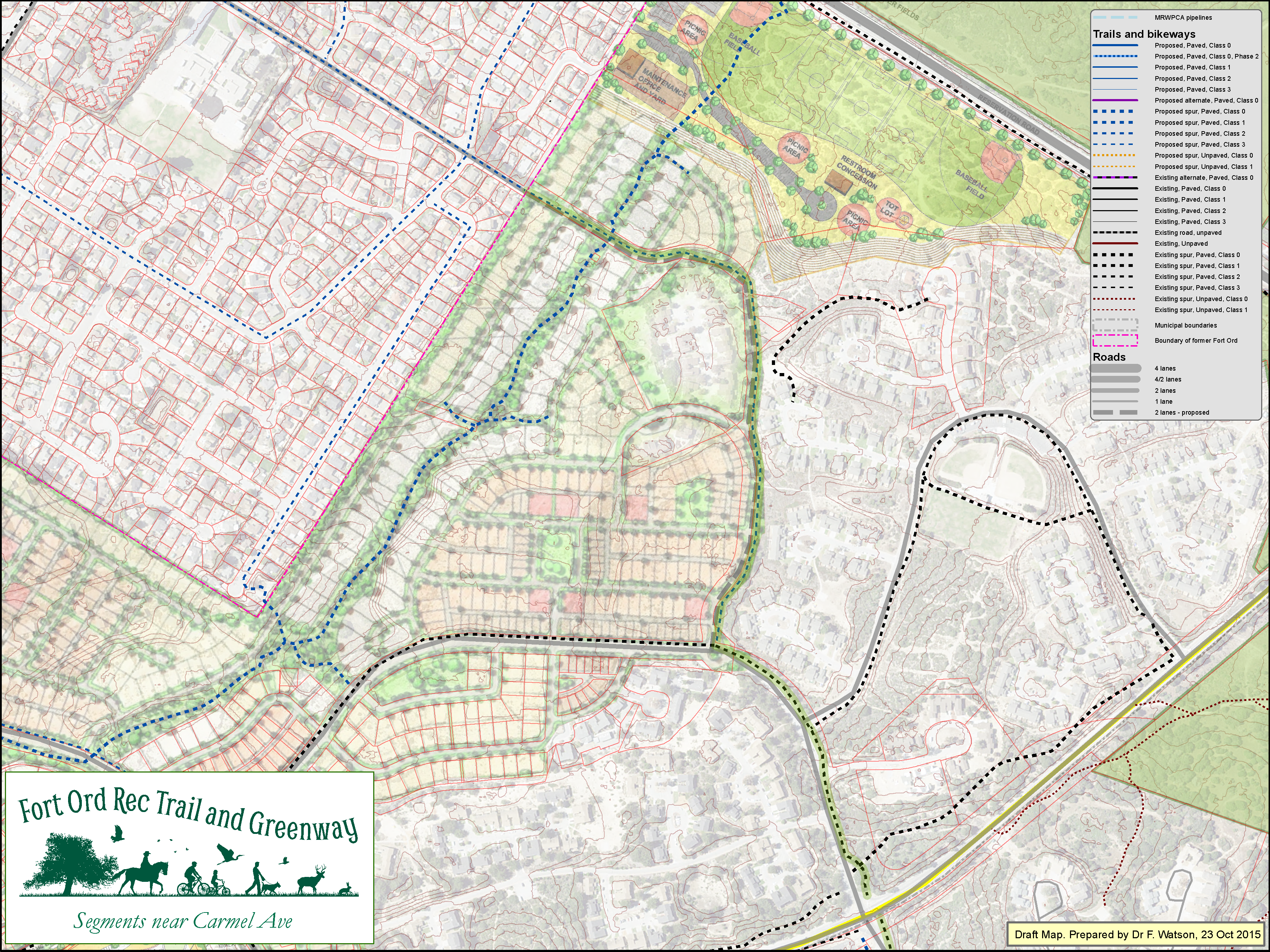
Click map to enlarge
East Garrison area - 6 Feb 2015
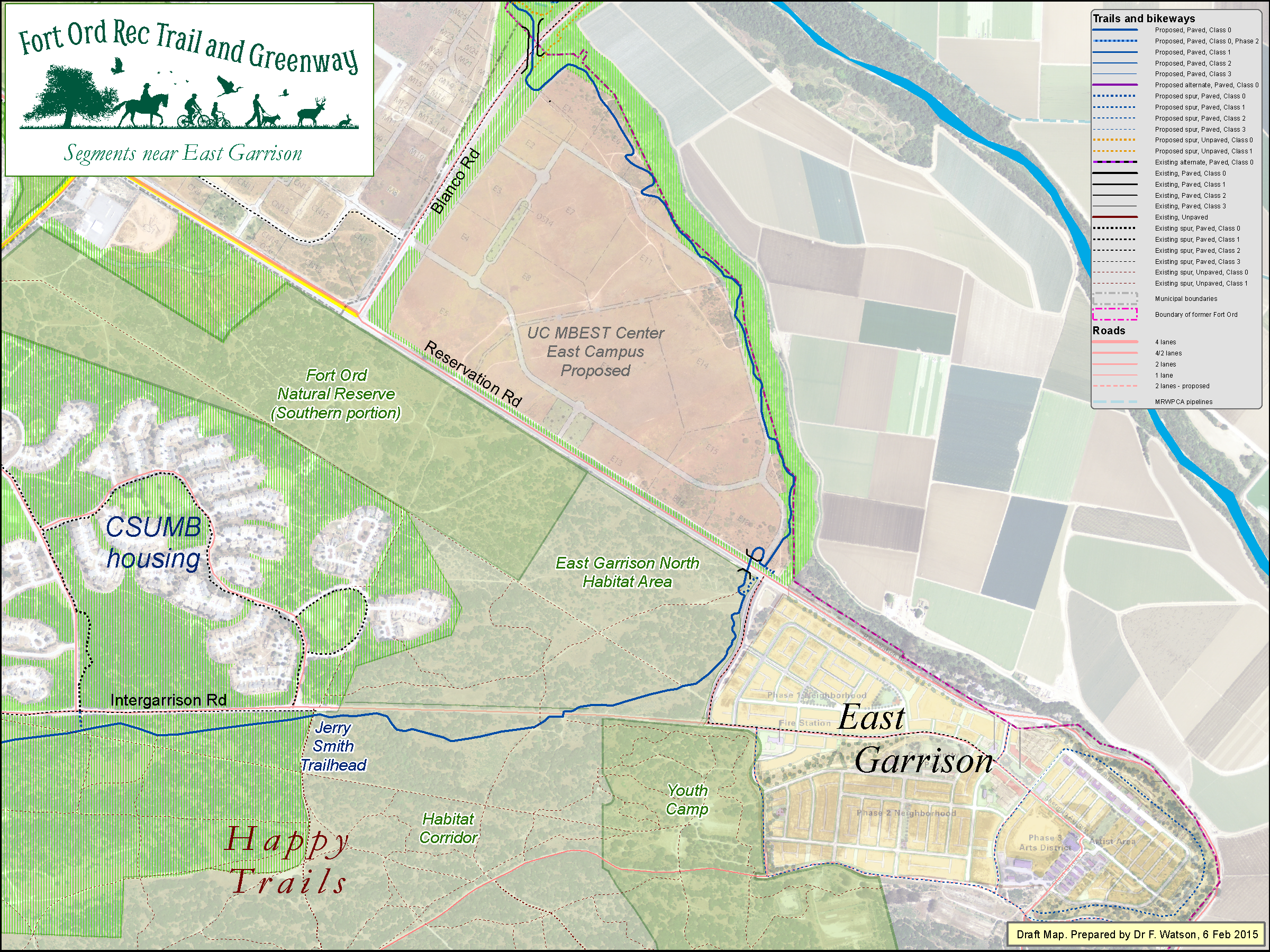
Click map to enlarge
Segments near Salinas River HMA - 30 Jan 2015
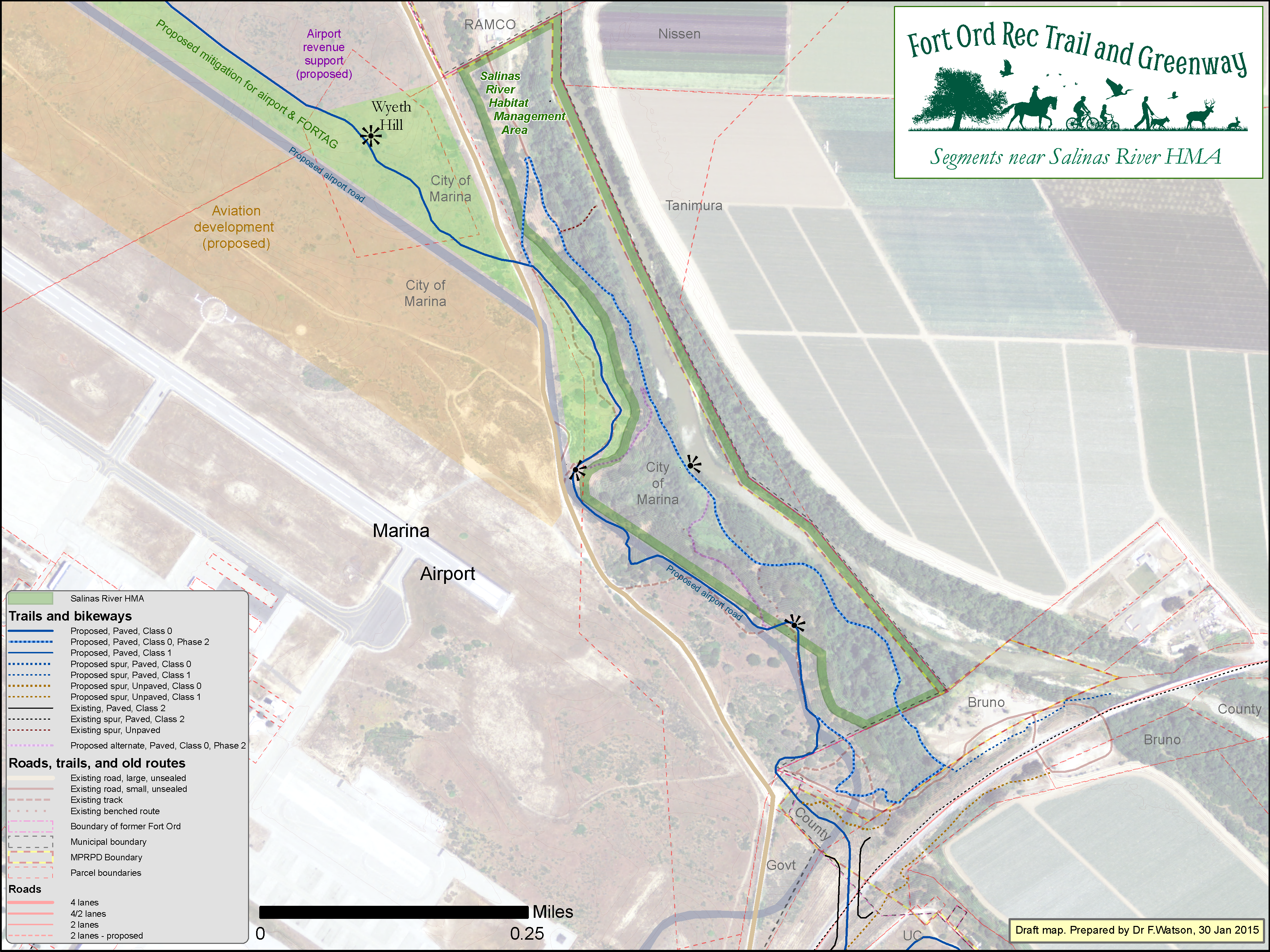
Click map to enlarge
Marina Airport - proposed mitigation plan - 19 Nov 2014
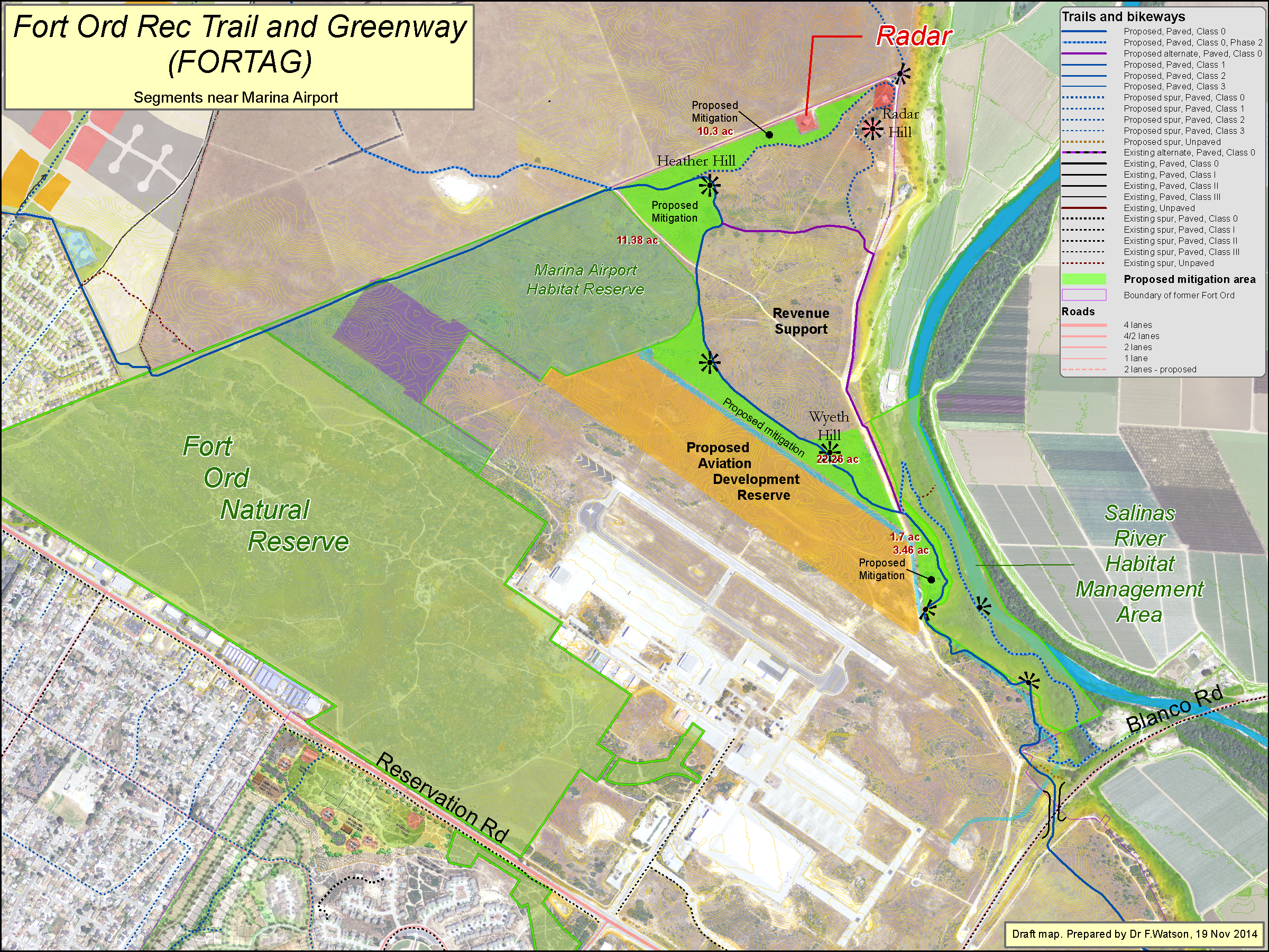
Click map to enlarge
Windy Hill (north side of Marina) - 19 Nov 2014

Click map to enlarge
Segments near Armstrong Ranch - 6 Feb 2015
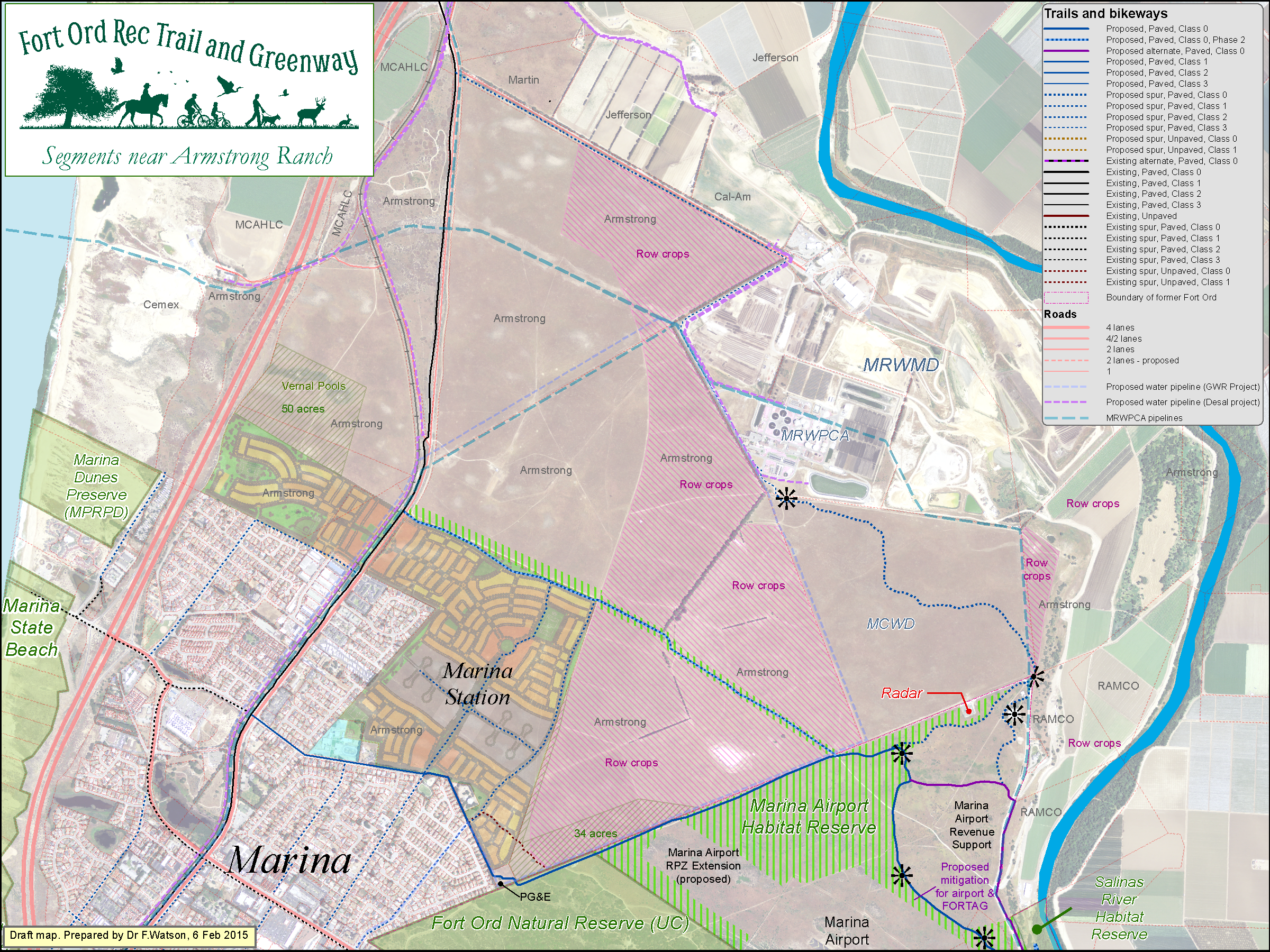
Click map to enlarge
Canyon Del Rey area - Wide view - 21 Aug 2018
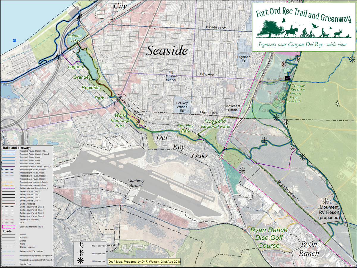
Click map to enlarge
Canyon Del Rey area - 24 Aug 2018
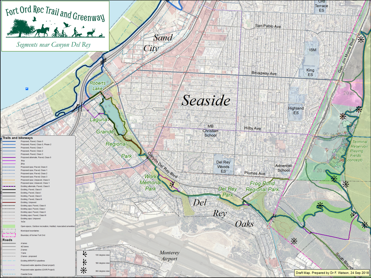
Click map to enlarge
Laguna Grande - 11 Dec 2015

Click map to enlarge
Laguna Grande - western end - 16 Dec 2015
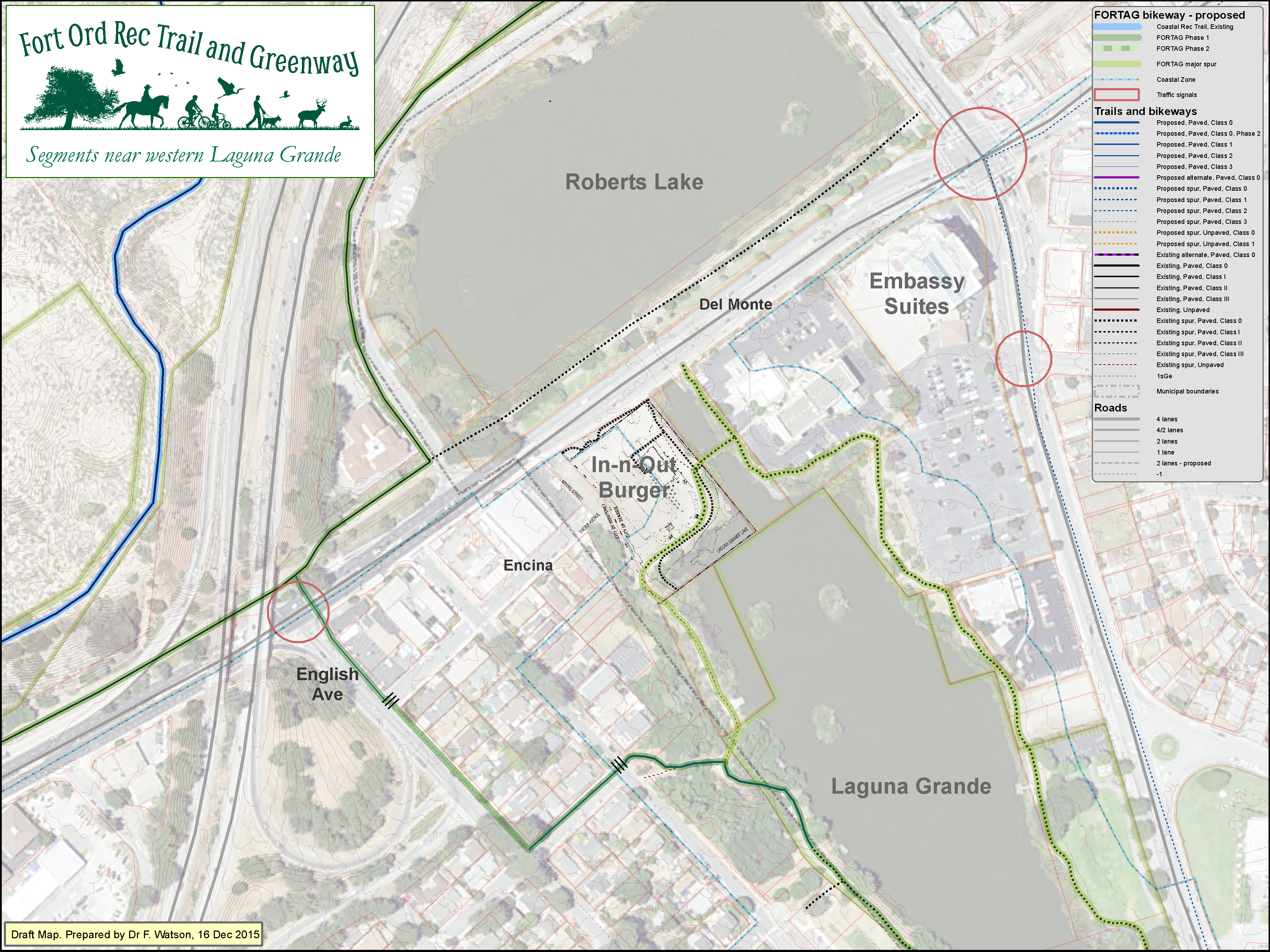
Click map to enlarge
Laguna Grande - eastern end - 17 Dec 2015
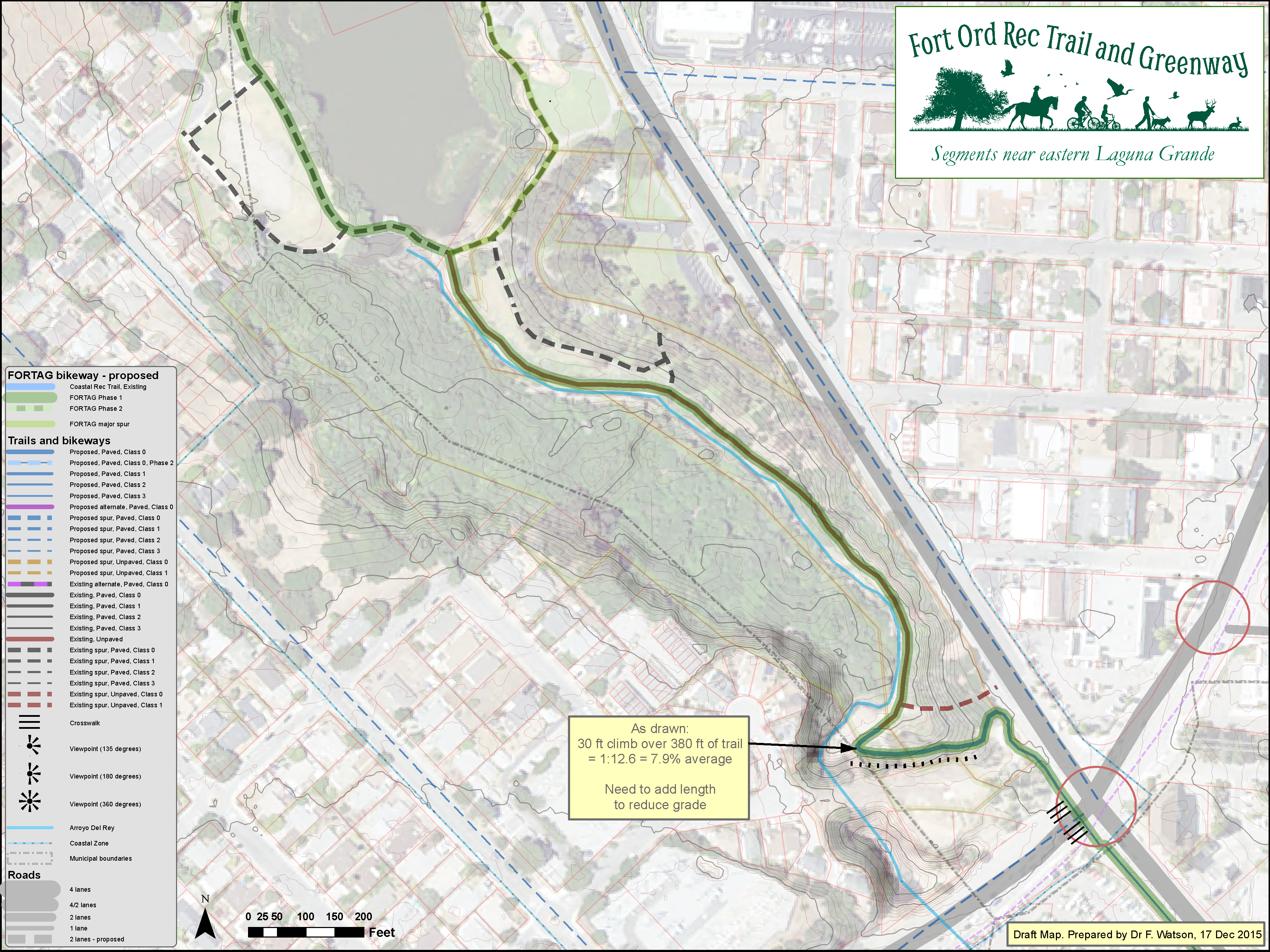
Click map to enlarge
Del Rey Oaks - West - 10 April 2015
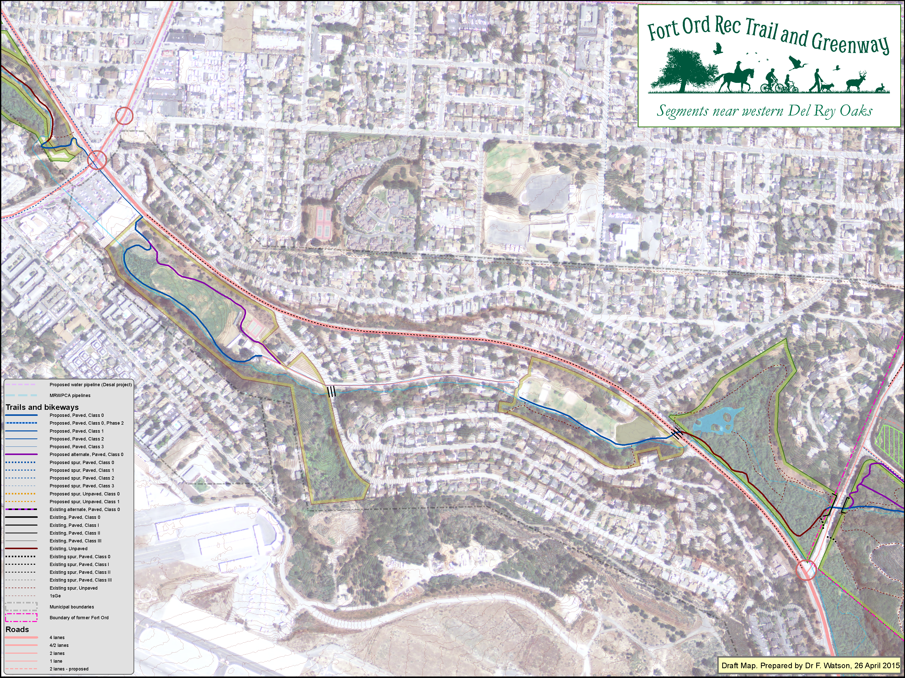
Click map to enlarge
Work Memorial Park (western portion) - 10 May 2015
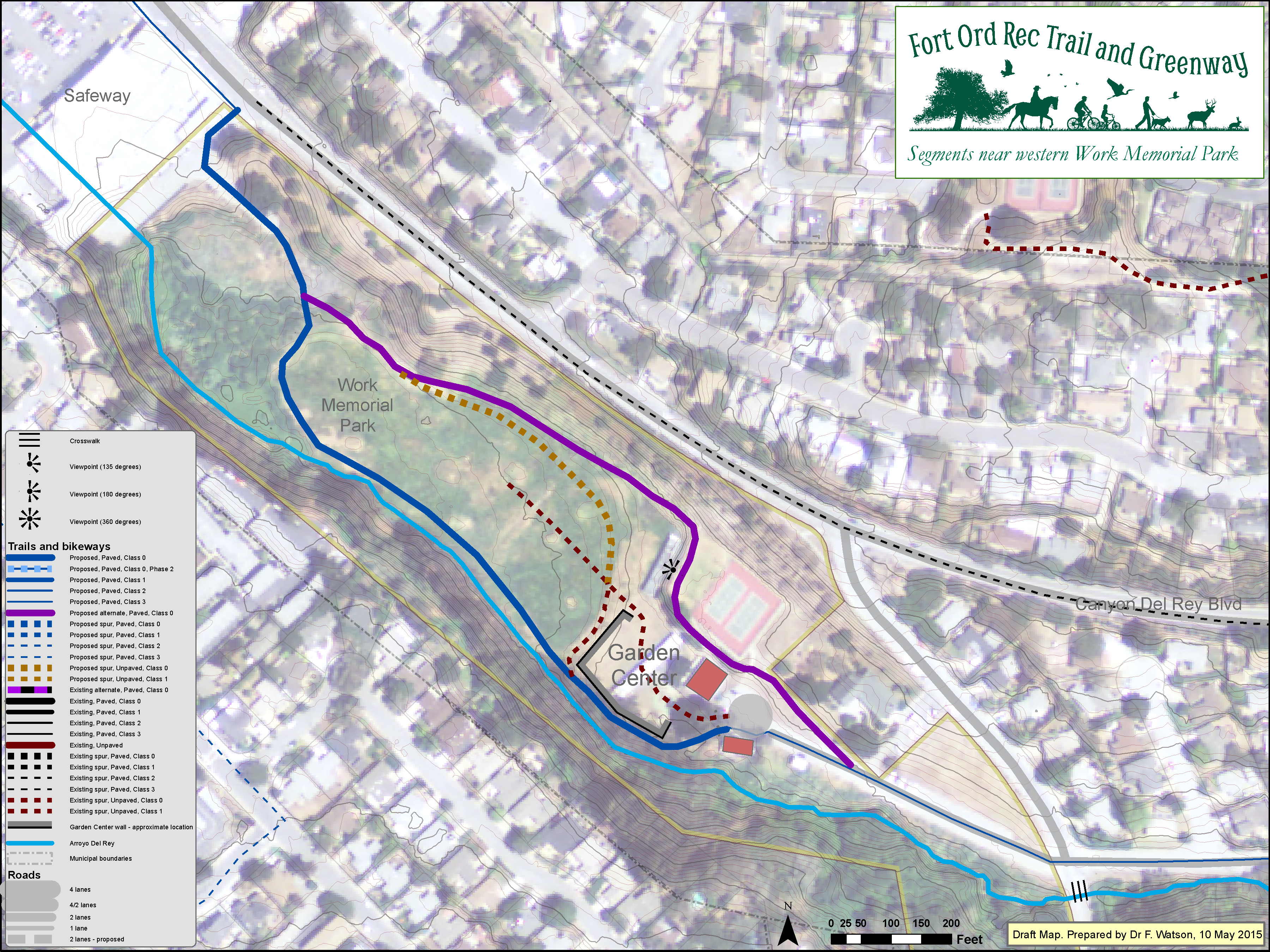
Click map to enlarge
Frog Pond area - 26 April 2015

Click map to enlarge
Del Rey Oaks - East - 19 Sep 2016
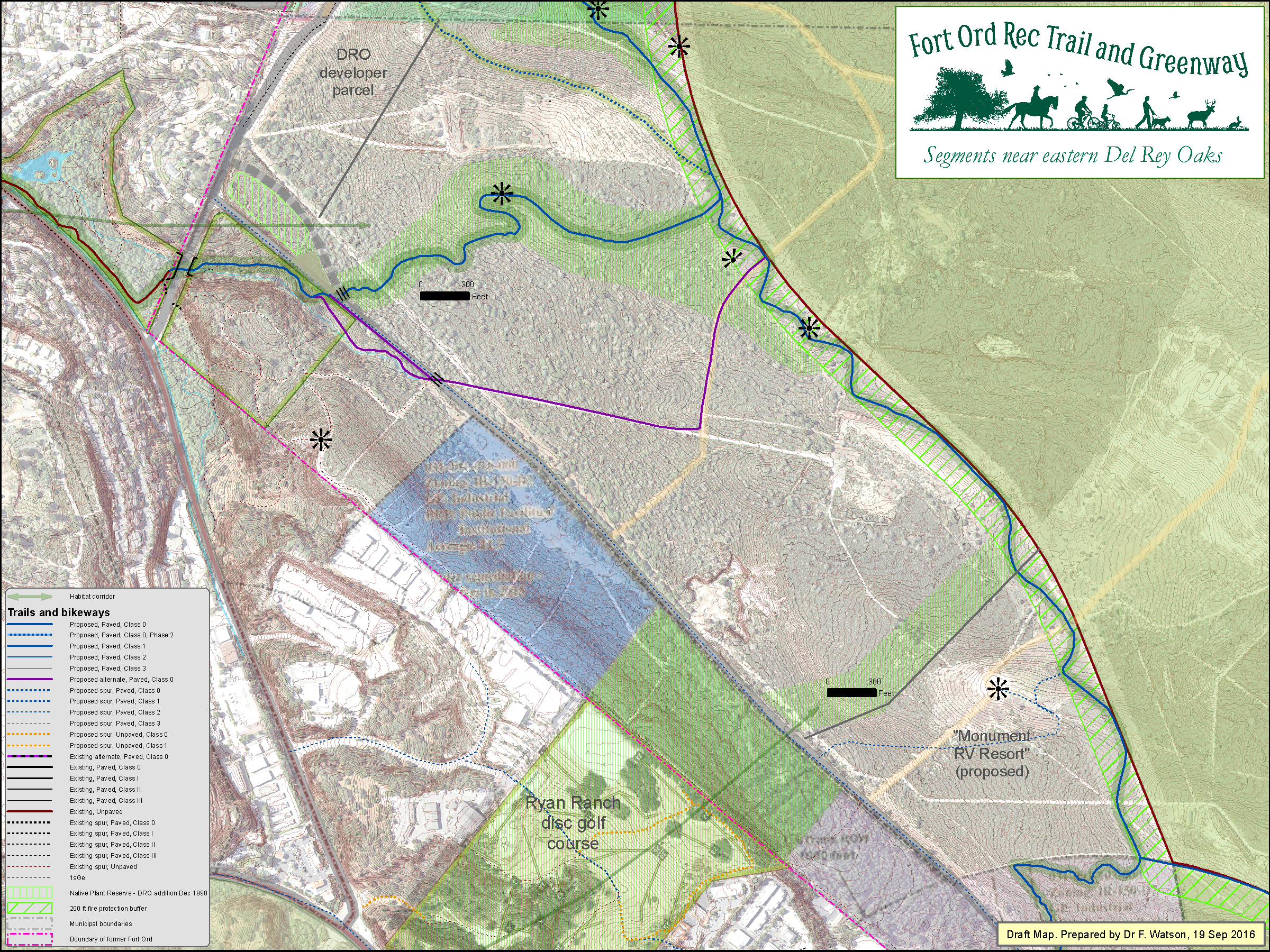
Click map to enlarge
Ryan Ranch - 23 April 2015
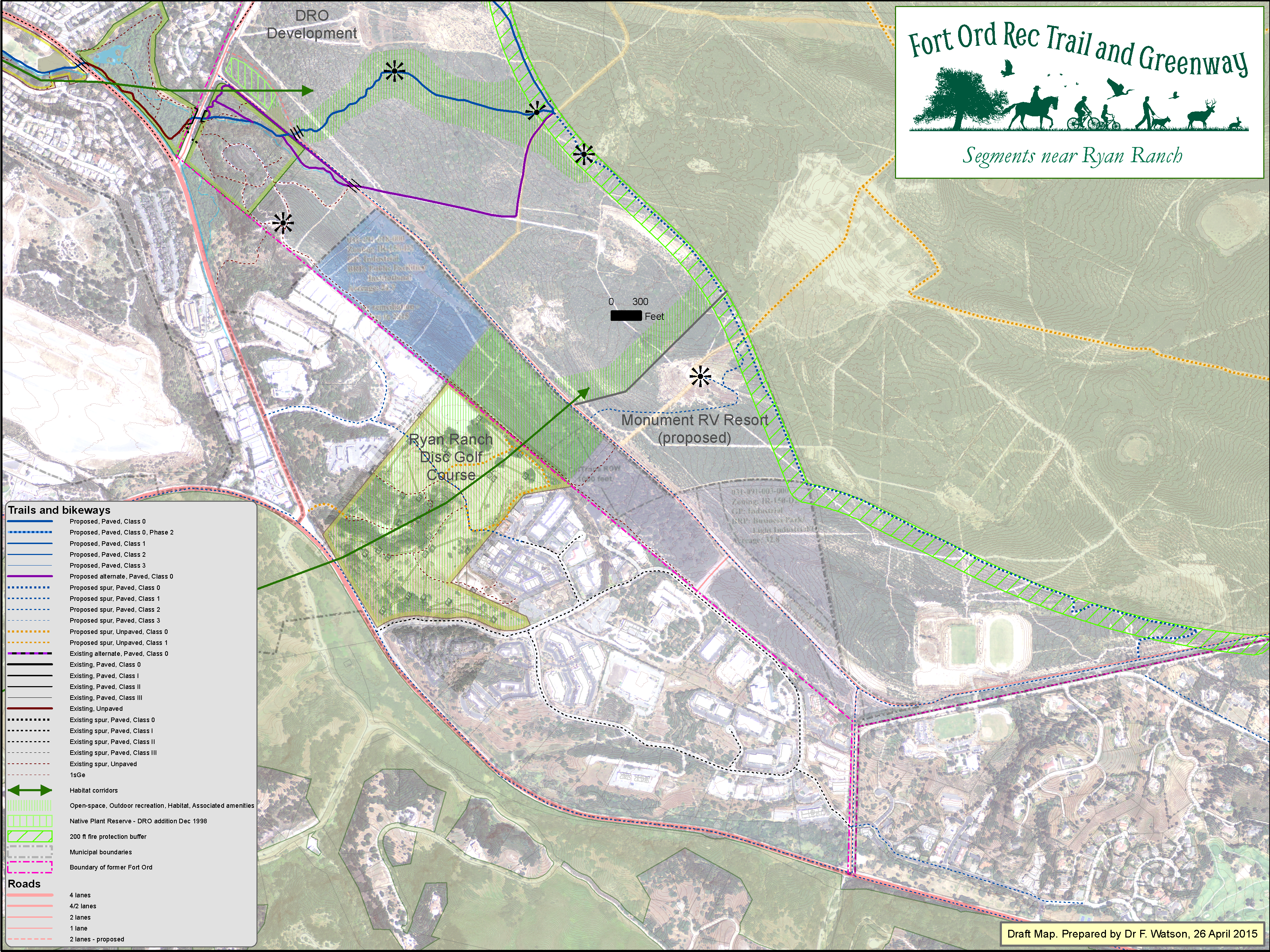
Click map to enlarge
Seaside East - 6 Dec 2016
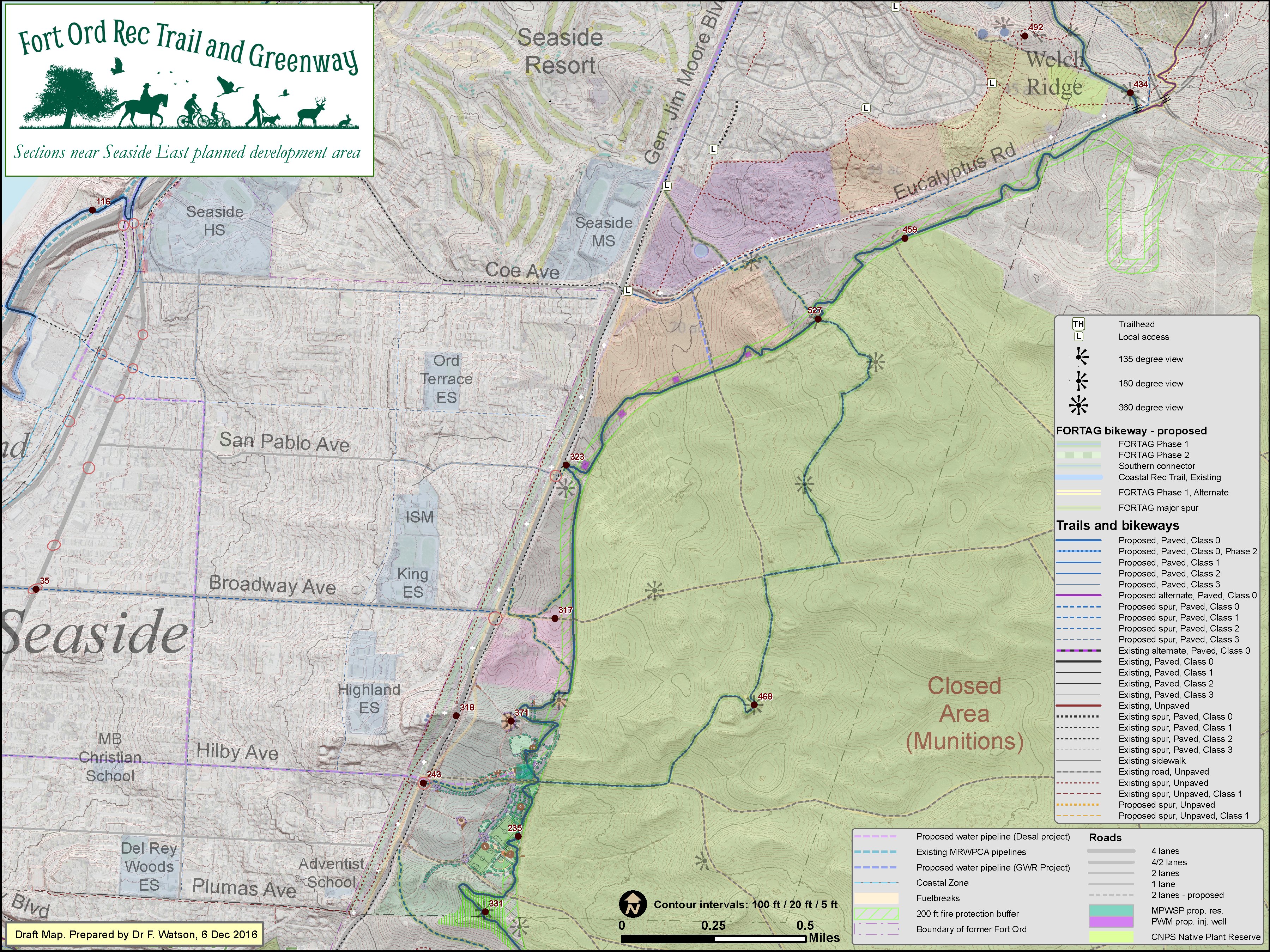
Click map to enlarge
Seaside East - terrain elevation - 6 Dec 2016

Click map to enlarge
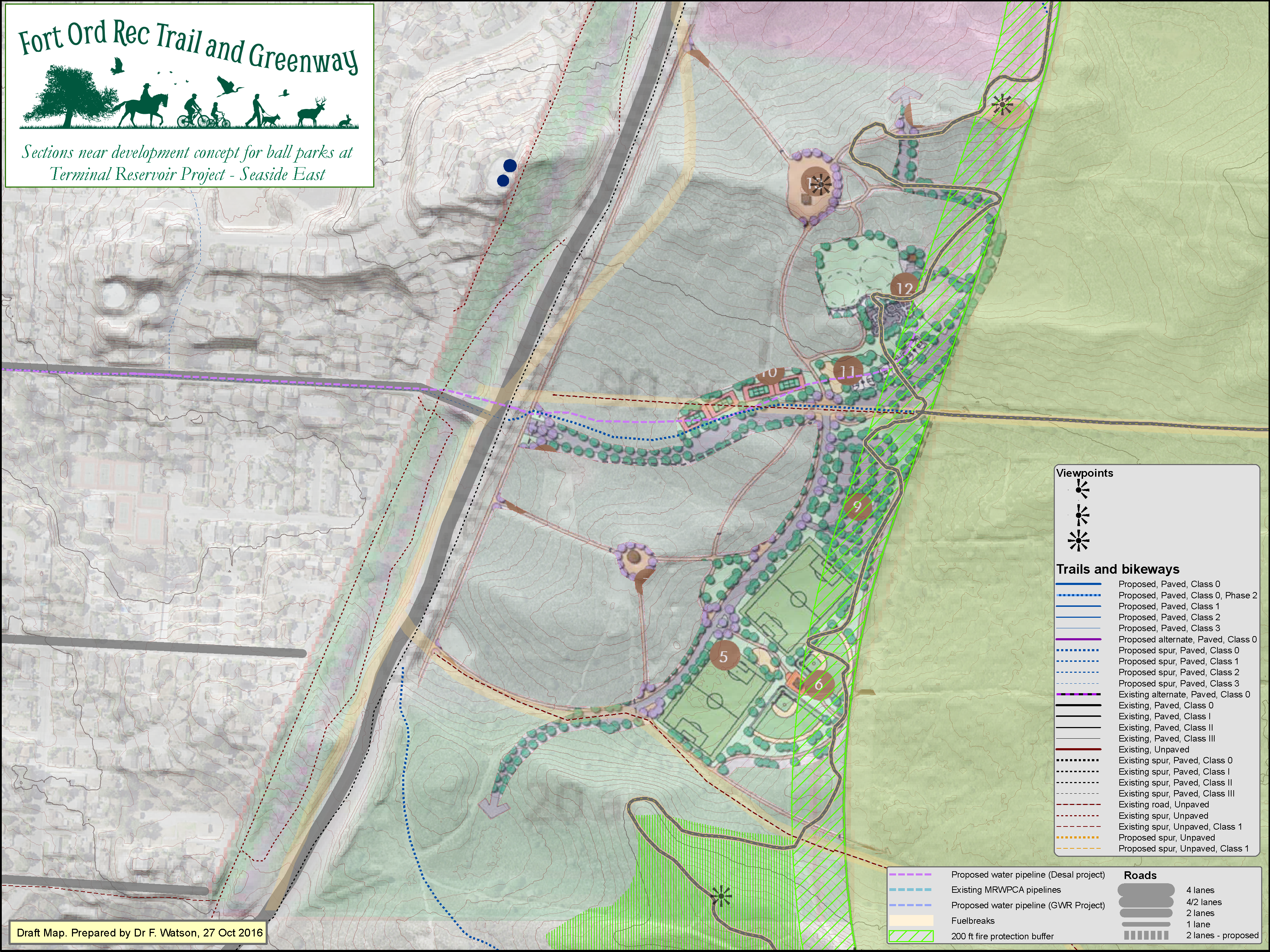
Seaside East - playing fields concept - 27 Oct 2016
Click map to enlarge
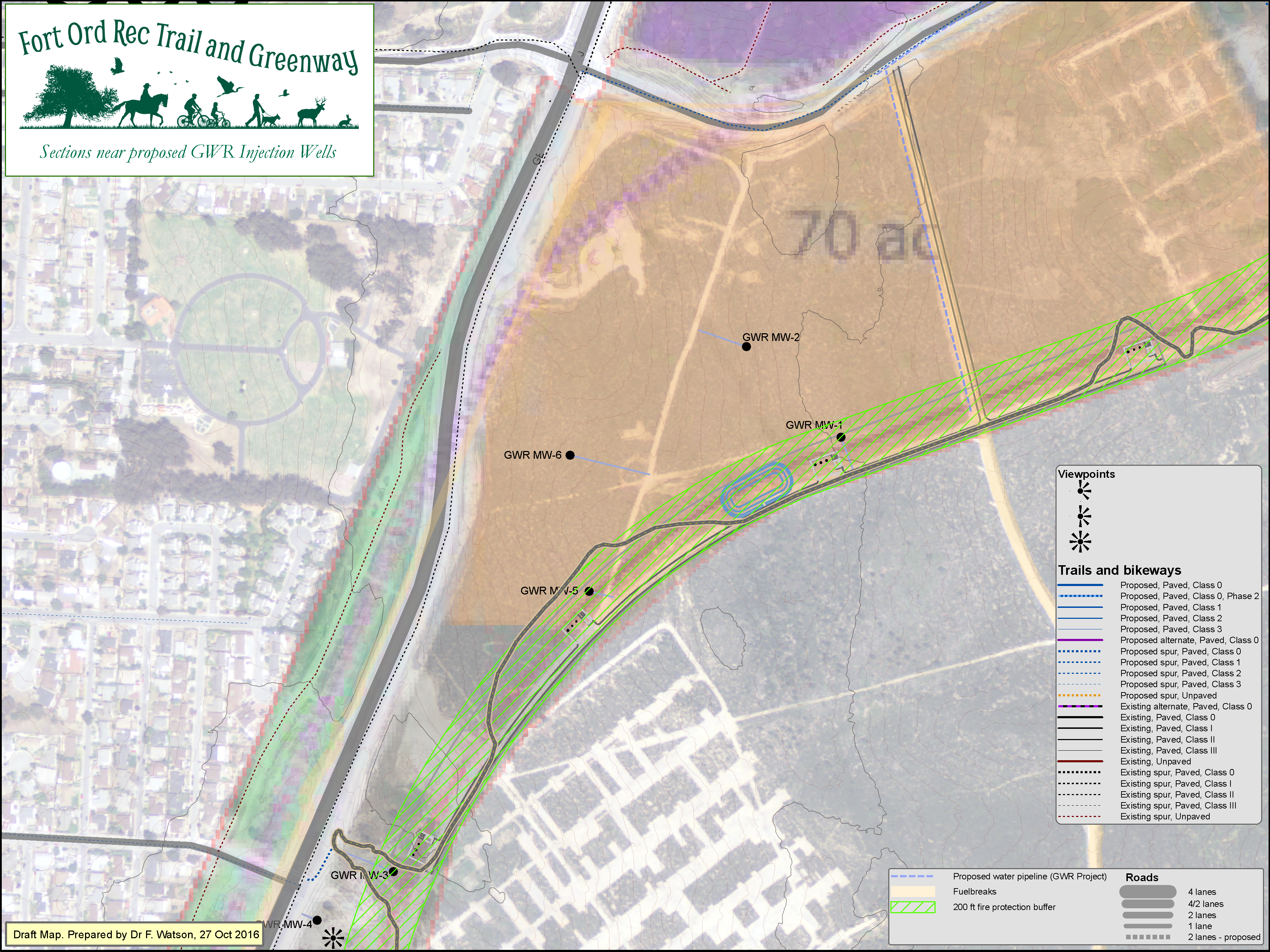
Seaside East - injection wells - 27 Oct 2016
Click map to enlarge
Presidio Annex - 20 Oct 2015

Click map to enlarge
Campus Town (in planning) - 31 Oct 2017

Click map to enlarge
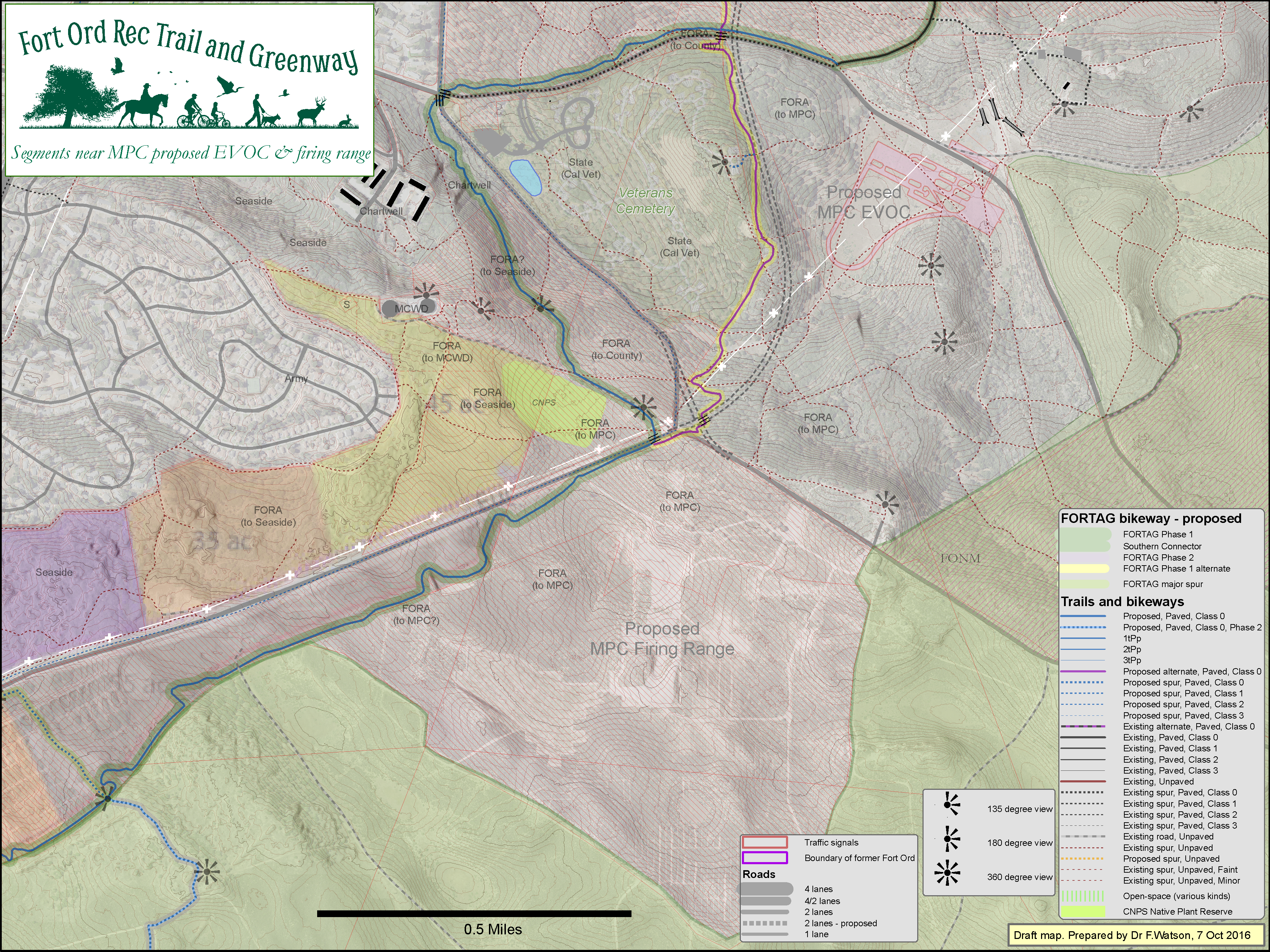
MPC EVOC & firing range - 27 Oct 2016
Click map to enlarge
Veterans Cemetery - 11 Sep 2015
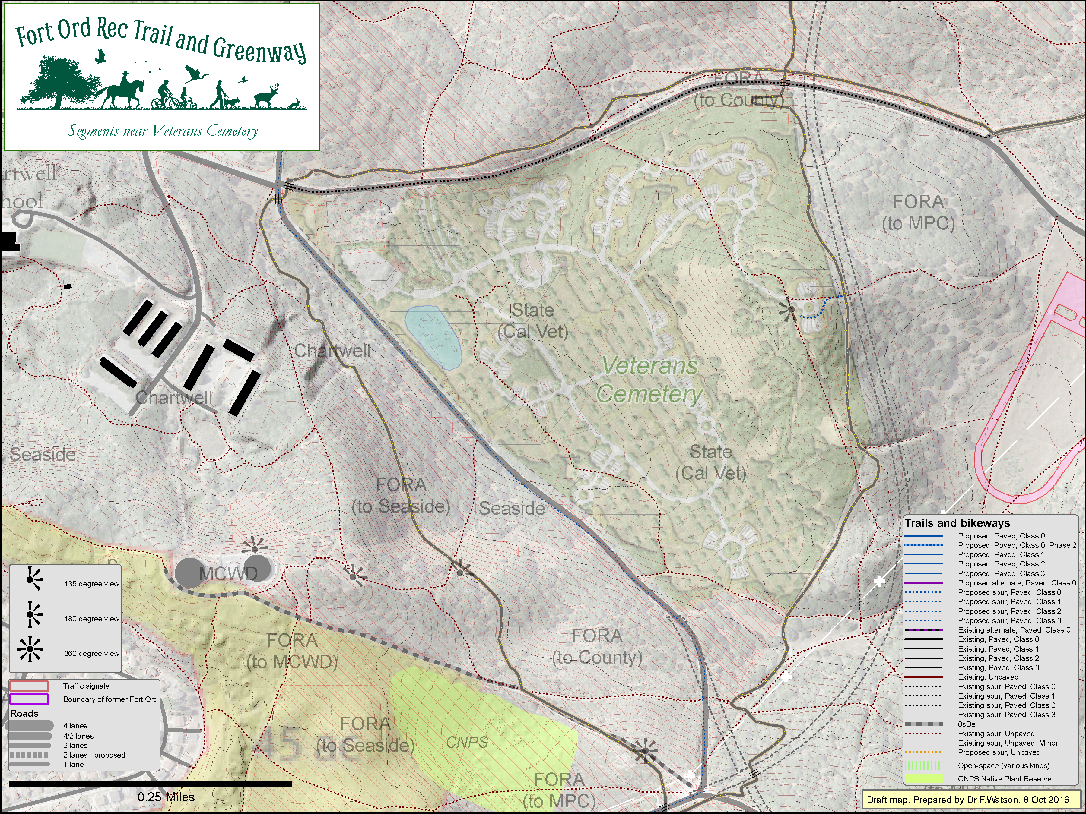
Click map to enlarge
Chartwell School & Veterans Cemetery - 8 Oct 2016
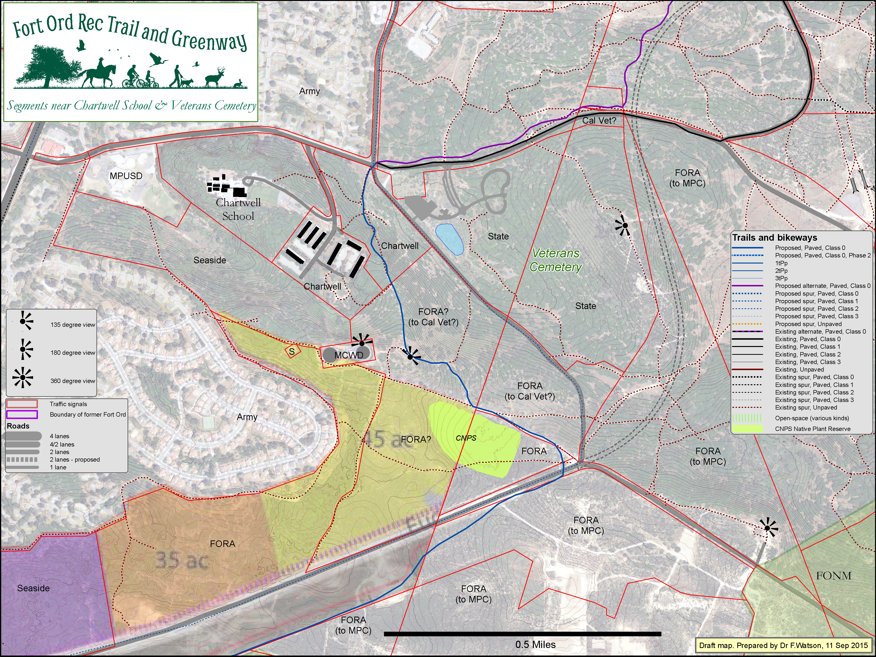
Click map to enlarge
Monterey Downs (formerly proposed) - 13 Oct 2015
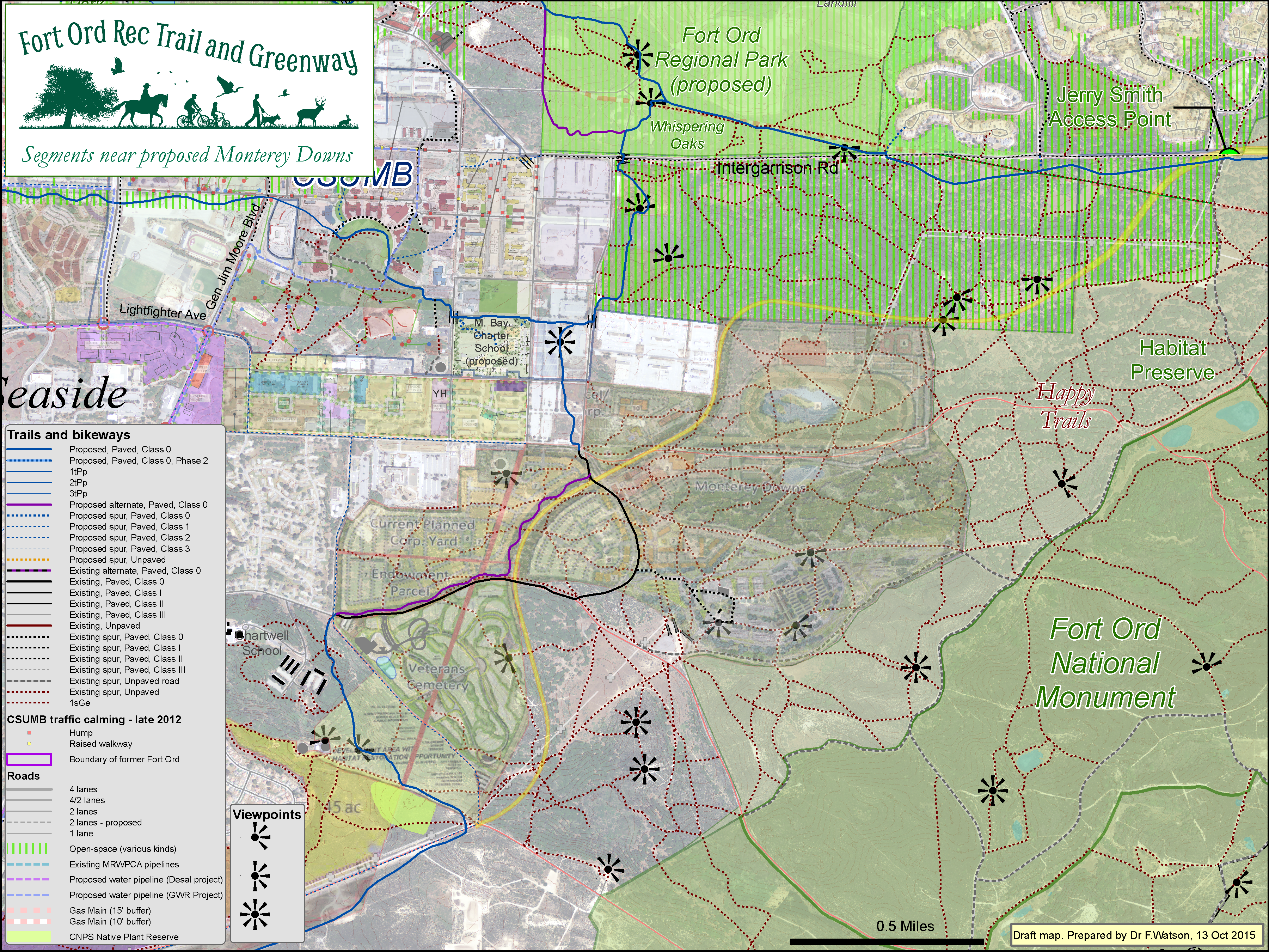
Click map to enlarge
Proposed site for Monterey Bay Charter School - 18 May 2015>
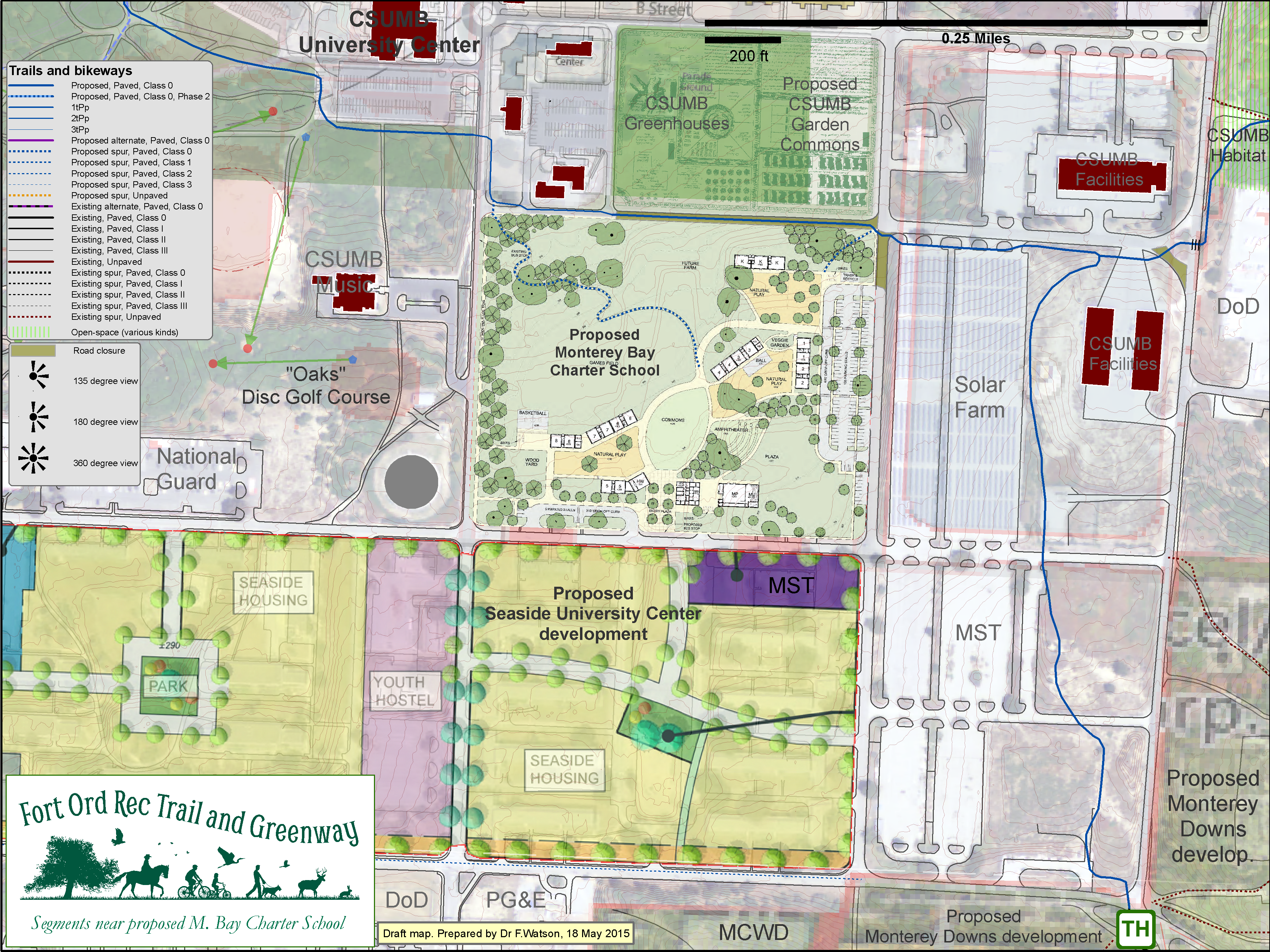
Click map to enlarge
CSUMB - 23 Sep 2016

Click map to enlarge
CSUMB southeast - 29 April 2015
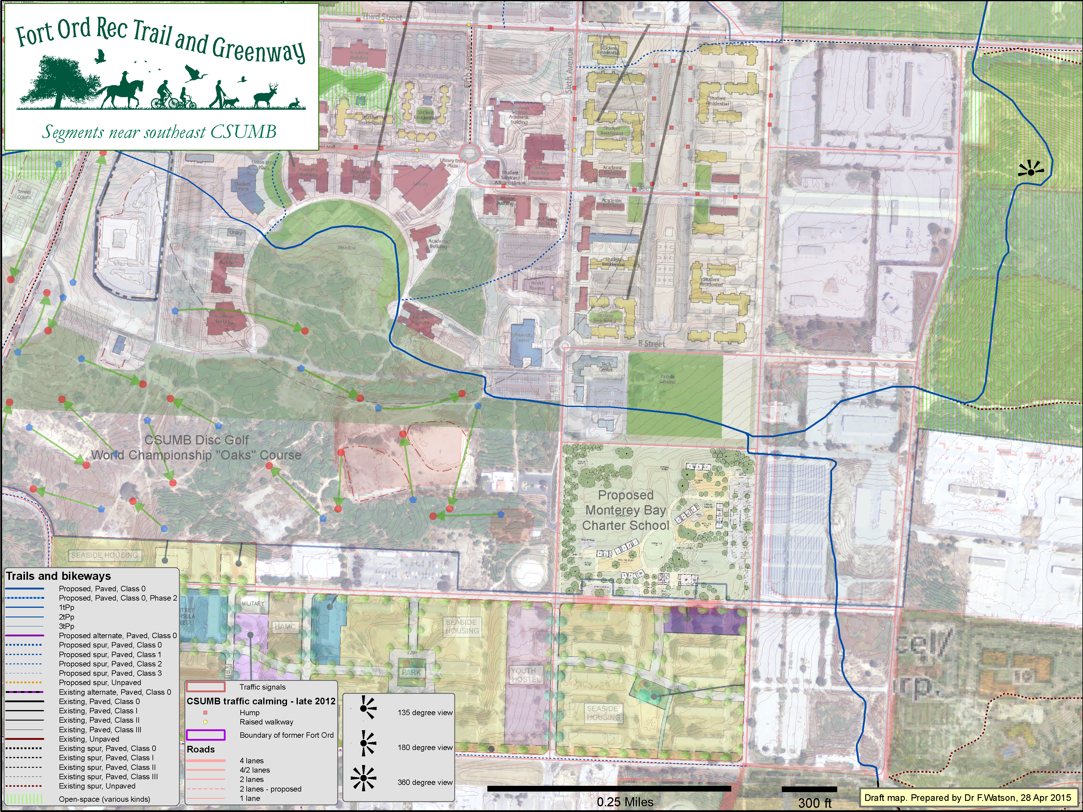
Click map to enlarge
CSUMB southwest - 26 Oct 2015

Click map to enlarge
CSUMB southwest oaks zoom - 13 Dec 2016
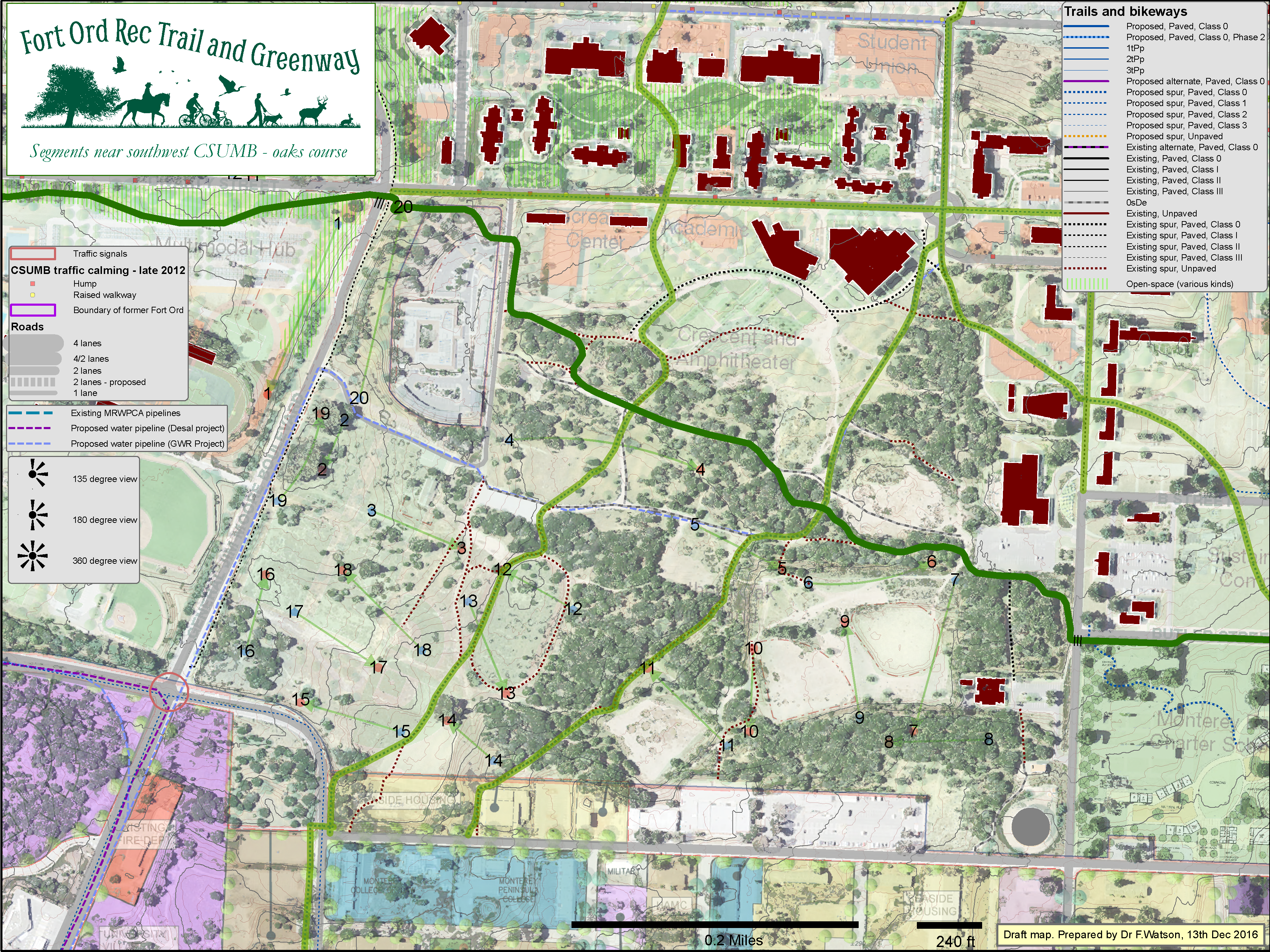
Click map to enlarge
CSUMB far west - 27 Oct 2015
Click map to enlarge
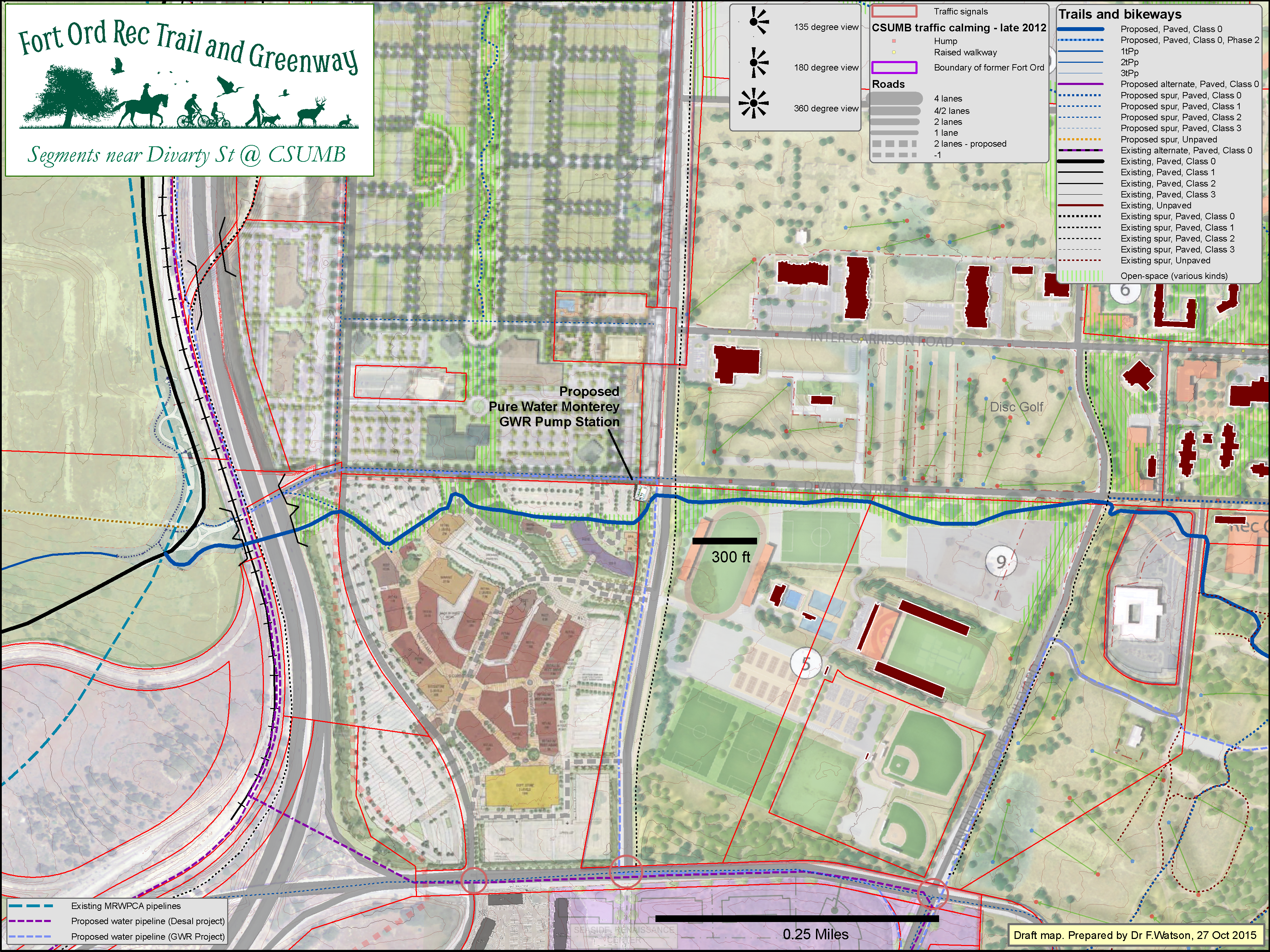
CSUMB 8th Ave - 20 Sep 2015
Click map to enlarge
CSUMB 8th Ave Zoomed - 20 Sep 2015
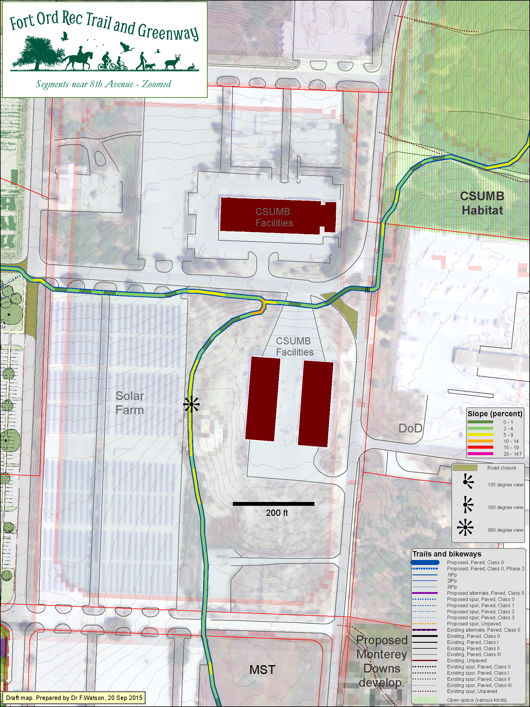
Click map to enlarge
CSUMB Intergarrison Open Space - 27 Nov 2015

Click map to enlarge
FORTAG maps with different themes
Fort Ord Reuse Plan - Trail / Open-Space Link - 13 Feb 2015
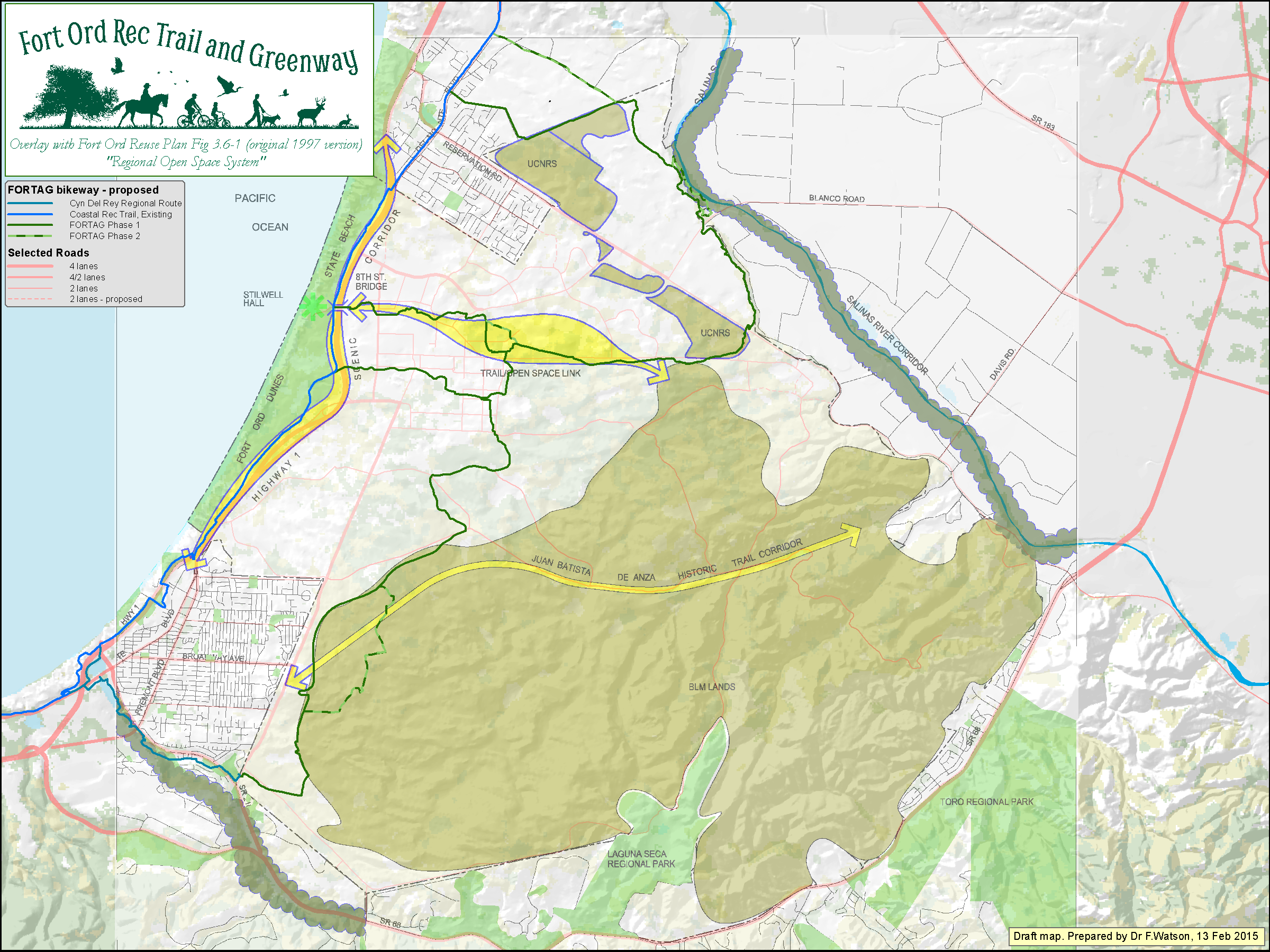
Click map to enlarge
Fort Ord Reuse Plan - Trail / Open-Space Link - Detail - 6 Feb 2015
Click map to enlarge
Fort Ord Reuse Plan - Hiker/Biker Trails - 13 Feb 2015
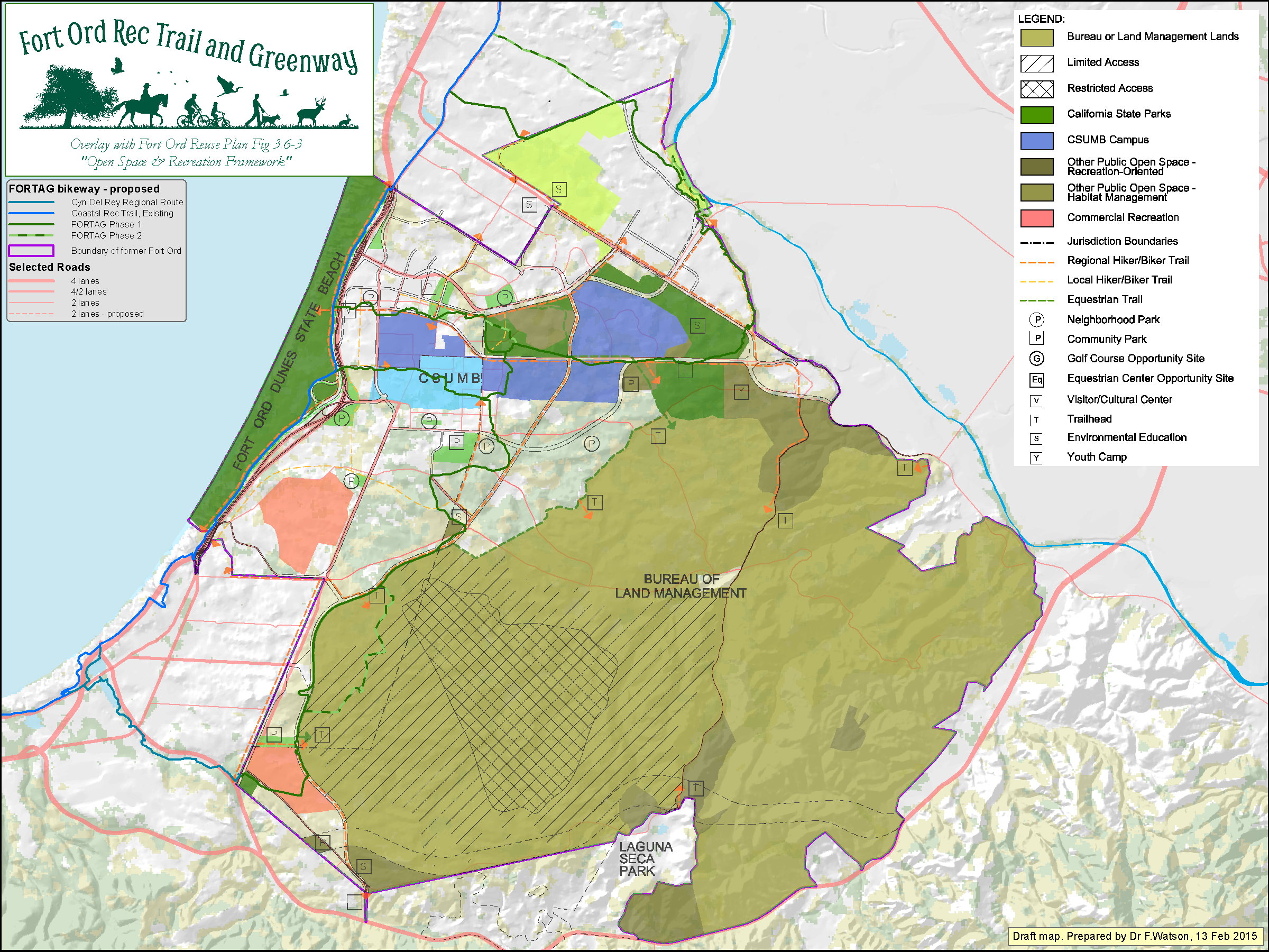
Click map to enlarge
Fort Ord Reuse Plan - Hiker/Biker Trails - Simpler Version - 20 April 2015
Click map to enlarge
Fort Ord Reuse Plan - Land Use
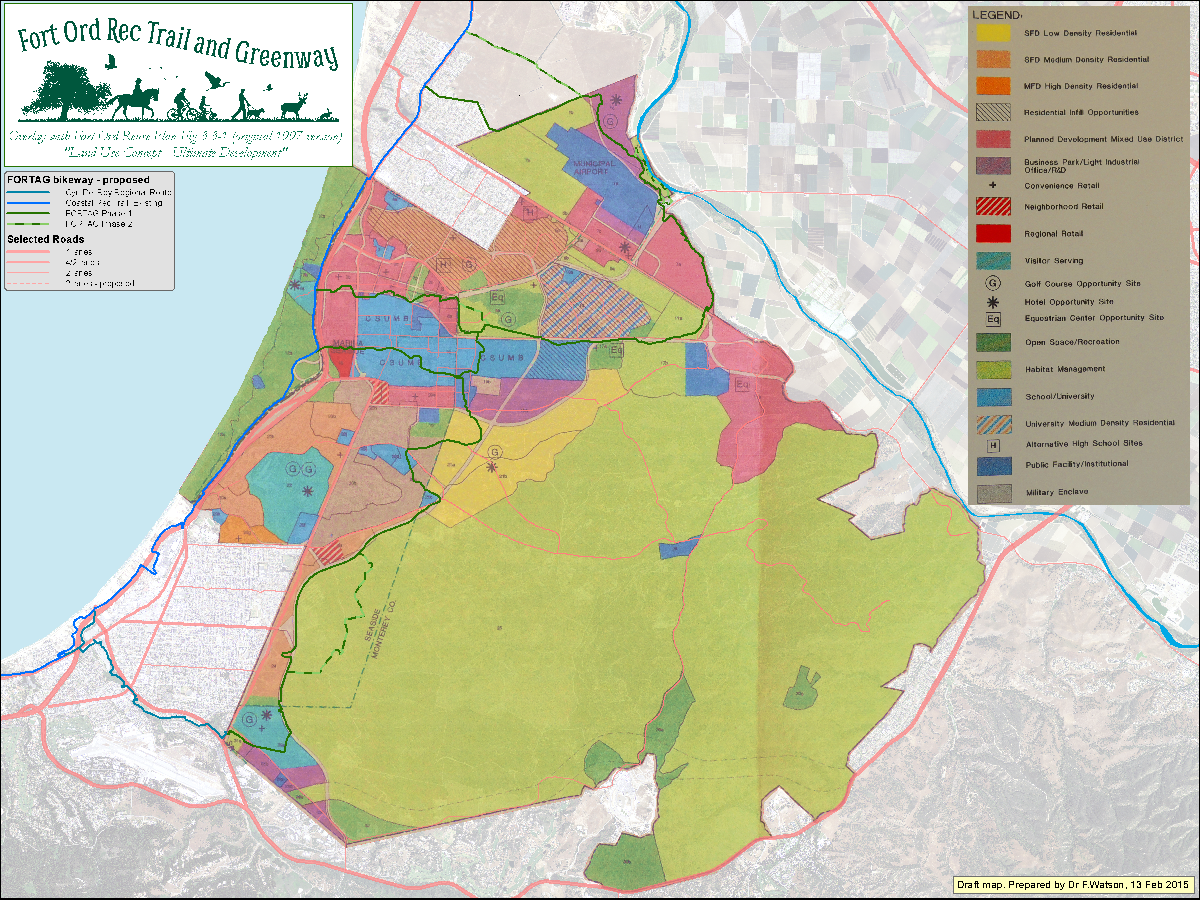
Click map to enlarge
8th St & Imjin Rd - with Marina General Plan - 9 Nov 2014
Click map to enlarge
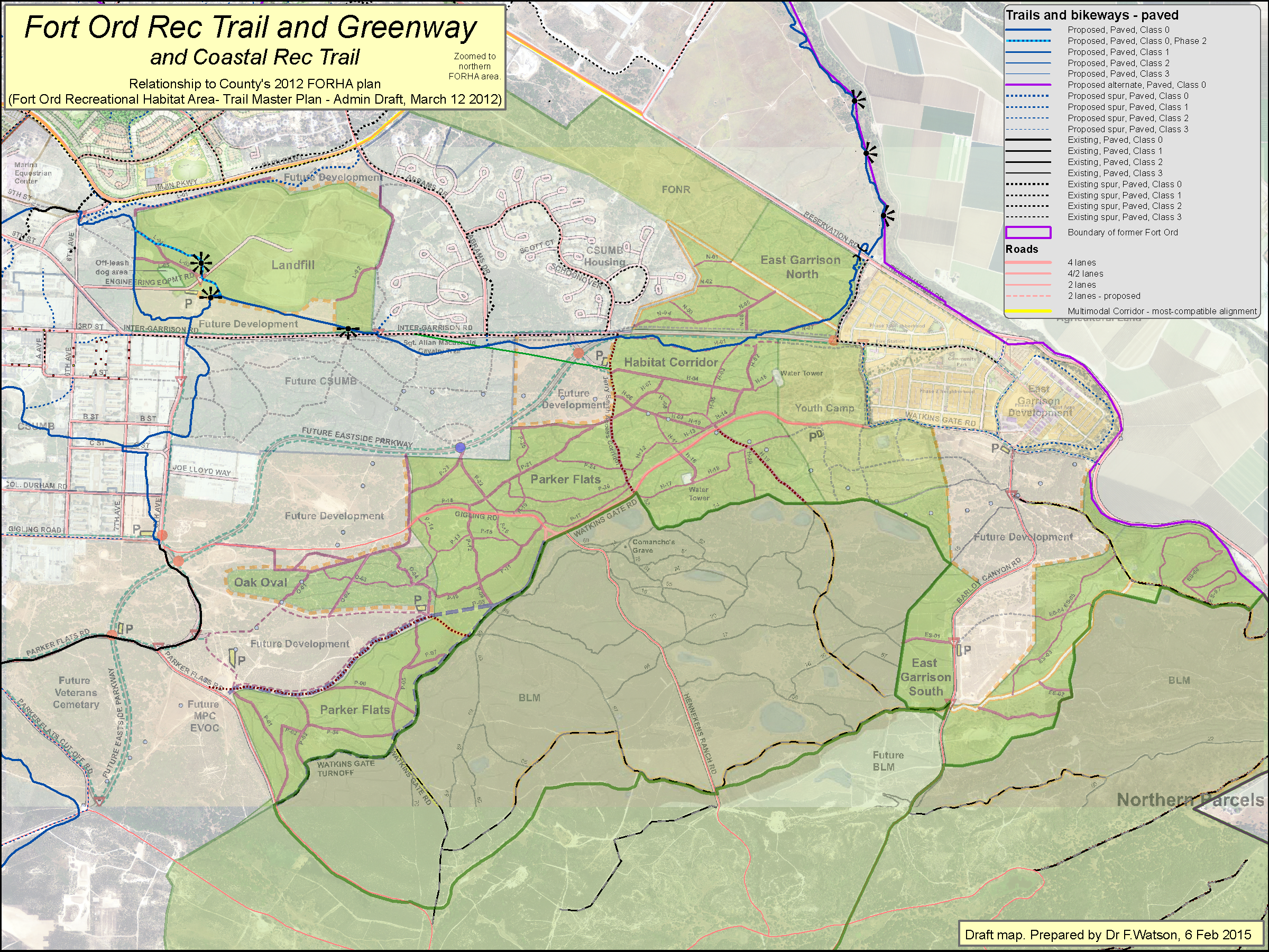
County FORHA Trails Plan - 6 Feb 2015
Click map to enlarge
County FORHA Trails Plan - Zoomed - 6 Feb 2015
Click map to enlarge
Watson/FORTAG recommendations on FORHA Plan - 13 April 2015
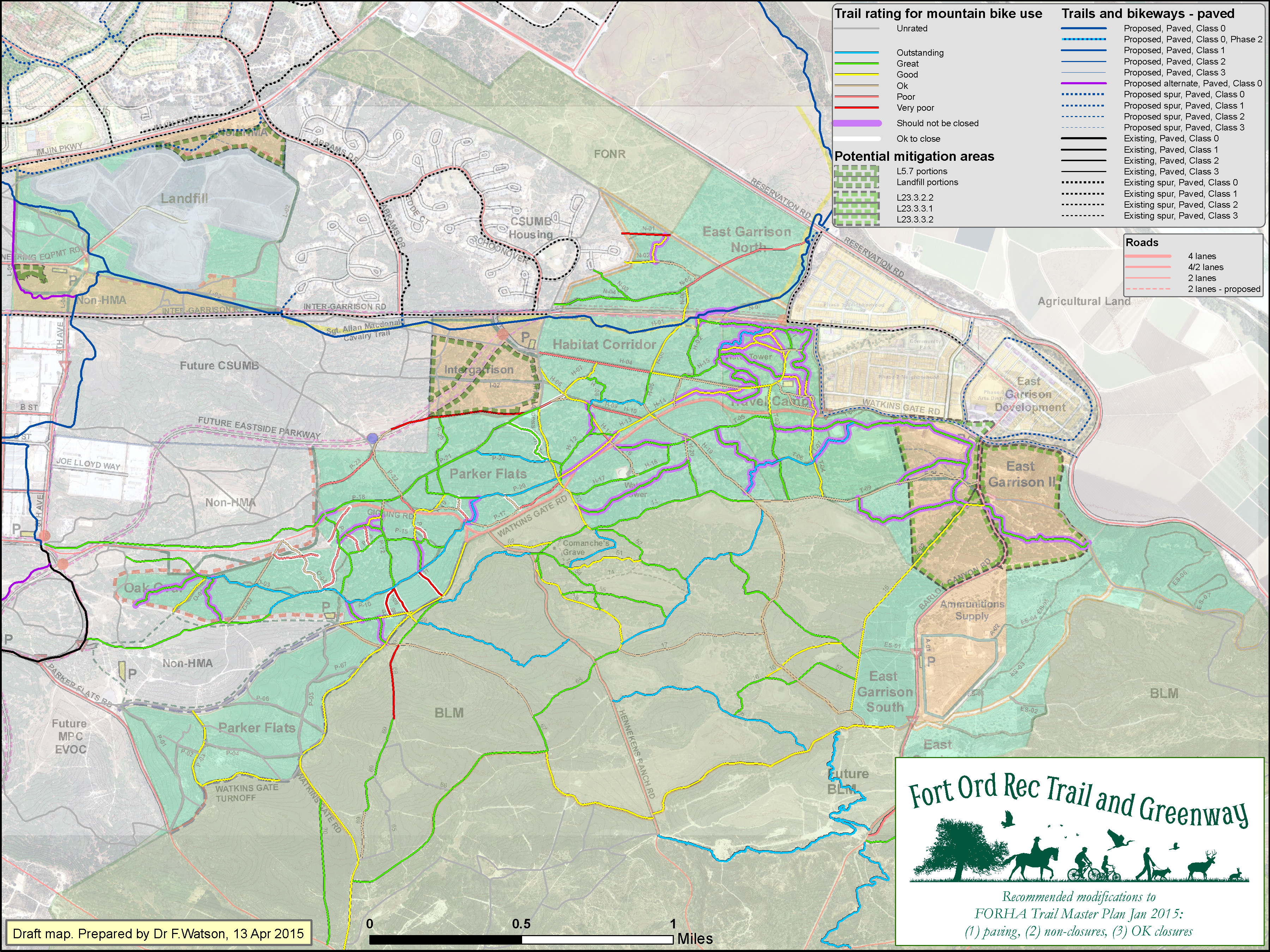
Click map to enlarge
Watson/FORTAG recommendations on FORHA Plan - 8 May 2015
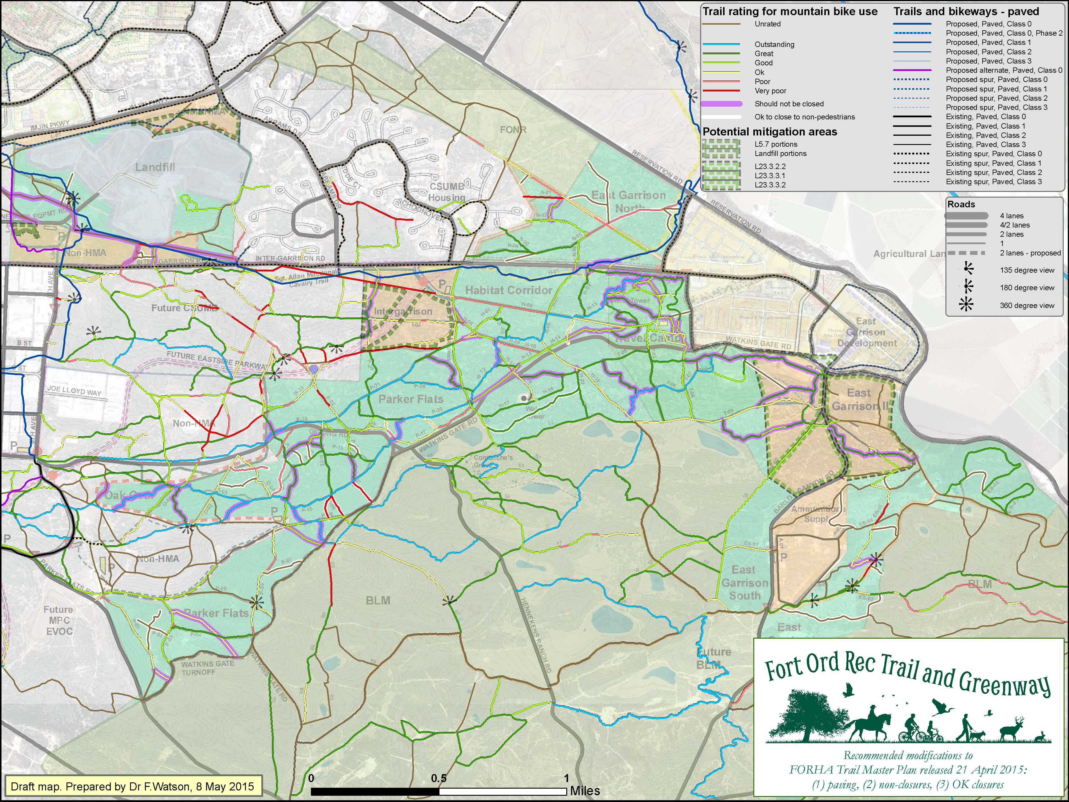
Click map to enlarge
Fort Ord Habitat Management Plan / Habitat Conservation Plan areas
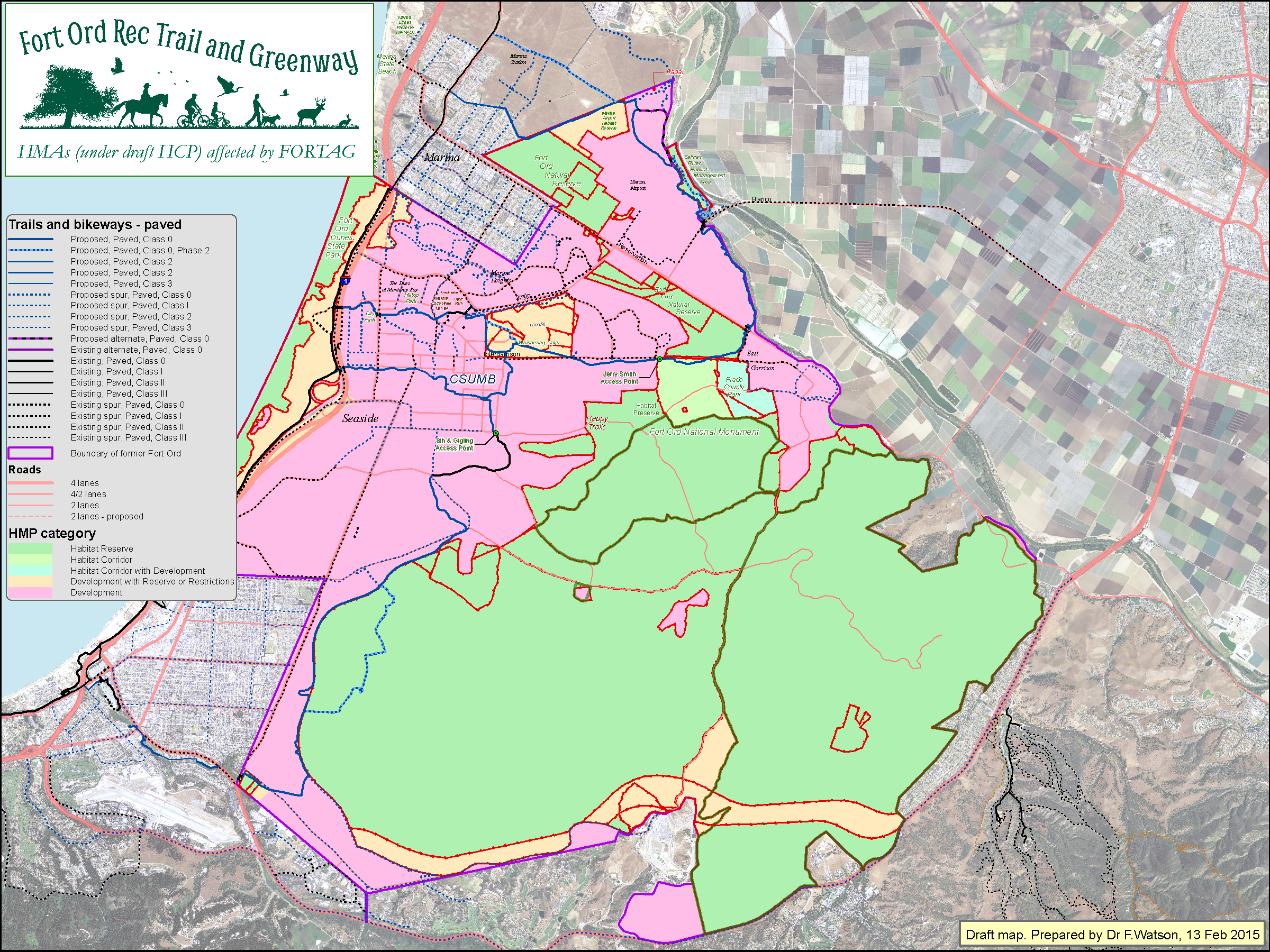
Click map to enlarge
Native Plant Reserves
Click map to enlarge
Native Plant Reserve 1 (near Frog Pond)

Click map to enlarge
Lengths of trail segments - 24 May 2016

Click map to enlarge
Slopes of trail segments - portrait view - 10 May 2016
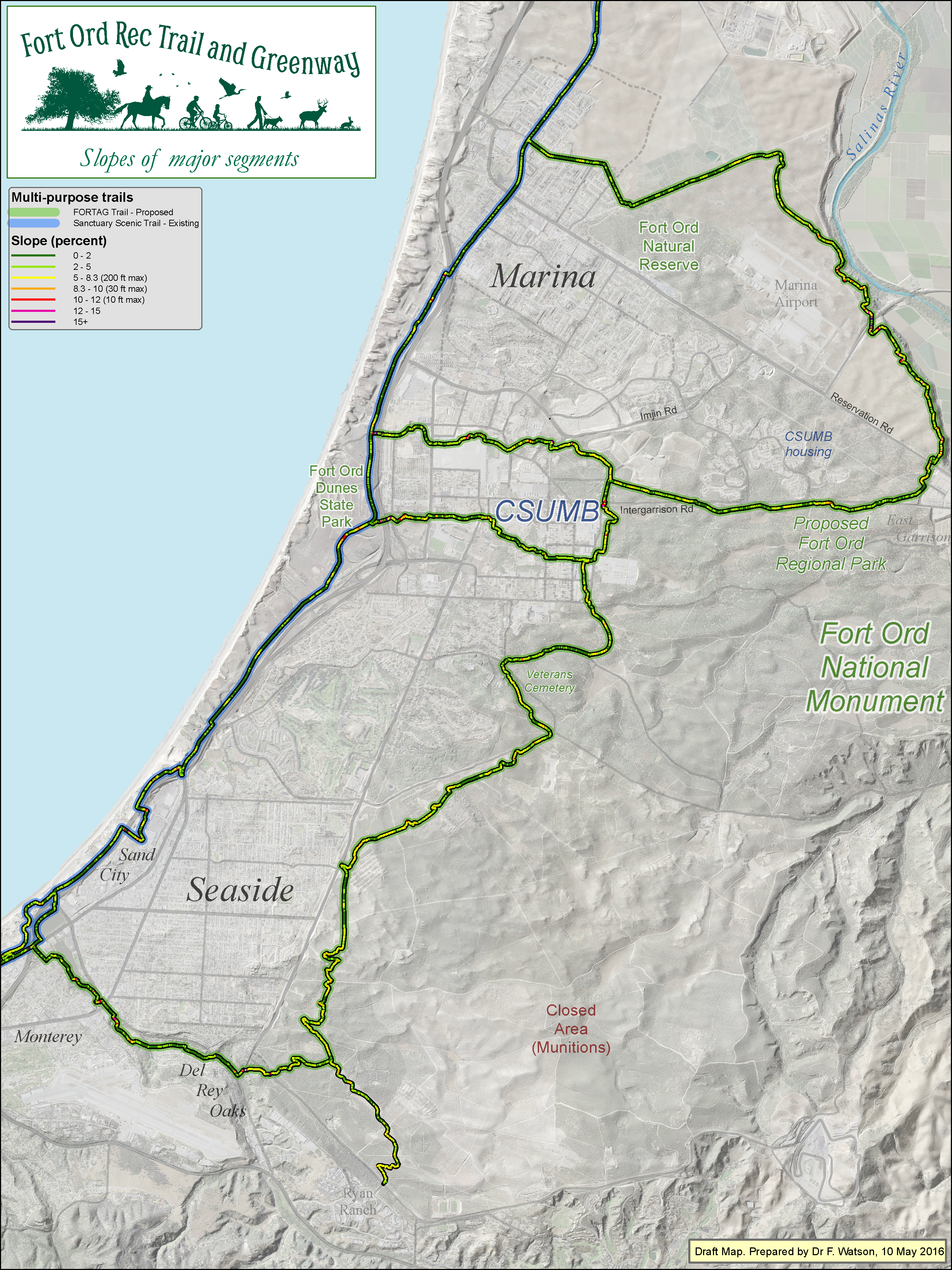
Click map to enlarge
Elevations of trail segments - 28 Mar 2015
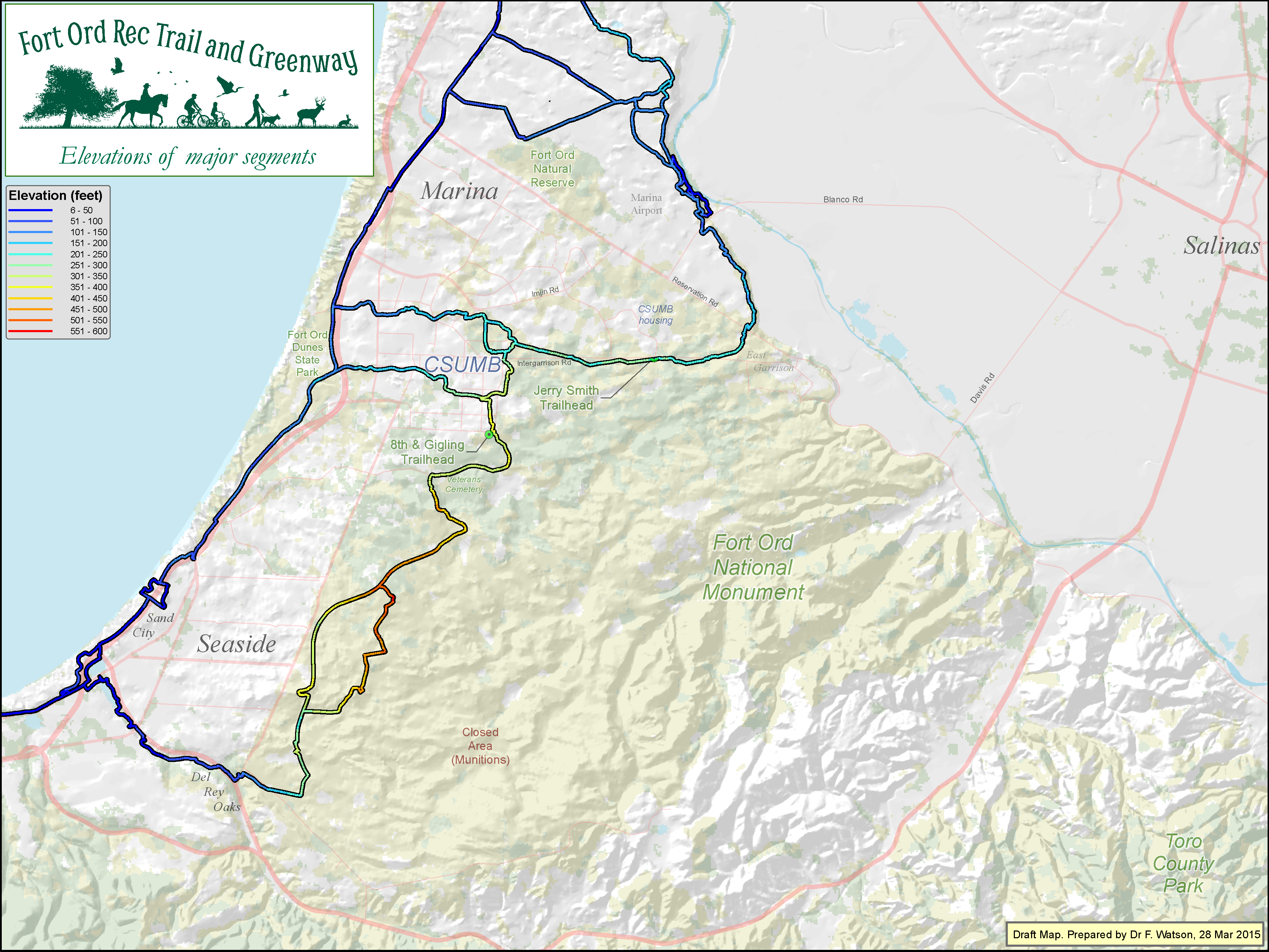
Click map to enlarge
Elevation of surrounding terrain - 6 Dec 2016
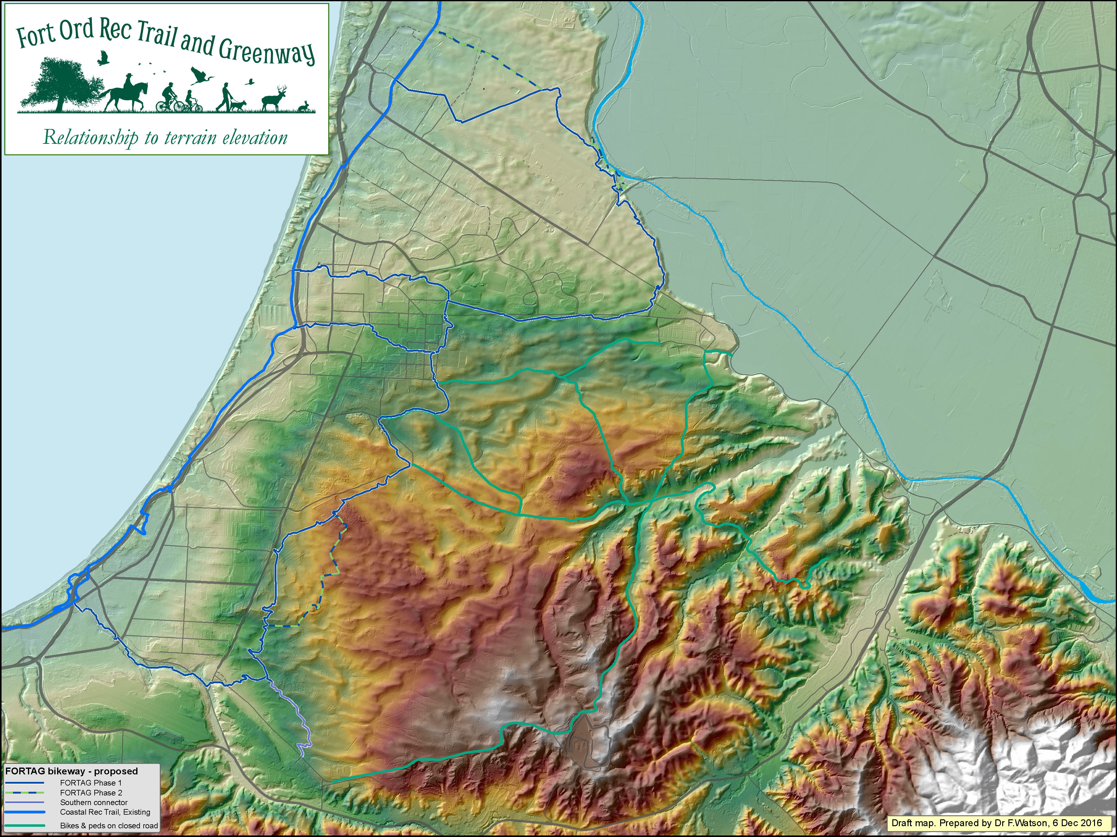
Click map to enlarge
Southern Loop with fuelbreaks shown prominently
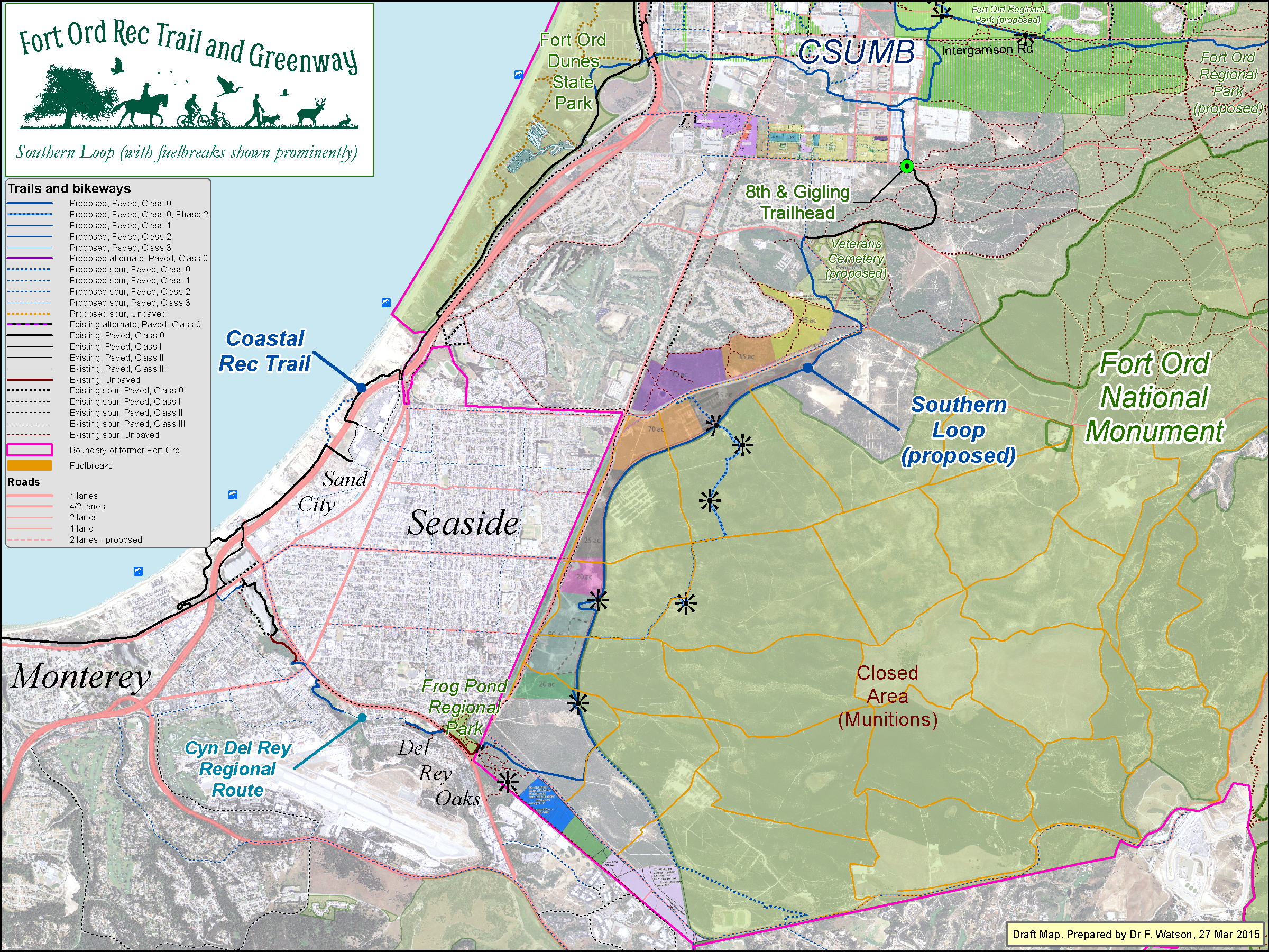
Click map to enlarge
landfill, with utilities & OU2 plans
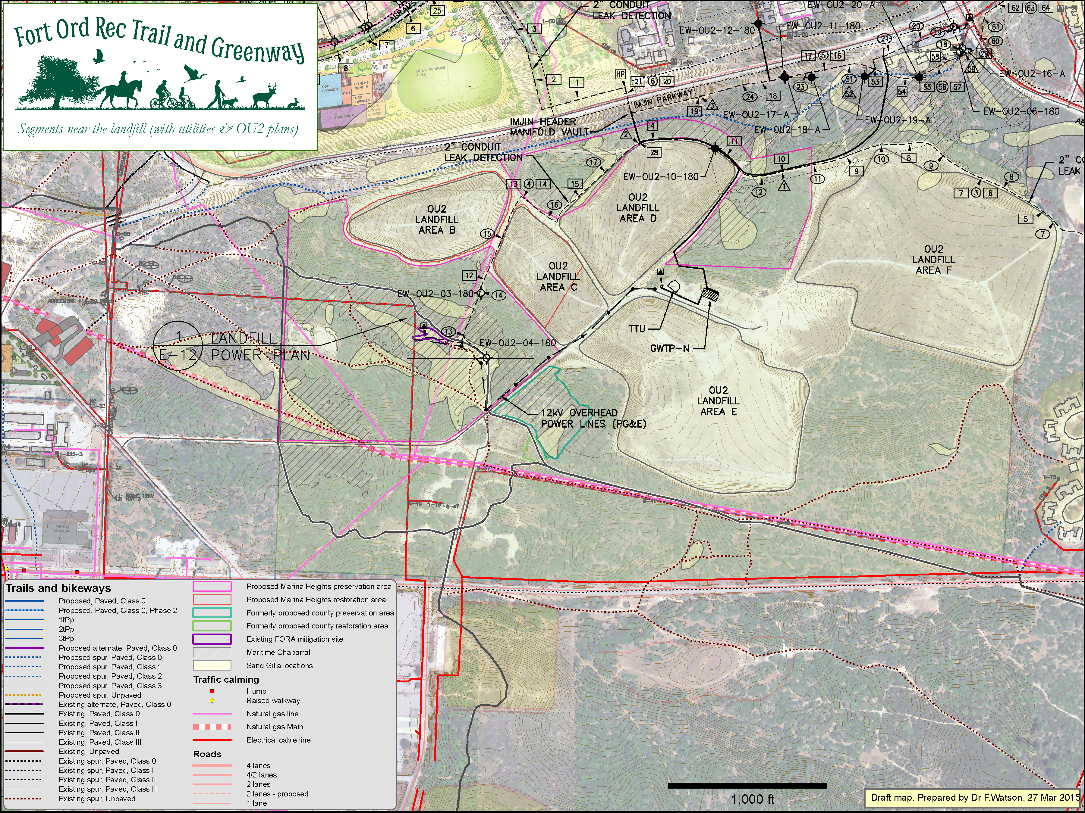
Click map to enlarge
landfill, with utilities & OU2 plans - zoom<

Click map to enlarge
Wider regional view - with TAMC BPMP 2011
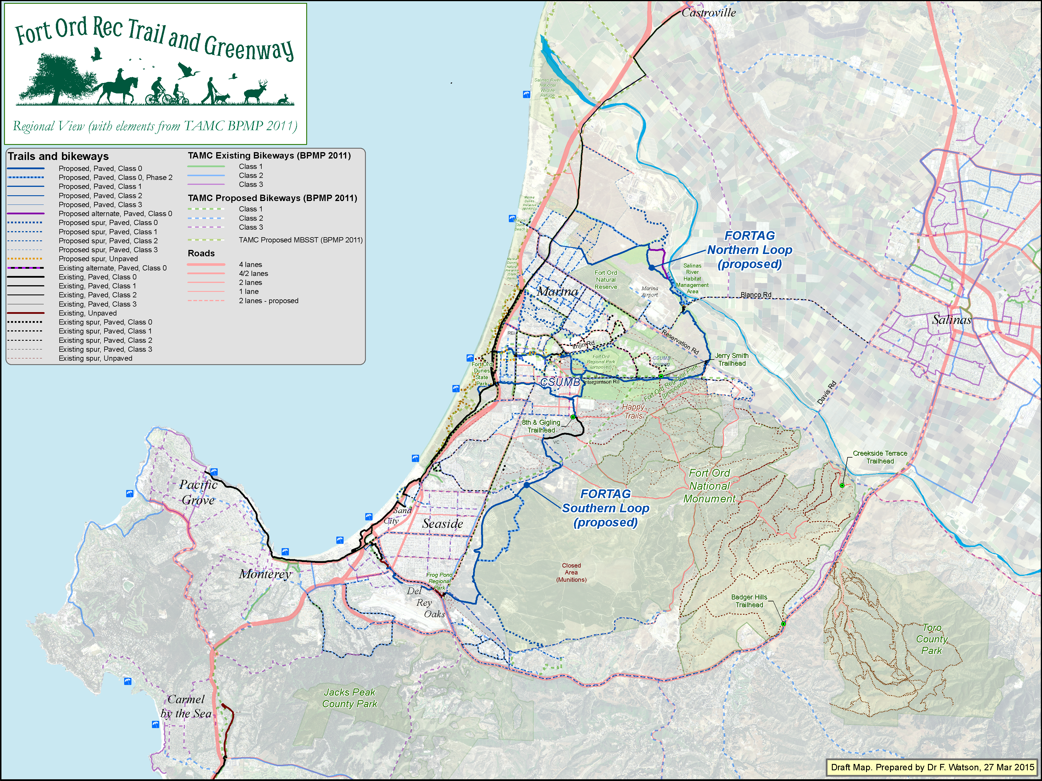
Click map to enlarge
MPRPD lands - county wide - 24 April 2015
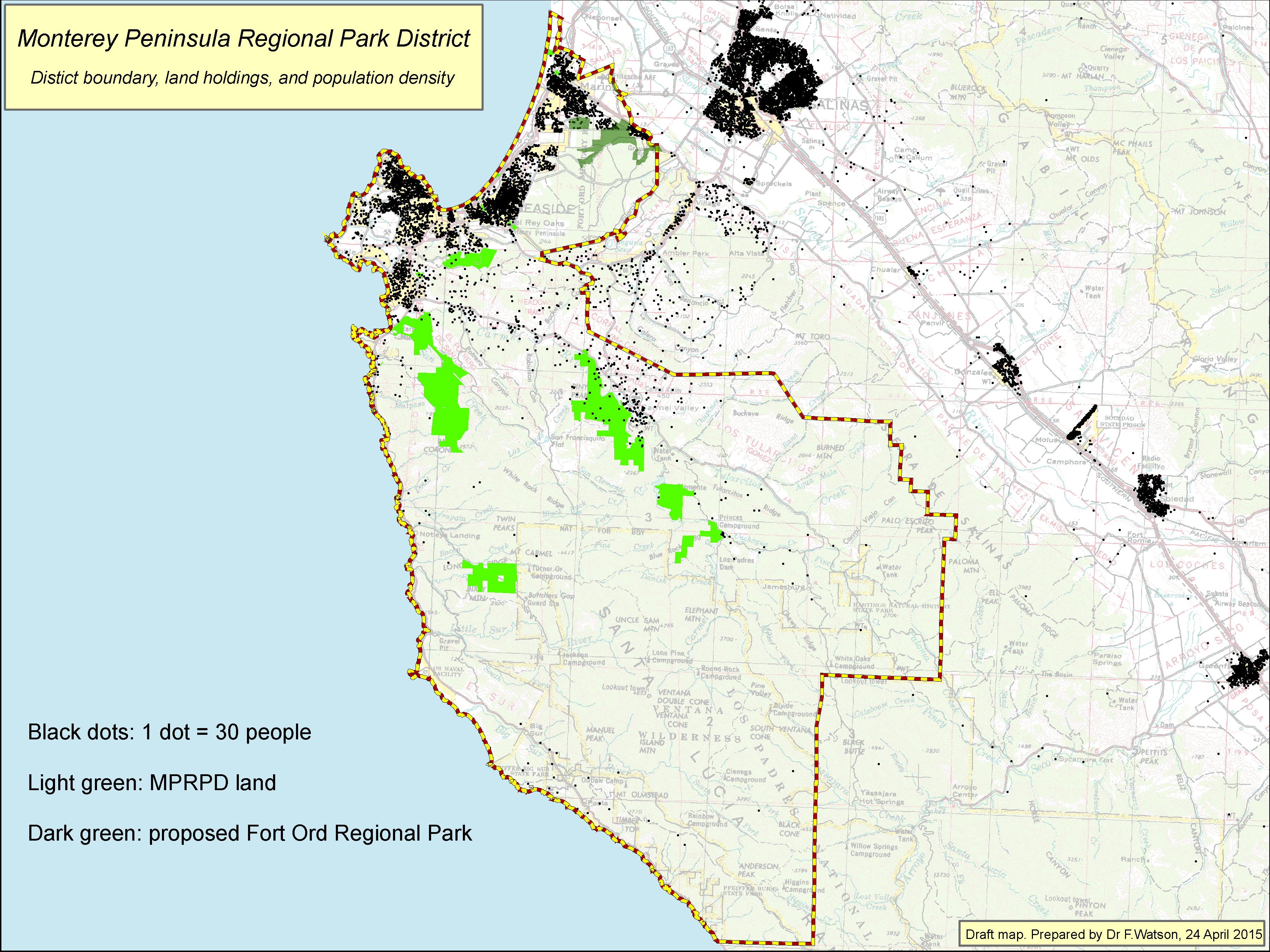
Click map to enlarge
Relationship to regional water infrastructure - 10 May 2015
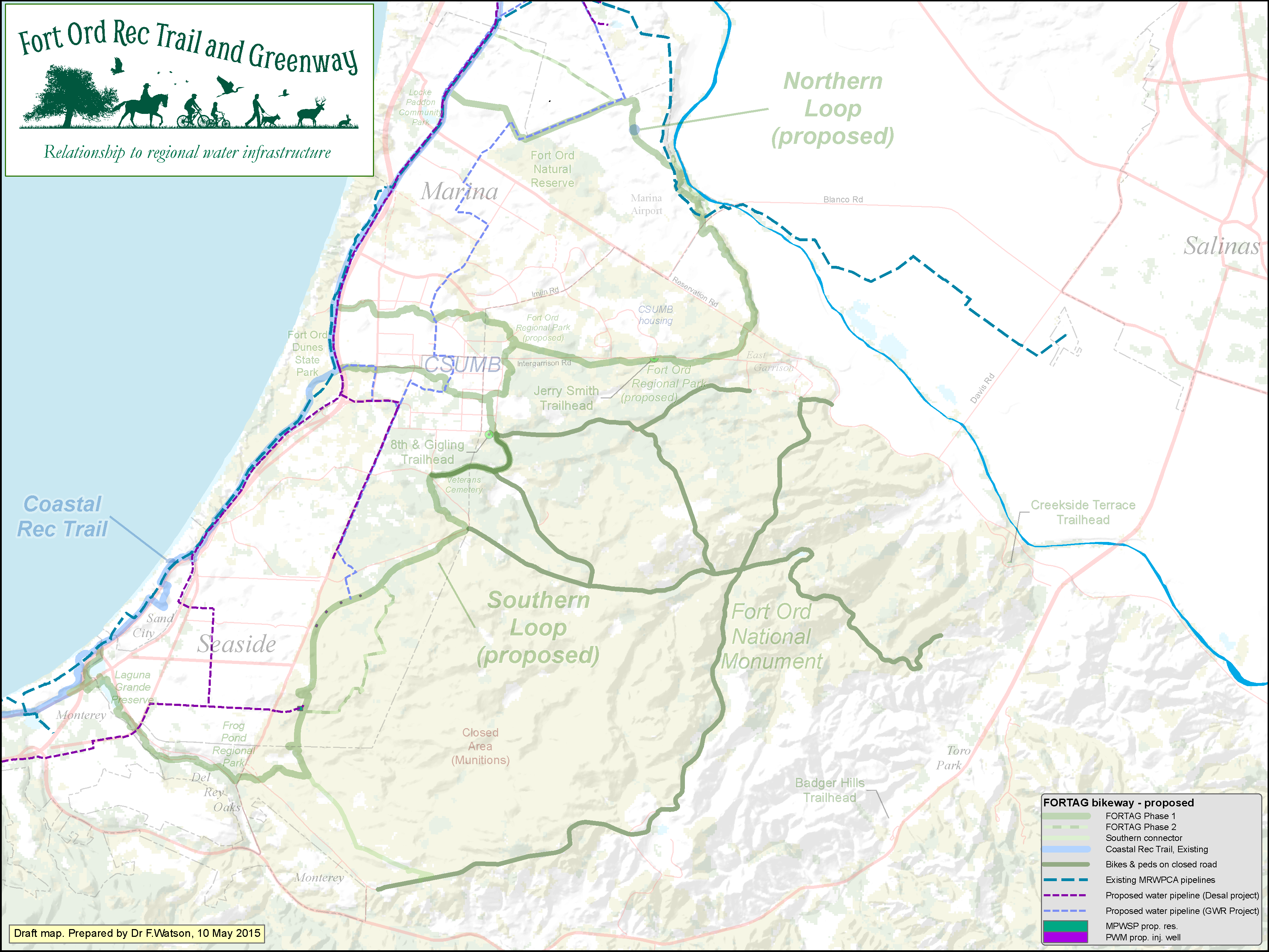
Click map to enlarge
Relationship to Marina Coast Water District land - 28 Oct 2015
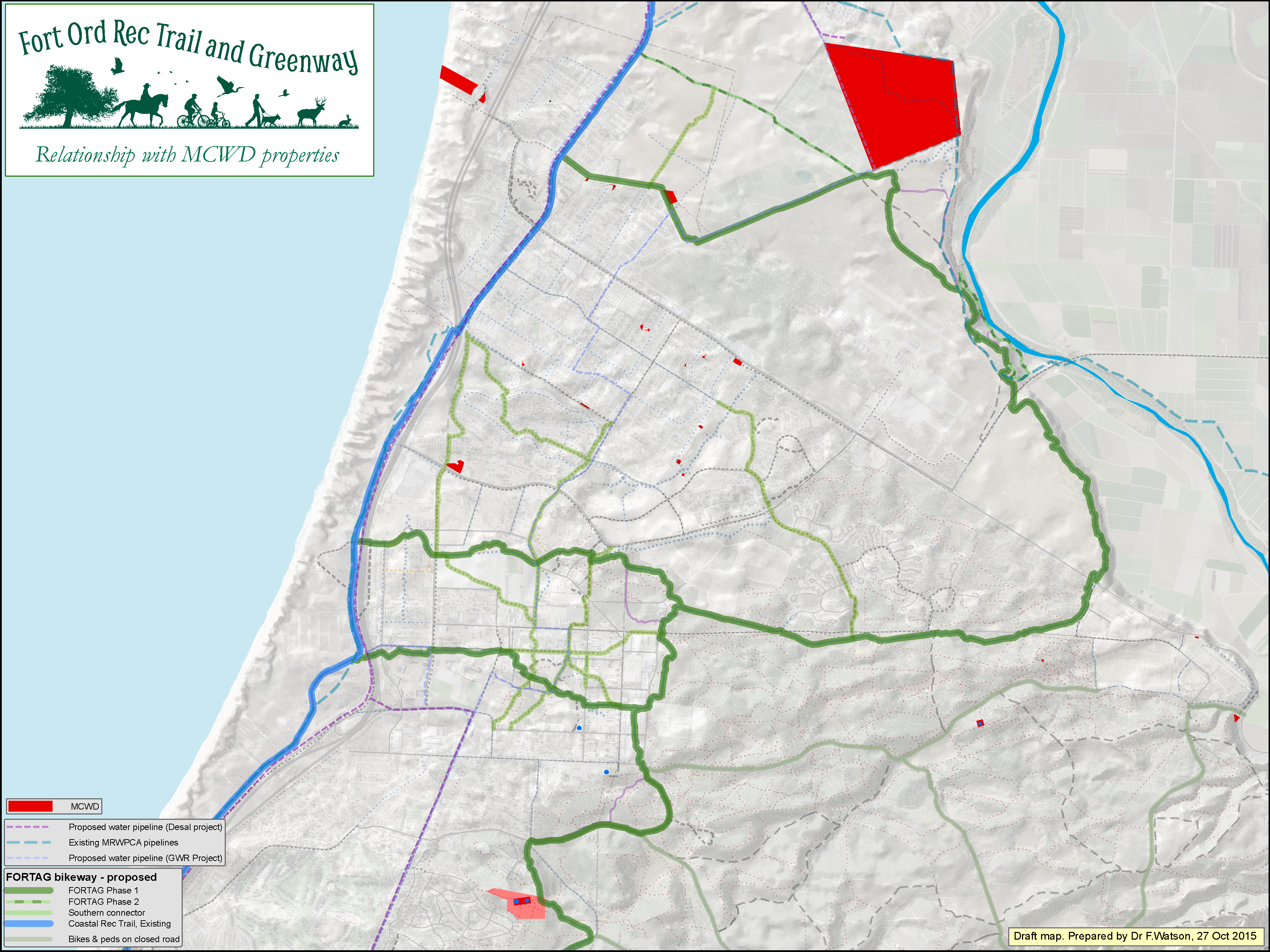
Click map to enlarge
Relationship to Monterey-Salinas Transit land - 6 Nov 2015
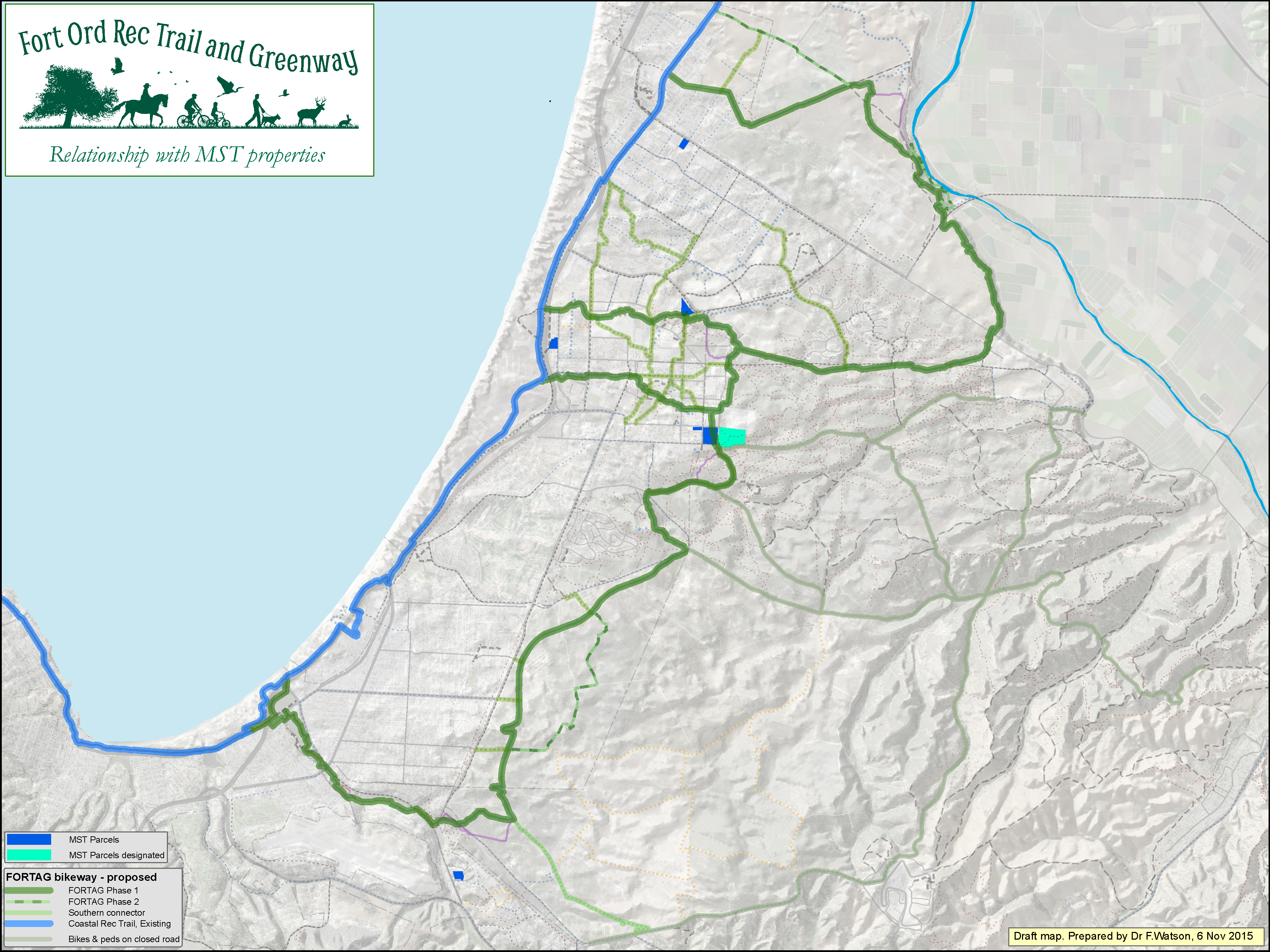
Click map to enlarge
Relationship to military history sites - 6 Nov 2015
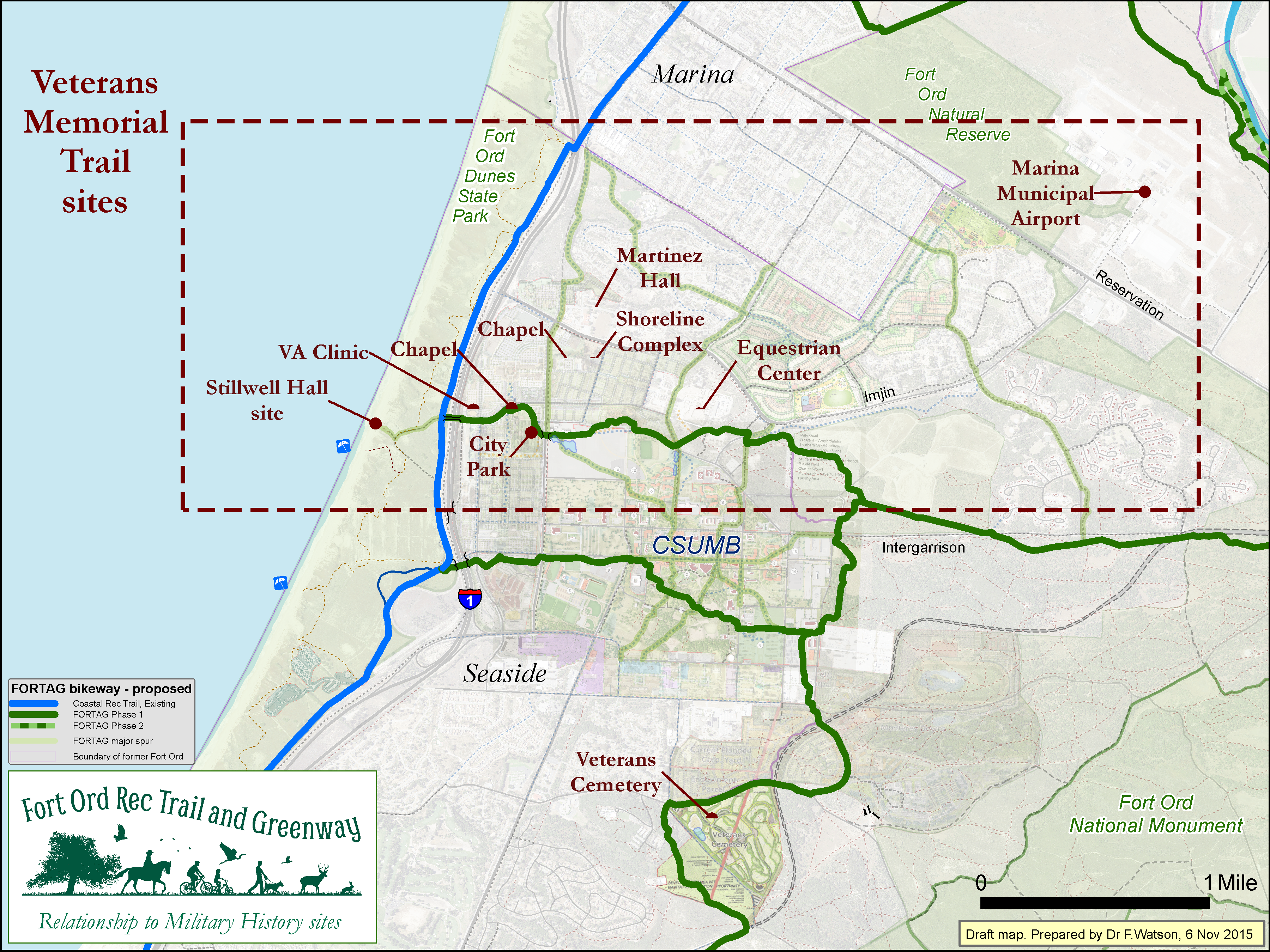
Click map to enlarge
Relationship to indicators of poverty - 20 Nov 2015
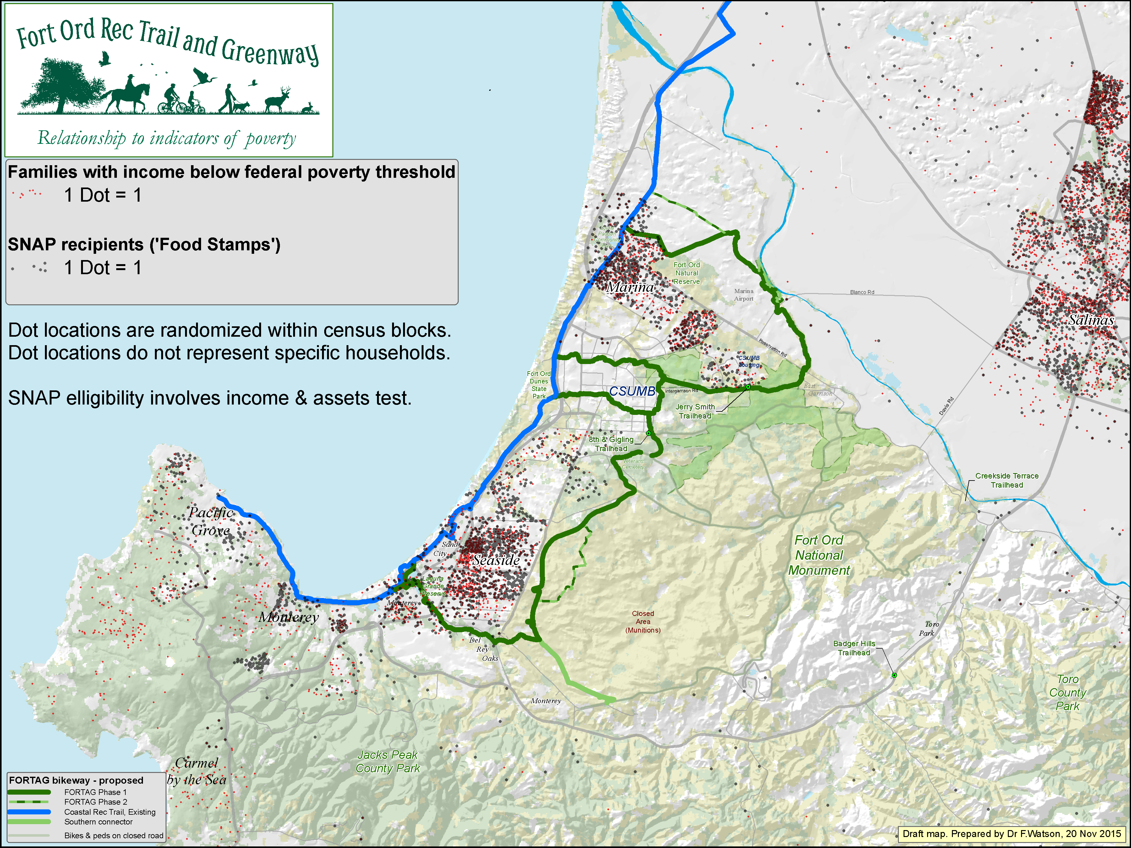
Click map to enlarge
Notes on sites most relevant to planning in Seaside - 27 Oct 2016
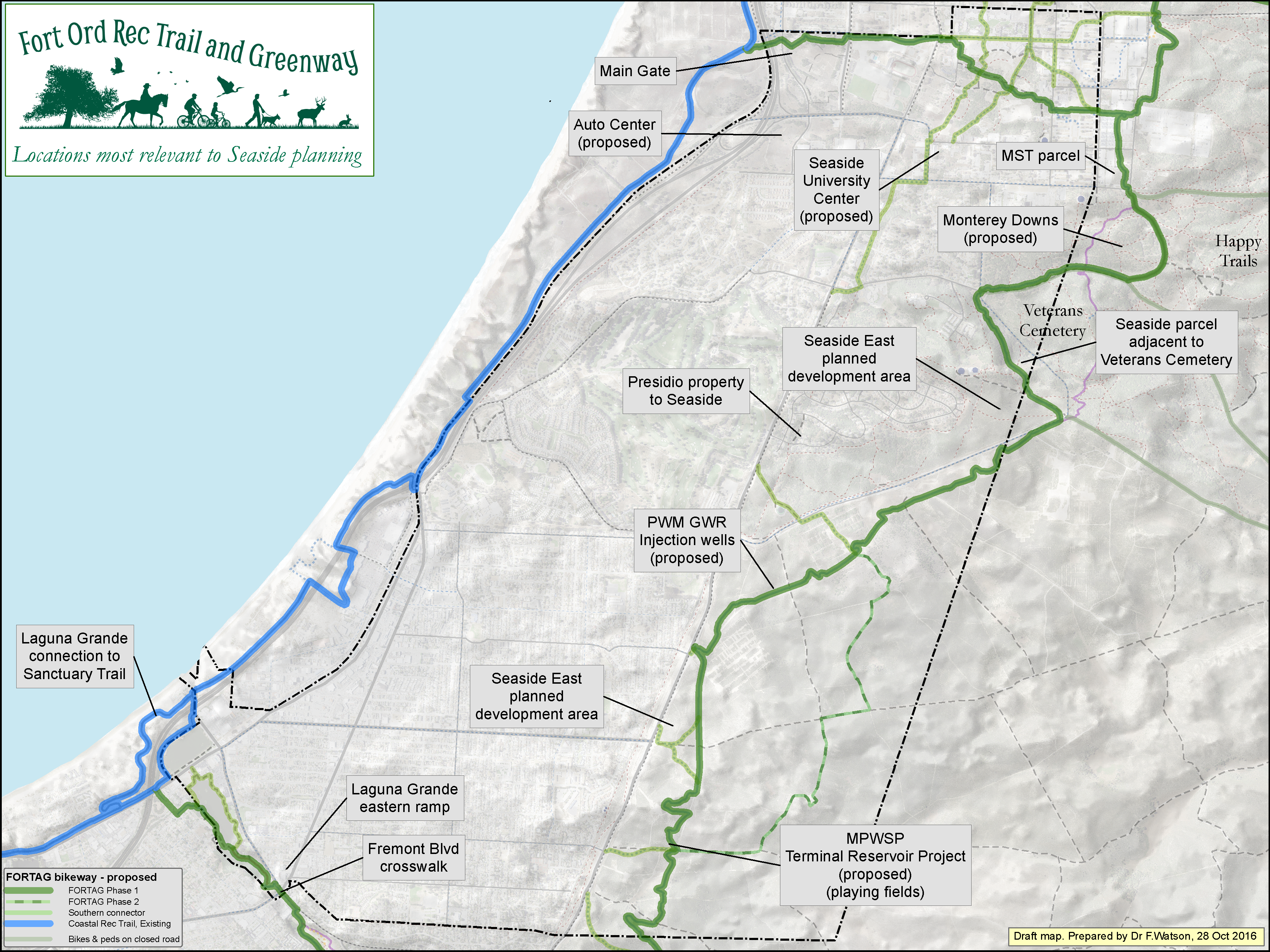
Click map to enlarge
FORTAG elements included in TAMC cost estimate (plain background)
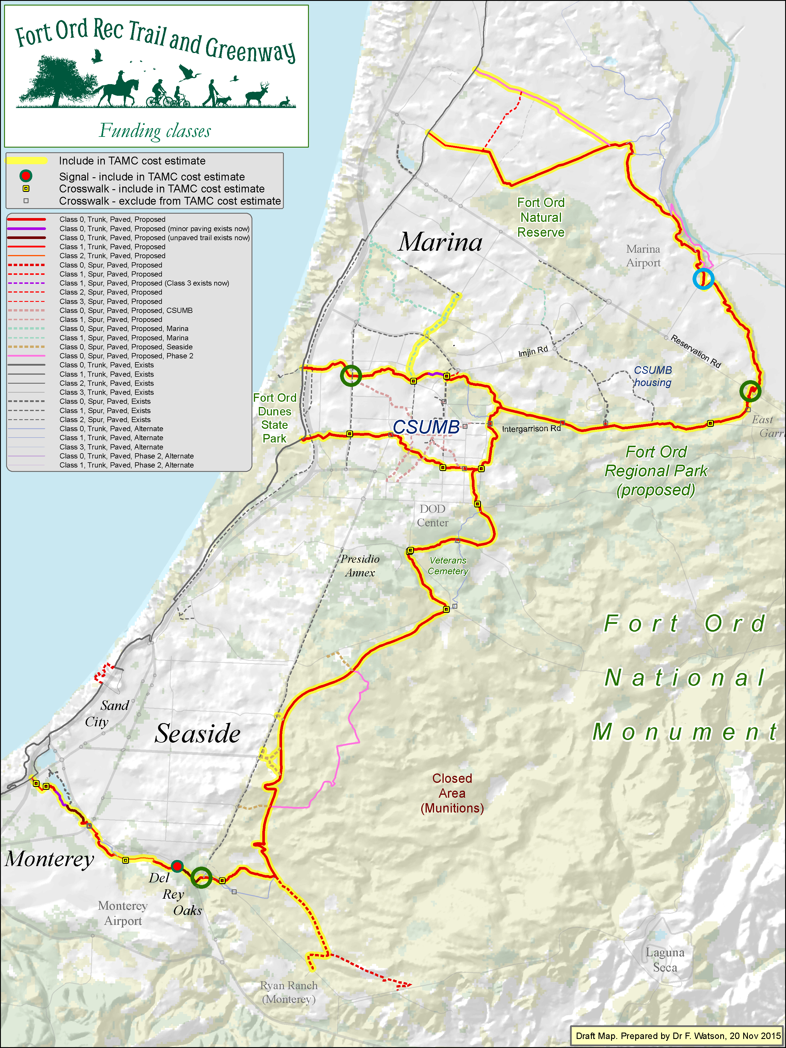
Click map to enlarge
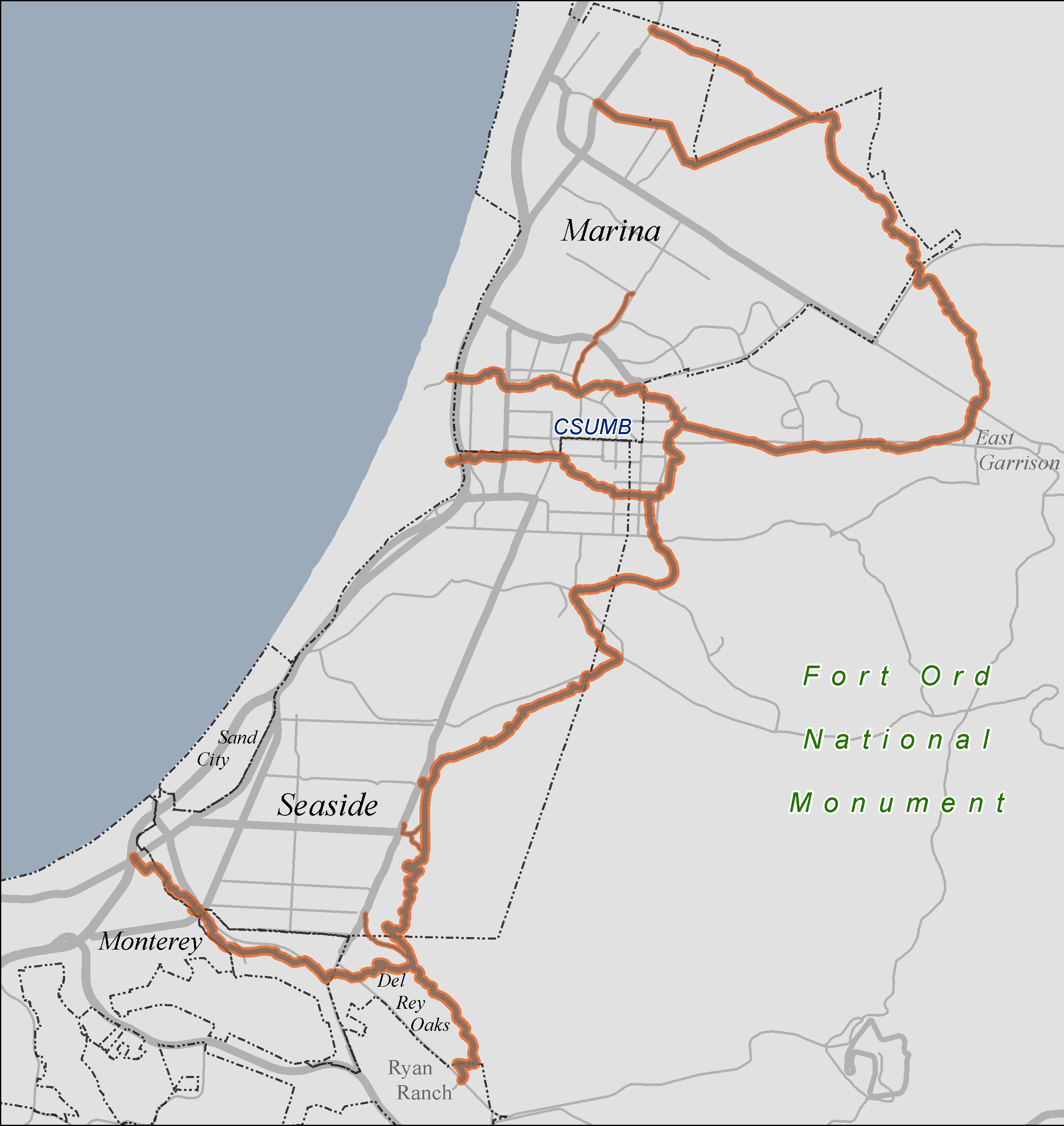
FORTAG elements included in TAMC cost estimate (aerial background) - 2 Sep 2016

Click map to enlarge
FORTAG elements included in TAMC Trabsportation Safety & Improvement Plan
Click map to enlarge
Terrain cross-slope and anticipated retaining walls

Click map to enlarge
Relationship to schools - 27 May 2016
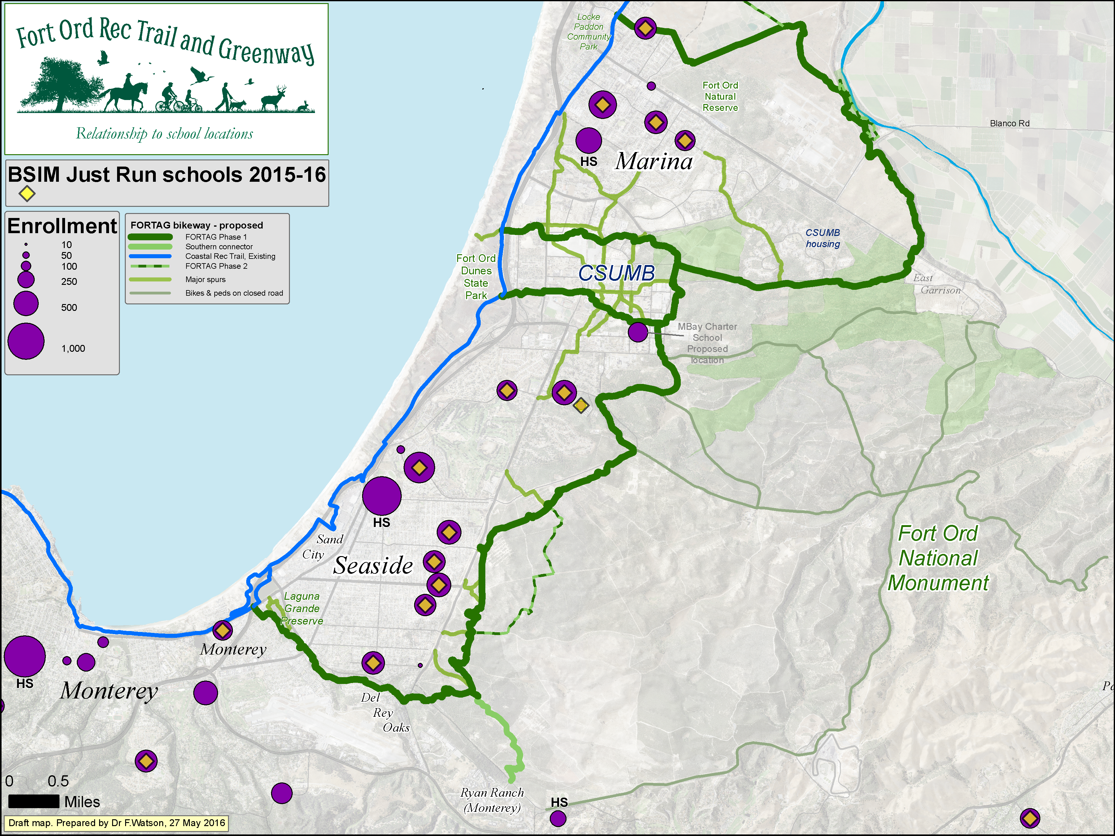
Click map to enlarge
Relationship to population - 13 May 2016
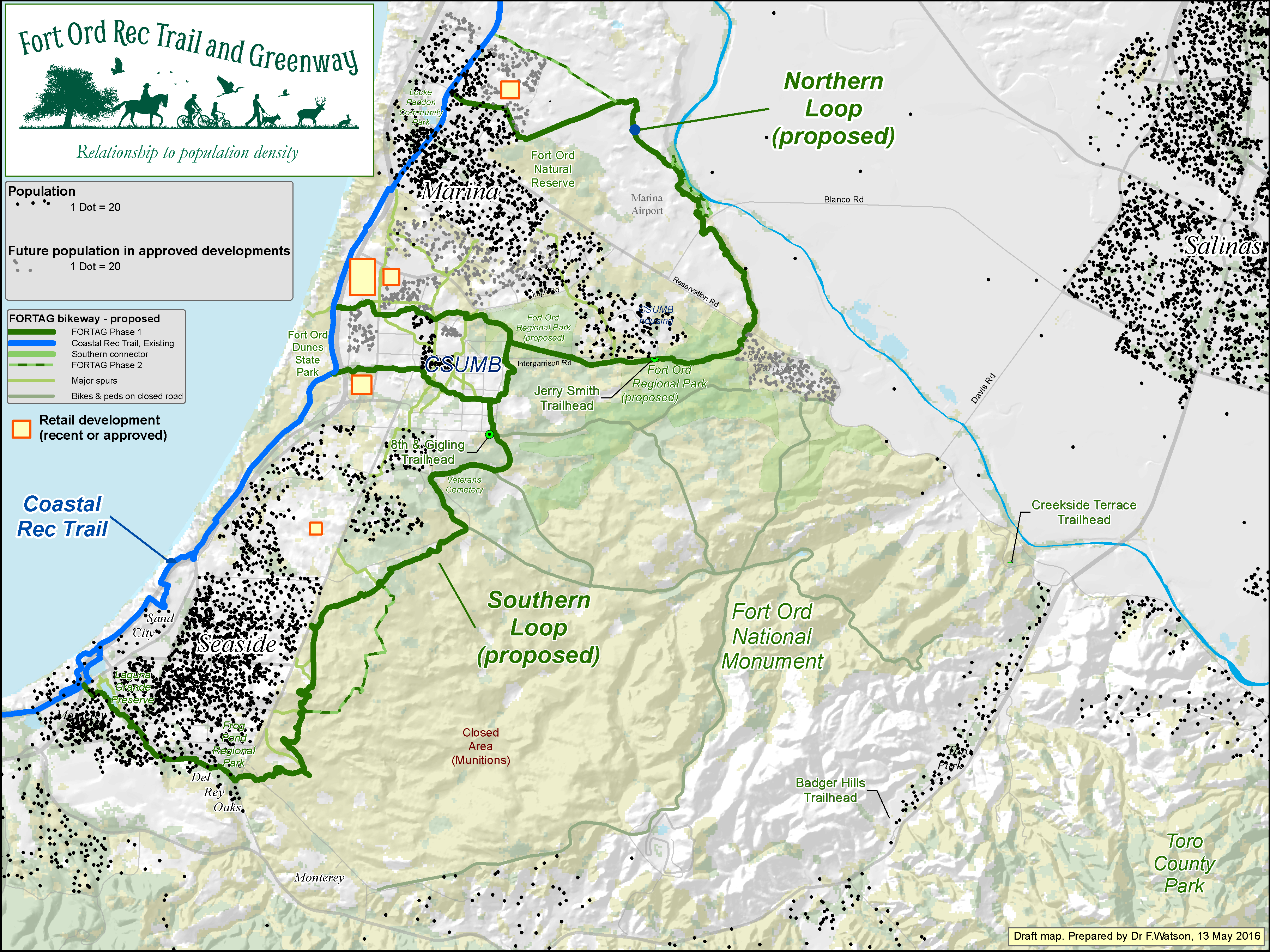
Click map to enlarge
Relationship to employment - 6 Dec 2016
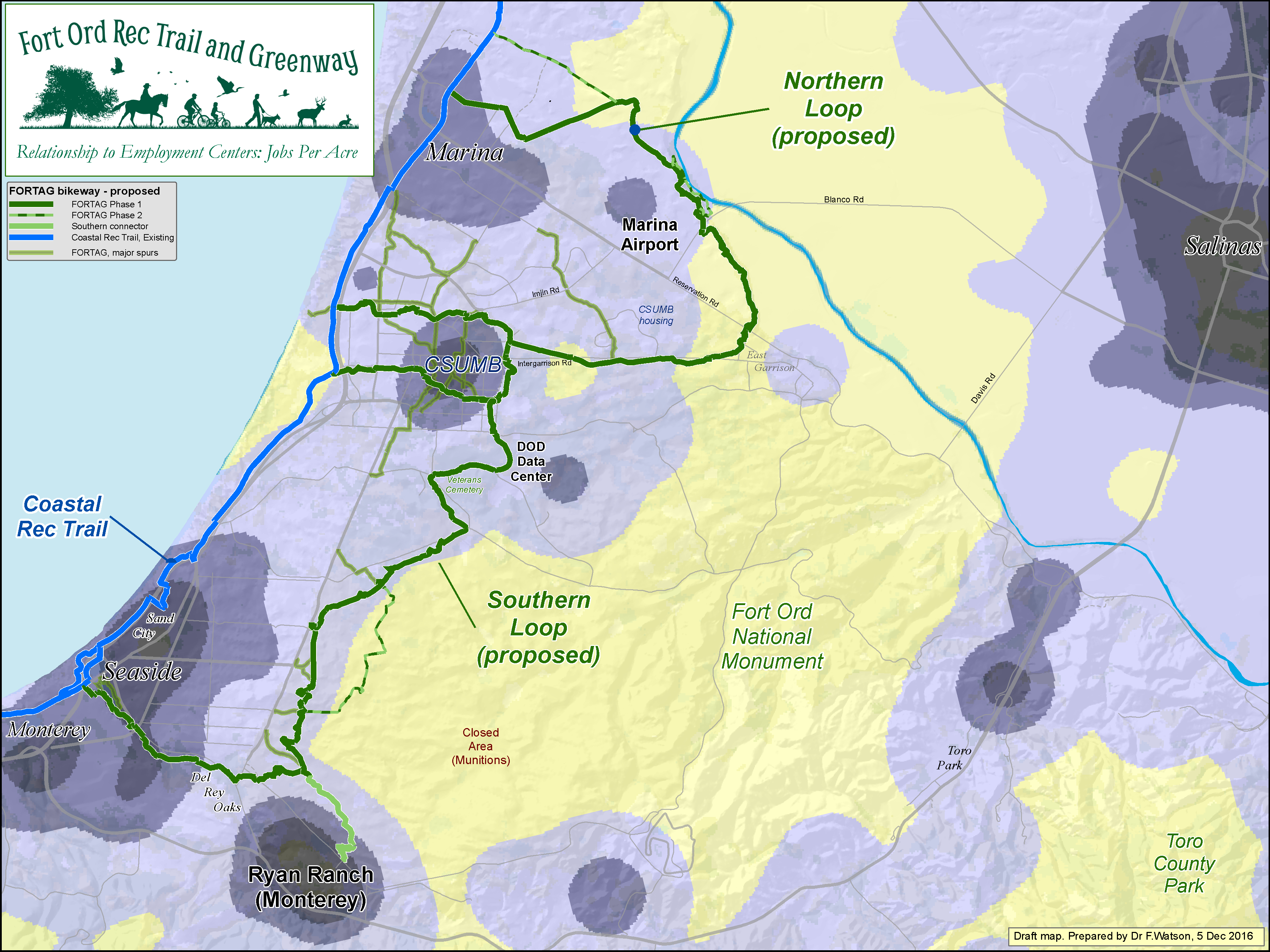
Click map to enlarge
Relationship to city revenue - 16 Dec 2015
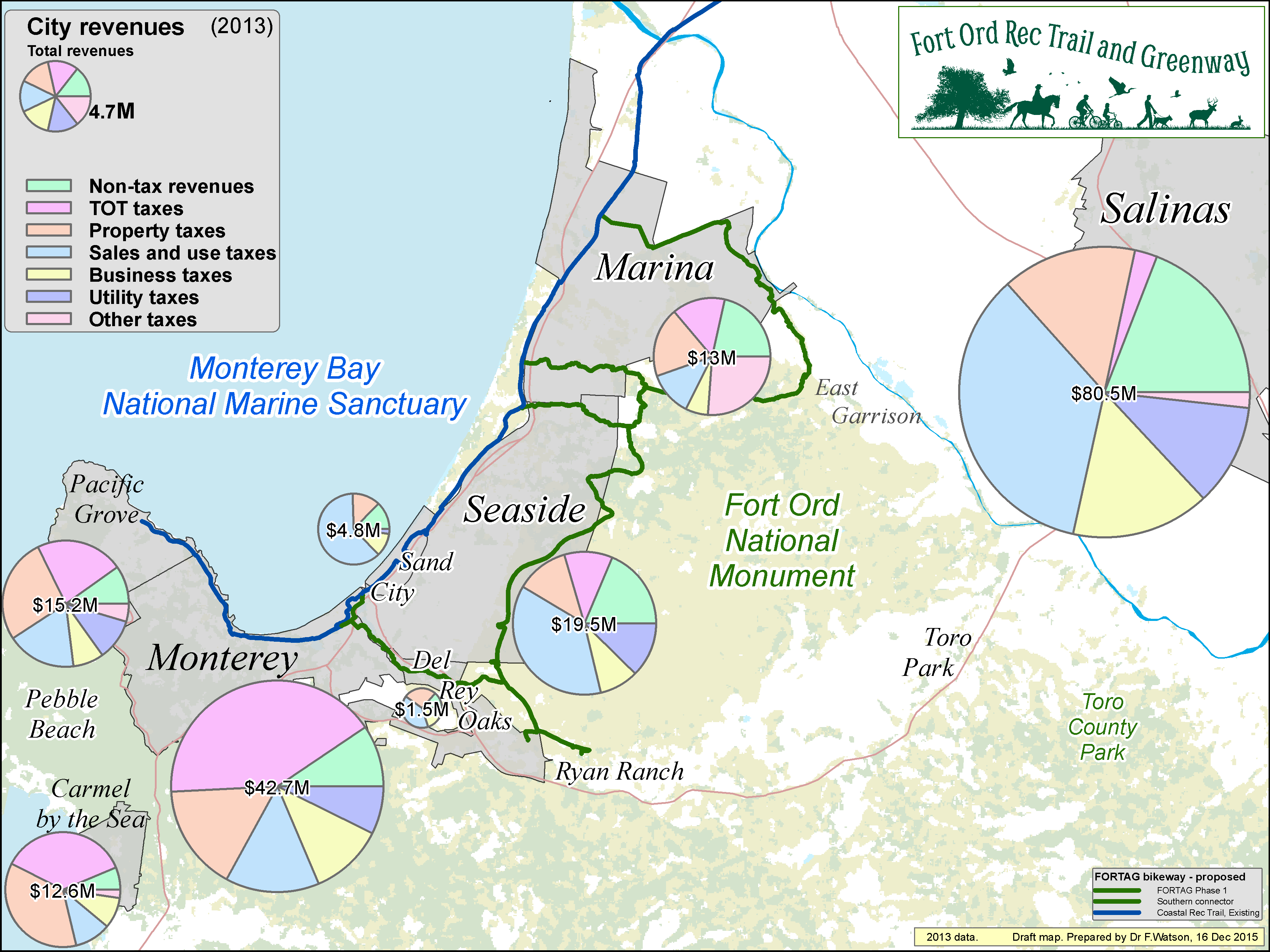
Click map to enlarge
Relationship to hotels - 29 May 2016
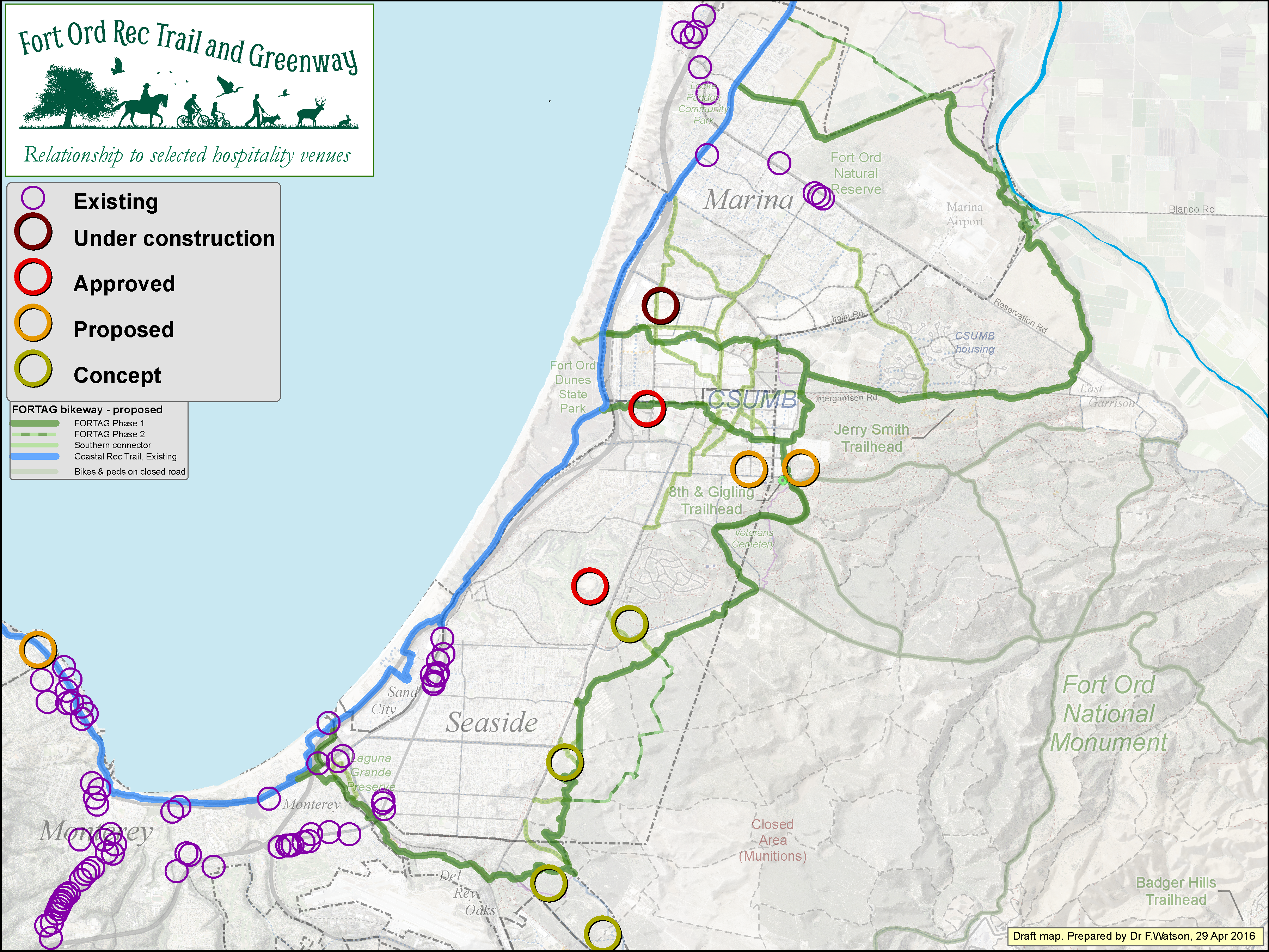
Click map to enlarge
Relationship to race routes - 29 May 2016
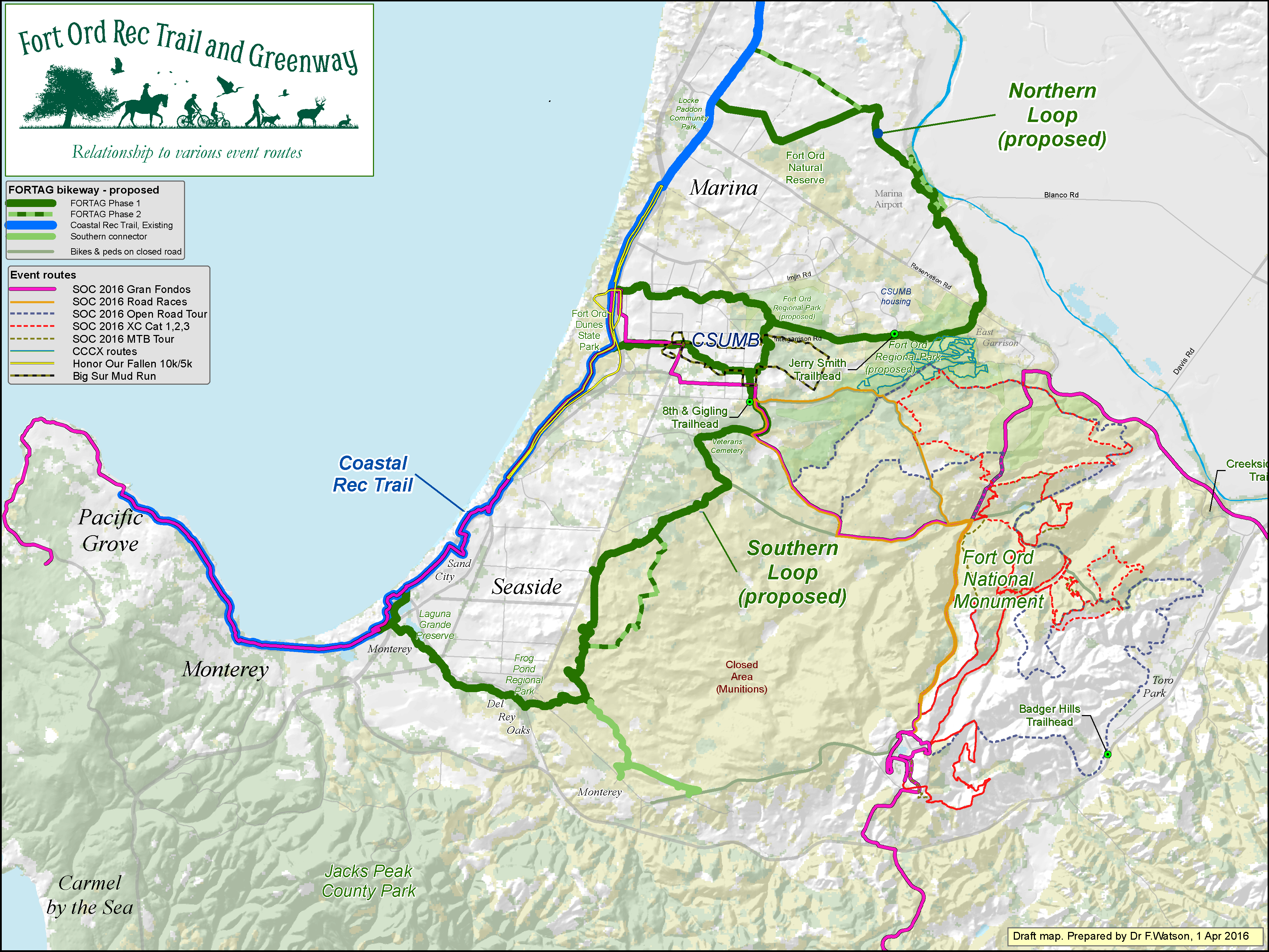
Click map to enlarge
Seaside East Planning Ideas - 12 Nov 2019
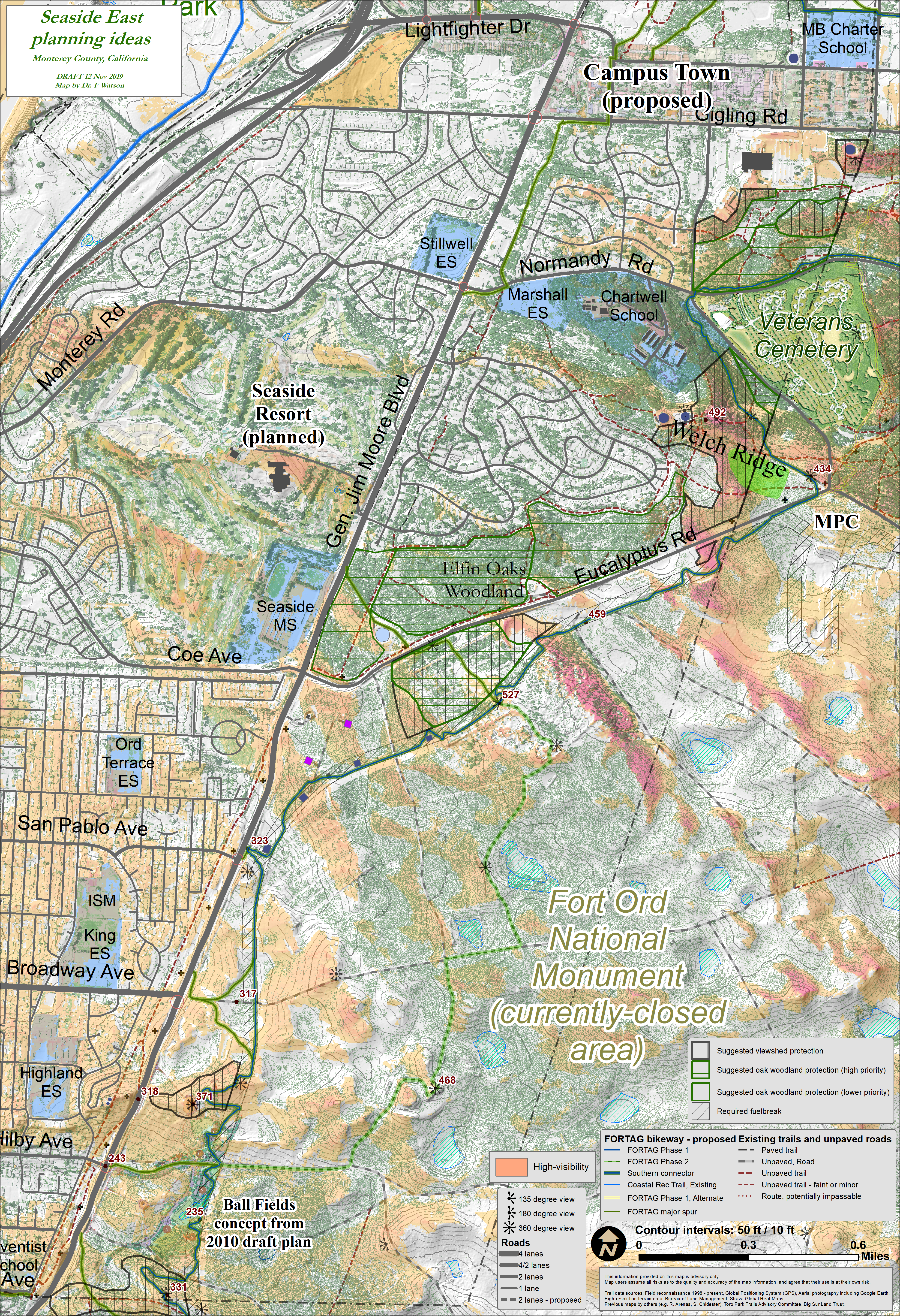
Click map to enlarge
Plenty of other maps are in the PDF slide shows on the docs page.